Crevice
Falls
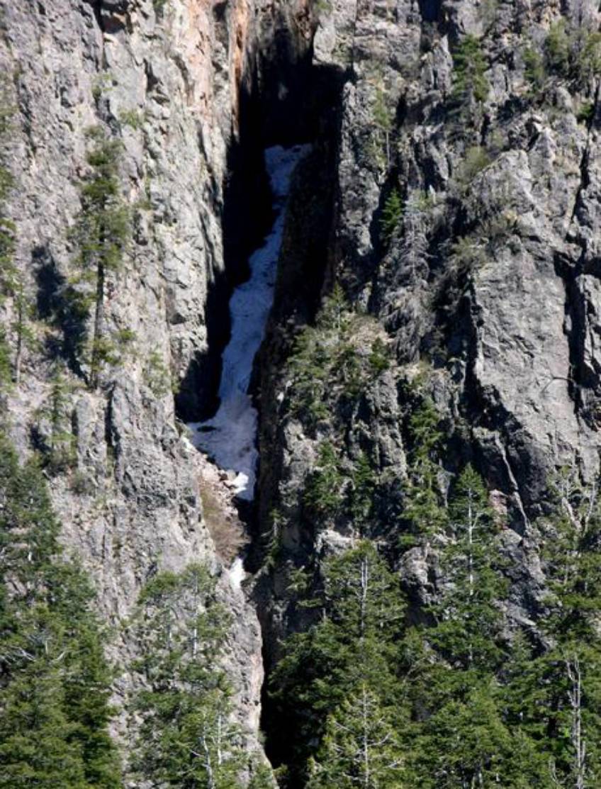
Crevice
Falls still had massive ice-build-up when we were there in mid-May. I would love to see it without the ice...!!!
A
little bit of whitewater shows in the middle of this photo just below a brown
leafless bush. This is the top of the
lower tier dropping down into the dark crevice below. Crevice Falls has unseen portions both above
and below what shows in this photo. This
entire tiered waterfall is 400 feet high.
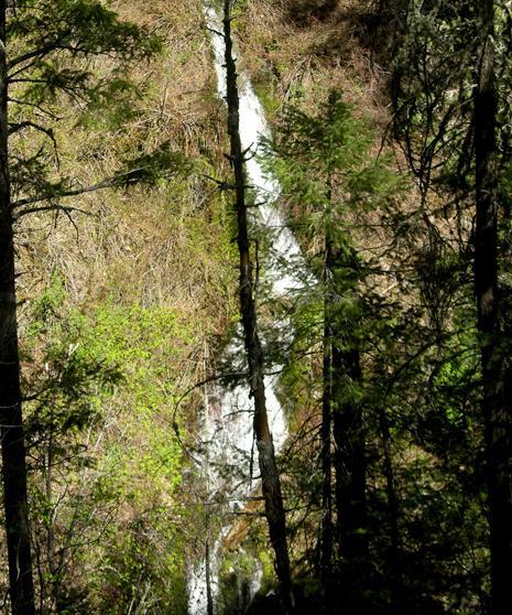
This
is a cascade that is about 50’ high. It
is “Crevice Falls Creek” below Crevice Falls.
This shows that
Crevice
Falls Creek does have good flow all the way down to it’s Spruce Creek confluence.
beta facts:
name- Crevice Falls
height- 400’ ...with several ledges and
tiers
elevation- 8600’
GPS coordinates- ±33°17.984’N 108°41.425’W
flow- perennial spring fed
best season- the frozen ice-pack probably doesn’t melt until
Memorial Day or later...!!!
accommodations- Gila Wilderness
ownership- Gila National Forest
access- 11 miles on trail
with an abundance of serious difficult bushwhacking
nearest town- Glenwood is about 11 miles west of
here
fun fact- Gila high country’s BEST…!!!!! …but
very hard to get to…!!!!!
essay bro
Crevice Falls is amazing... but a killer to
visit... Long hard
miles of grueling climbing and brush whacking... wheeeew...
but I plan to return. This upper
Big Dry Creek, Mogollon high country is New Mexico’s most wild and remote...
ah... and... can I say most beautiful...!!! 400’ high Crevice Falls are great
significance and splendid eye candy. It
is best to view Crevice Falls from the opposite side canyon outcroppings.
Spruce Creek Cascades cut thru the Spruce
Creek Box Canyon. We found no waterfalls
on Spruce Creek more than about 15 to 20 high.
However they are extra beautiful within the “Box” because the canyon
walls are sculpted and sheer for hundreds of feet overhead. This is a delightful place. See: Spruce Creek Cascades.
We did not have time to explore the “slot
canyon” farther up stream, but it likely holds
beautiful waterfalls of it own. In fact each tributary is a likely waterfall
candidate because this whole area is waterfall prone. Especially the two upper
creeks that parallel Crevice Falls Creek flowing off the north slopes of
10,643’ Black Mountain. We expect
the middle of these creeks to have a waterfall 200 feet or higher...!!!
Hanging Rock Trail and Silver Drip Trail
are the two most direct routes into the upper Big Dry Creek drainage. Both have been abandon
by the National Forest Service. We will
soon loose these “two most spectacular trails of the Gila Wilderness”. They are both marked on the map below as
“unmaintained trail”. If we
outdoor-people use these trails and care for them each
time we hike them... they will be preserved... otherwise they will be lost.
Crevice Falls is found in the
upper right-hand side of the map below.
For a new
updated and much enlarged map of this area click here
Enhanced
USGS 7.5’ topo map
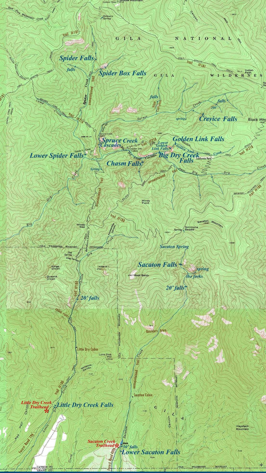
________ONE MILE_______
This area has as fine a waterfall collection as New Mexico
owns...!!!
Send questions and comments to dscott@TheMarbleSculptor.com