Clear Creek Falls
See on youtube:
Cimarron Canyon State Park
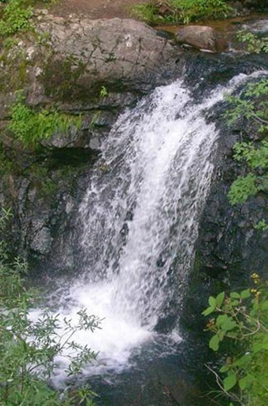
Clear Creek Falls #1 is 16’high #2
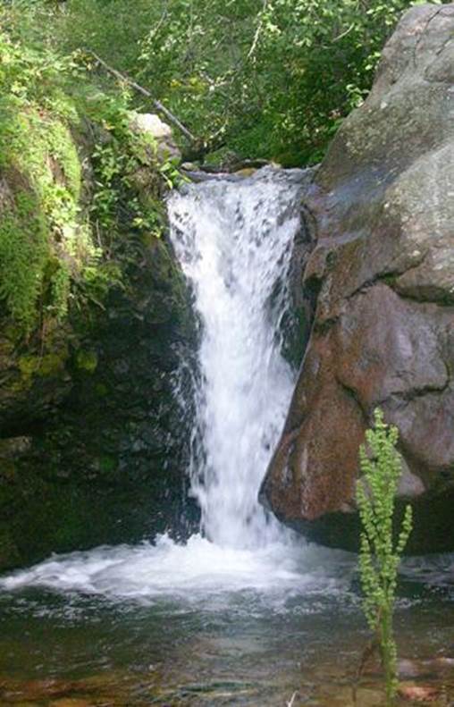
is about 10’ high
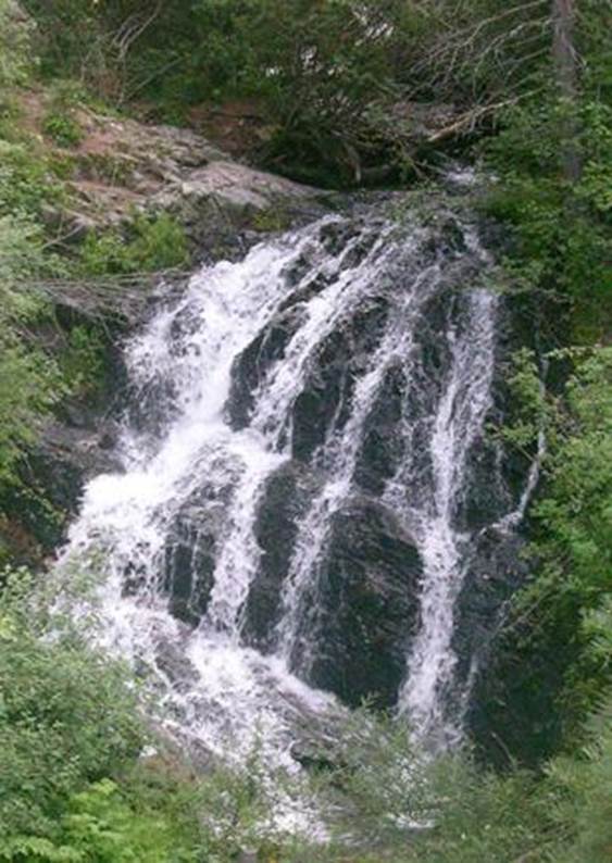
falls #3 is 20’ high falls
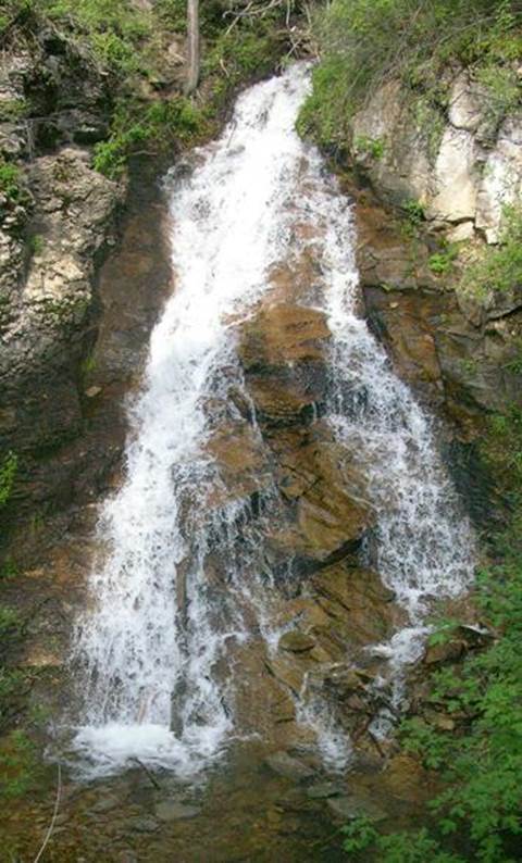
#4 is 35’high
beta facts:
name-The Clear Creek Waterfalls
height- #4 is the highest at 35’.
elevation- 8400’
GPS coordinates- ±#36°30.640’N 105°10.800’W
flow- this is a perennial trout stream
season- May thru October
accommodations- State park campgrounds are nearby.
ownership- public – Cimarron Canyon State Park
access- a mile and a half hike from US Hwy 64.
nearest town- Eagle Nest is 6 miles west of here
and Ute Park is 6 miles east of here.
fun fact- Sparkling Clear Water…!!!!
essay bro:
There are many creeks named Clear
Creek. However the Clear Creek of Cimarron
Canyon State Park in northern New Mexico has beautiful waterfalls. This is a fine waterfall lover’s hike. Park near milepost 292. About a mile up the trail from your car you
will come to a small but pretty 3 or 4-foot high cascade. This means you are now entering Clear Creek’s
fabulous water “show”! Falls #1 is a
couple hundred yard ahead. #2 is an eighth mile after #1 and #3 is
another eighth mile again. #4 is about a
quarter mile beyond the others. #2 and
#3 cannot be seen from the trail, so listen for them and watch for a small
trail forking off towards the creek.
AND HEY….. Support
a worthy cause BUY an annual State Parks Pass…. It cost 40 bucks… just do it … it will feel good….. and it makes parking your car along Hwy 64 in Cimarron Canyon
actually legal. Help support our State
Parks system. At least buy a Day
Pass. A day pass
Costs 5 bucks.
…AND …there is one more
legality that you really should know.
When you walk up any trail in Cimarron Canyon State Park you are
trespassing. Because Cimarron Canyon
State Park is actually a very thin narrow corridor of land ±100 yards wide and
about 8 miles long. Once you are more
than 50 yards up the mountain from either the Cimarron River or Highway 64,
without warning land ownership changes to Colin Neblett
Wildlife Management Area.
To be legal the State of New Mexico says
you must have one of three things. A
hunting license during hunting season or a fishing license during fishing
season or an access permit called a GAIN permit. An annual GAIN permit costs $19 for an adult
resident of New Mexico and they are available for purchase anywhere hunting and
fishing licenses are sold.
How many hoops can you jump thru on your
way to a waterfall…??? JJJ
The most important of these
several permits is the State Parks Pass
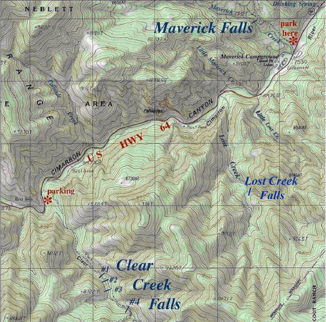
Right-click-save-as on the map below and print yourself a hard
copy to have in your hand when you take this hike
This map is the only map on earth with this information
Enhanced USGS 7.5’ topo map
Send questions and comments to doug.vivian@yahoo.com