Chino Falls
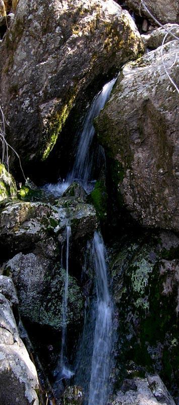
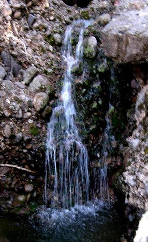
Chino Canyon’s tiny tumbling spring flow dances over several waterfalls
and cascades 10 to 20 feet high... but it likely runs dry during dry times.
beta facts:
name- Chino Falls
height- many falls and cascades here… up to 20’
high
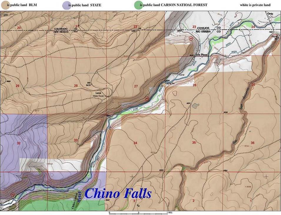
elevation- 8400’
GPS coordinates- ±36°57.194’N 106°06.025W
flow- small
season- late spring is best
accommodations- outhouses are on the state lands along the
Los Piños River
ownership- public – State of New Mexico and Carson
National Forest
access- ¼ mile hike
nearest town- Ortiz, Colorado is shown on the map
below.
fun fact- we saw lots of wildlife… 30 elk and
a dozen antelope above Chino Canyon.
essay bro:
We wanted to catch these waterfalls at
their best. So we paddled a raft across
the flooding Los Piños in order to access Chino Falls
in late April. However these falls can
be accessed from the south on forest lands.
Check your Carson National Forest map.
Enhanced USGS 7.5’ topo map
Send questions and
comments to doug.vivian@yahoo.com