Charette
Falls
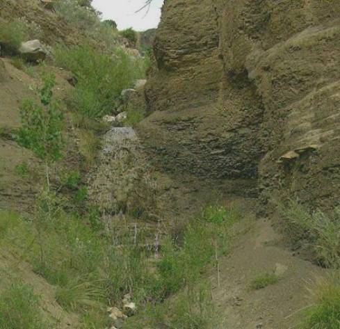
This
20’ high sprinkle over mudstone is one of several Charette falls
beta facts:
name- Charette Falls
height- several falls up to 20’ high
elevation- 6400’
GPS coordinates- ±36°10.800’N 104°47.640’W
flow- perennial spring flow
season- anytime
accommodations- outhouses at the lake
above.
ownership- public – Charette Lakes State
Park
access- A quarter mile climb/hike with no
trail descends from a dirt road.
nearest town- Springer is 22 miles
northeast of here.
fun fact- you will encounter no one on your
hike.
essay bro:
Only in rare floods does any water ever
flow thru the outlet of lower Charette Lake. However a spring appears soon after the steep and
severely eroded gully descends the rim of the Ocate Box Canyon. This rivulet, Charette Creek leaps over
many waterfalls on it’s way to Ocate Creek 400 feet below. These are not the most beautiful falls
on the farm… but All falling waters are ”good stuff” to me.
The Ocate Box Canyon looks like a great
hike to me. I enjoy strolling
along its north rim. It is much
like the Rio Grande Gorge except it has way less water flowing and yet an
abundance of more lush plant life.
Enhanced
National Geographic 7.5’ topo map
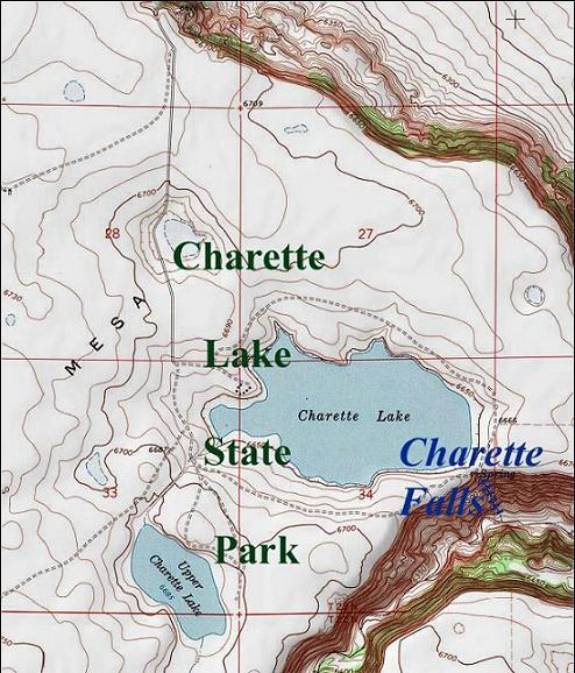
one
mile is represented by the thin red section lines above
Send questions and comments to doug.vivian@yahoo.com