Chamisal
Falls
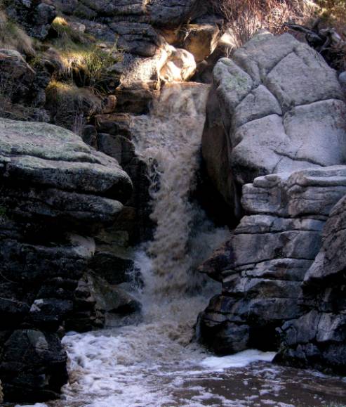
20’
High Chamisal Falls turns brown and violent during snow-melt in April and May
beta facts:
name- Chamisal Falls
height- 20’
elevation- 7100’
GPS coordinates- ±36°11.461’N 105°45.441’W
flow- perennial
season- spring, summer and fall
accommodations- none
ownership- BLM and public domain
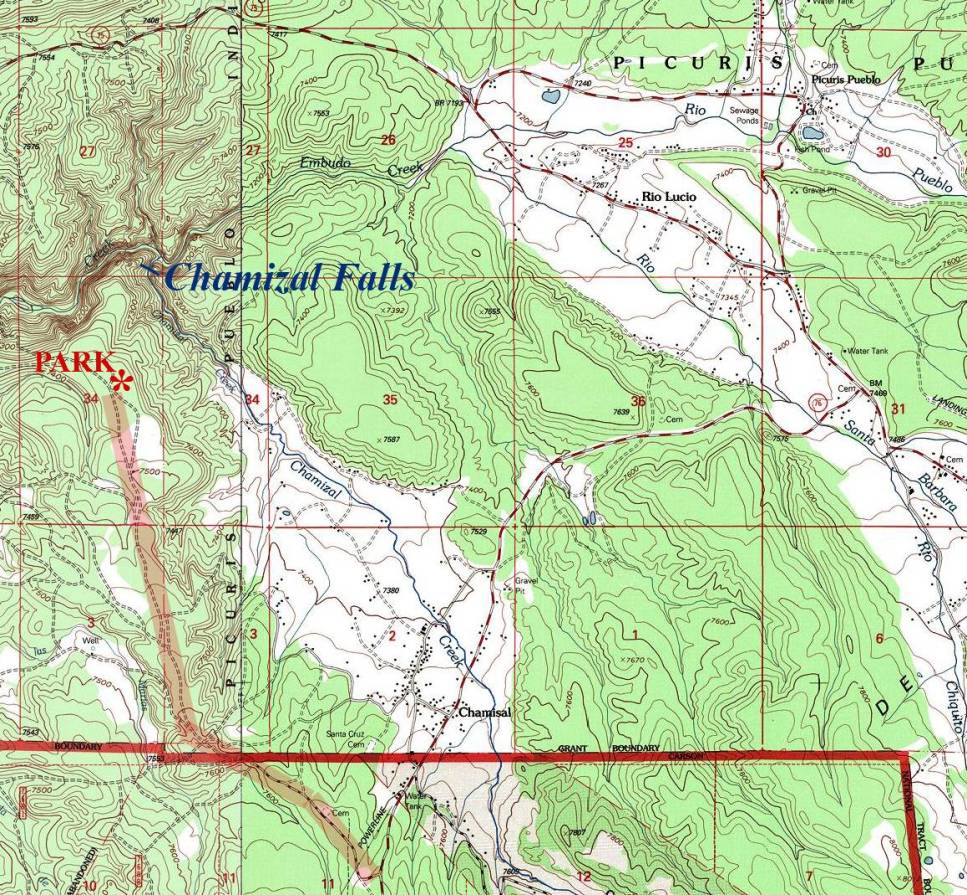
access- see map below
nearest town- Chamisal is about 2 miles
southeast of here
fun fact- absolute “fairy-land” beauty
essay bro
Roads have changed since these maps were
made so your topo reading skills will have to be good… but even if you can
drive close… just walk on in from where ever you can park. Actually while I was walking out I
found a 4WD road that came almost down to the falls. this is a place that I will return to time and again, it’s
beautiful.
Enhanced
National Geographic 7.5’ topo map
Send questions and comments to dscott@TheMarbleSculptor.com