Casa Falls & Casa Creek
Cascades
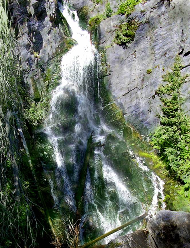
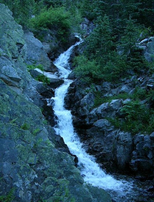
50’ high Casa Falls is
a short 100 yard scramble from the end of a 4WD road and a bit less than a 2
mile hike from Walker Flat 2WD forest road
This waterfall is also known as North Fork Falls and/or North
Casa falls
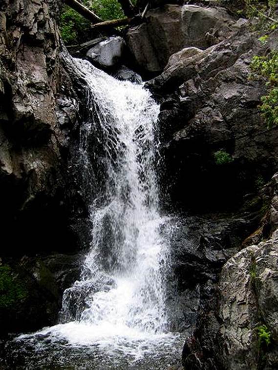
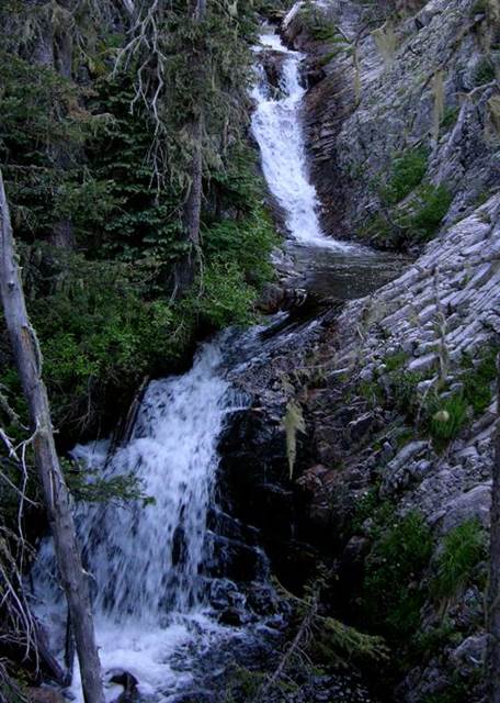
The photo below shows a 25’ high waterfall that can be visited
via a quarter-mile scramble upstream from Casa Falls shown above
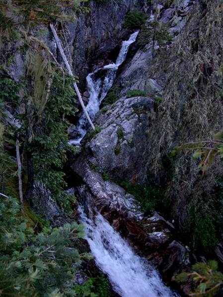
The rest of these falls are very difficult
to get to and there are way more falls here than I
have photos of.
...and these will appear starting upstream
and heading downstream.
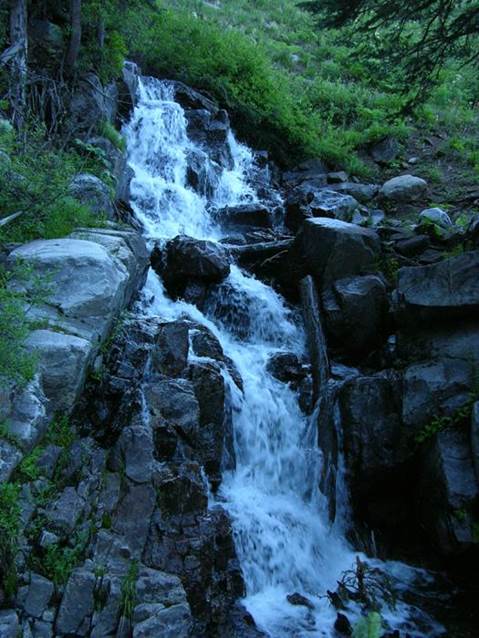
...a 45 foot high cascade...
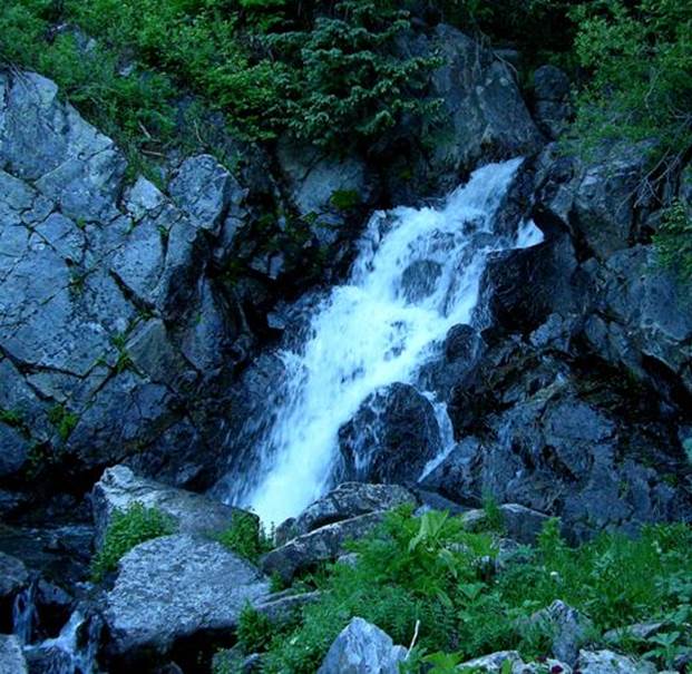
...a 25
footer...
...a 50’ high cascade...
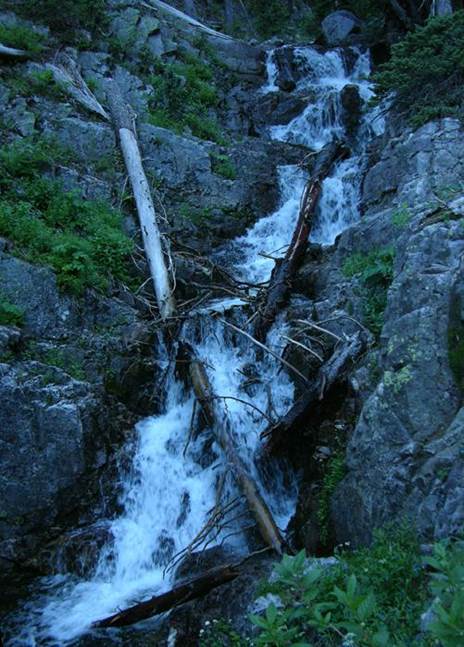
I couldn’t budge these huge logs but I wish
I could’ve cleaned them out of this beautiful 50’ tiered waterfall
...a 30’ tier and a 15’ tier...
This photo shows only part of one tiered
cataract that falls about 100’. This
steep rugged canyon greatly hampers photography.
beta facts:
name- Casa Falls
height- 1500’ of waterfall after waterfall... but 50’
high Casa Falls is the most well known
elevation- 9500 to 11000 feet
GPS coordinates- ±36°00.812’N 105°28.903’W (very approximate
because there are many falls here.)
flow- a fine perennial trout stream
season- May thru Oct… earlier is best flow… but you
may have snow
accommodations- none – Pecos Wilderness
ownership- public – Carson National Forest
access- 4WD roads and short trails to the first
two falls... after that is class 3 and 4 bushwhack scramble...!!!
nearest town- Mora is about 15 miles east of here
fun fact- you will see no road signs telling
where you are or where you’re driving... I’m told the locals use these for
firewood
essay bro:
Upper Rio la Casa, sometimes called North
Fork Casa Creek, has as many waterfalls as can be found on most any creek in
New Mexico. Falls of all shapes, kinds
and sizes line up single file for more than a mile. Sparkling cascades, natural waterslides,
plunges and cataracts carve their way thru solid granite downstream from North
Fork Lake. Ferns, greenery and moss fill
this wet wonderland.
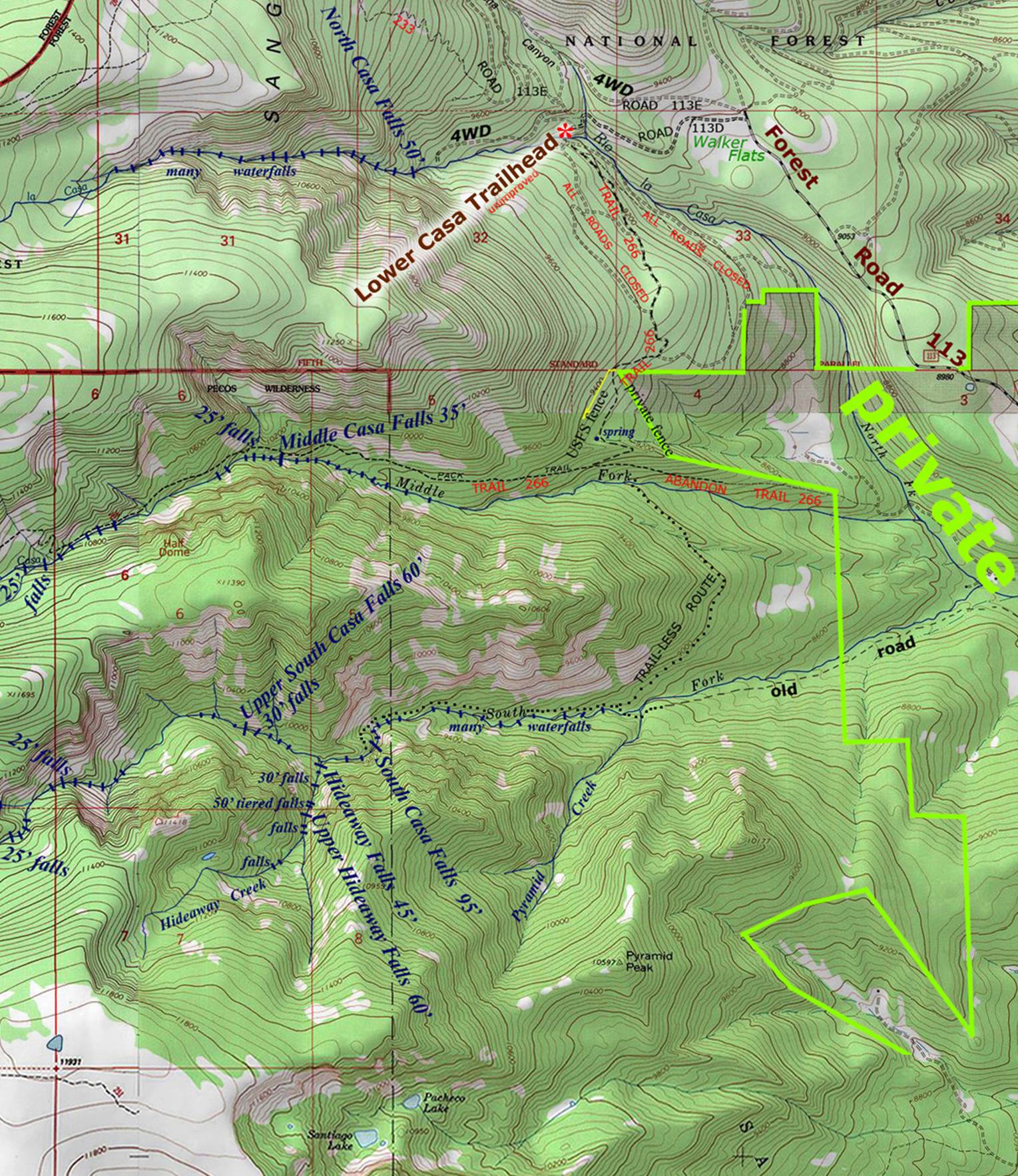
Four miles north of Mora on NM hwy 518 you will find the little town of Cleveland,
NM. Turn west here on county road B-028
for 5 miles and follow forest road # 113 to Walker Flats. This is where the going will get sketchy as
I’m told that the locals in this area use forest road signs for firewood… so, you will likely have to go by feel from here. But the good thing is that you are close,
very close. Casa Falls are about one
mile straight west of Walker Flats… AND looking west you will see the canyon
that you’re looking for. Walker Flats is
on this topo map below. Try mixing a
little luck with a little Español also a National Forest Map as well as a copy
of my map below, to find a place to park and begin your hike.
The four-wheel-drive road that takes you
into the lower two Casa Falls is not a bad choice ...but the class 3 and 4
bushwhack scramble up to see the many falls above... is quite difficult. I prefer to hike up the trail and cut over to
descend this steep canyon instead of ascending it.
Enhanced USGS topo map NORTH IS UP
Send questions and comments to dscott@themarblesculptor.com