Caballero Falls (spanish – Cowboy)
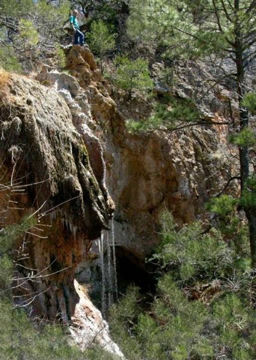
The real waterfall cowboy poses
with the top half of Caballero Falls
beta facts:
name- Caballero
Falls
height- 50’
elevation-7000’
GPS
coordinates- ±32°52.563N 105°50.352’W
flow- perennial
spring
season- anytime
accommodations-
none
ownership-
Lincoln National Forest
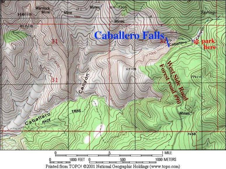
access- ¼ mile
hike (west) down Caballero Canyon from forest road #90
nearest town-
High Rolls is 8 miles north of here via West Side Road aka forest road #90
fun fact- there
is a real nice old couch near the brink of the falls… sit back and enjoy the
refreshing waterfall sound
essay bro:
Following the
directions in the beta facts above you should park your wheels at Caballero
Canyon. You will know that you are
at the right place because big round metal lids are scattered all over the face
of the earth here. These metal
caps are harvesting the spring water and running it into a pipeline connected
directly to all the water faucets in the city of Alamogordo. Just imagine how much water used to
flow over this waterfall before the city of Alamogordo stole all it’s
water….!!!!!
Oh well… don’t
feel too bad about it… just drive right down to Alamogordo and take in a nice
big drink of water.
Enhanced
National Geographic 7.5’ topo map
Send questions and comments to dscott@TheMarbleSculptor.com