Bluff
Springs
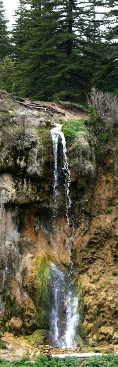
Bluff
Springs Falls (east finger) Bluff
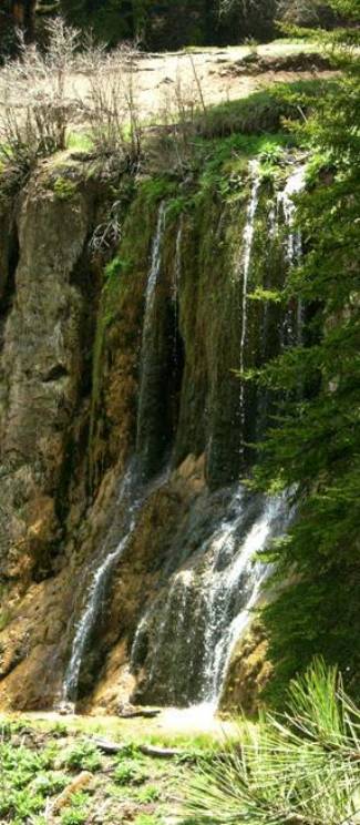
Springs Falls (west fingers)
beta facts:
name- Bluff Springs
height- 40’
elevation- 8100’
GPS coordinates- ±32°49.833N 105°44.299’W
flow- perennial, nice
season- anytime
accommodations- only restrooms… no camping
ownership- public – Lincoln National Forest
access- falls are viewable from the parking
area.
nearest town- Cloudcroft is 12 miles north
of here.
fun fact- pure clean water pours out of a
hole in the ground just before it jumps over a cliff…!!!!
essay bro:
These beautiful waterfalls are viewable from
forest road C-017. This tributary
called Bluff Springs flows about 100 yards and pours over a 40-foot high bluff
just before it’s confluence with Rio Penasco.
Enhanced
National Geographic 7.5’ topo map
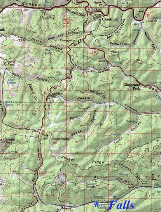
the
thin red section lines above represent one mile
Send questions and comments to doug.vivian@yahoo.com