Beaver Creek Falls
These are not really named
waterfalls… but they are a very worthy and beautiful destination
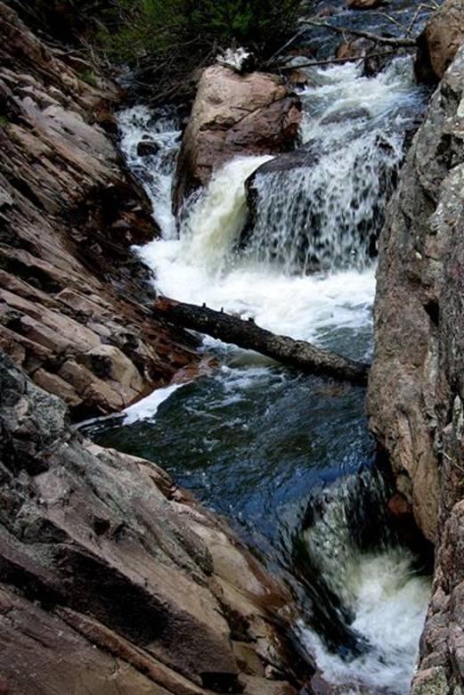
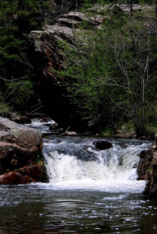
This 12’ falls is the
highest one of many small falls in Beaver Creek …a 6’ falls
downstream a ways
beta facts:
name- not really a named waterfall, but a
beautiful and worthy destination
height- Beaver Creek has many falls; the
highest is about 12 feet
elevation- 7900’
GPS coordinates- ±35°44.333N 105°26.300’W… very approximate
flow- this is a strong flowing trout stream
season- May thru Oct
accommodations- forest service campground
at the trailhead
ownership- Santa Fe National Forest – Pecos
Wilderness
access- a “stunningly beautiful” hike up
Beaver Creek (2½ miles) from El Porvenir Campground.
nearest town- Las Vegas, NM is about 18
miles southeast of here
fun fact- This area is a waterfallers paradice… and a
rock-climbers dream
essay bro:
I have not found
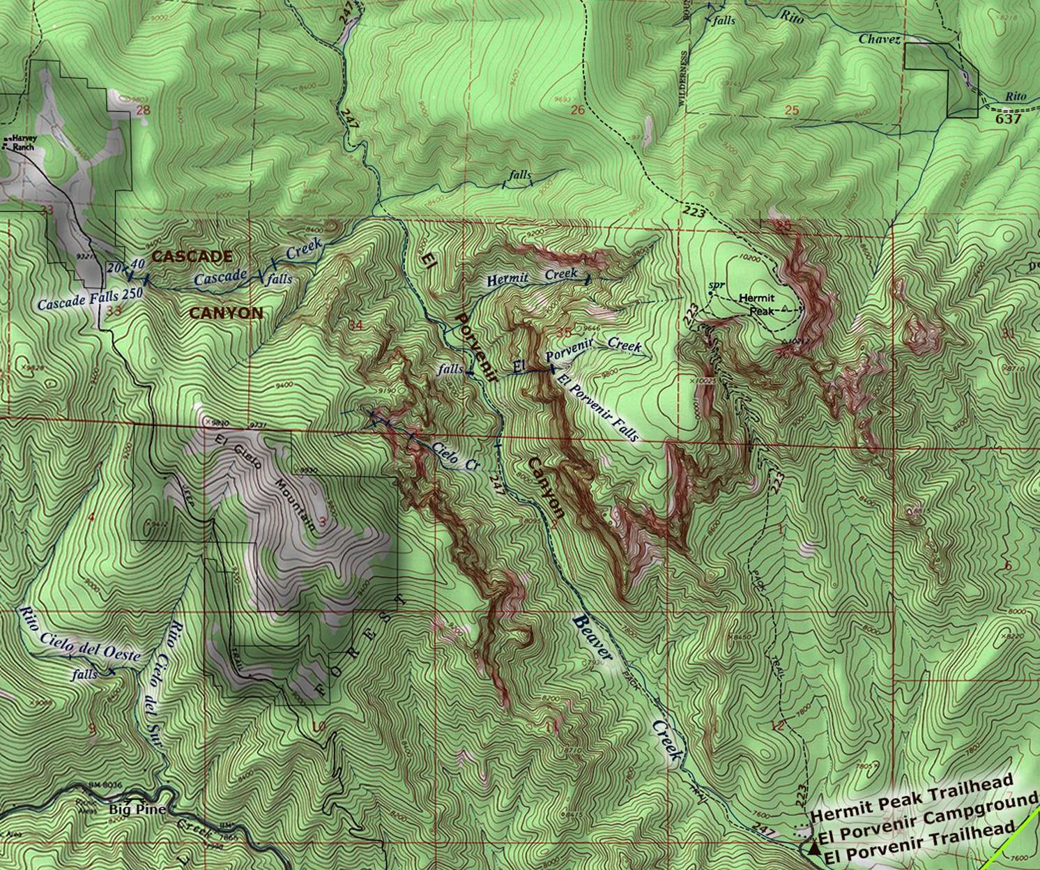
a more beautiful place in all “the Land of Enchantment” ….!!!!!!!! There are many waterfalls here but it takes a
lot of “off-trail” bushwhacking to see the higher ones up Cascade Creek, Cielo
Creek, Porvenir
Creek and Hermit Creek. I was amazed
that there seemed to always be a downed tree to provide a “dry” crossing, near
each one of the many “wet” creek crossings that the trail makes. Our shoes and pants stayed dry during a
mid-May trek in 2008.
We
found that many steep, small side canyons cascade over high cliffs as they pour
into Beaver Creek at the bottom of El Porvenir Canyon
during wet times. Some of these high
trickling falls can be seen from the trail while others can only be visited
after a vigorous “off-the-trail” climb.
We estimate the highest of these high waterfalls to be about 600 feet
high. It is a beauty.....! ! ! AND it tends to have a more significant
waterflow than any of the other side stream tributaries. Some locals we visited with refered to this amazing - 600 feet high waterfall as “El Porvenir Falls.”
Therefore, we call this tributary “El Porvenir
Creek.” Please see it on our map
below. Later this spring we hope to give
El Porvenir Falls an official measurement.
Enhanced USGS 7.5’ topo map
__________ONE_MILE__________
Send questions and comments to art@DougScottArt.com