Aragon
Falls
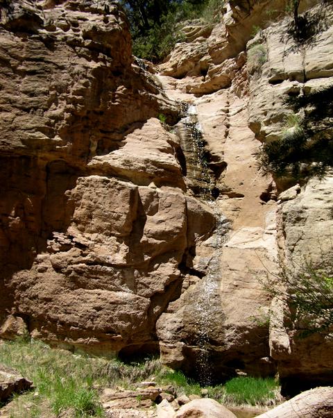
Aragon Falls
pours over slickrock sandstone
The
hike up Aragon Canyon to the falls from the river…. is a goodern’.
beta facts:
name- Aragon Falls
height- 40’
elevation- 6750’
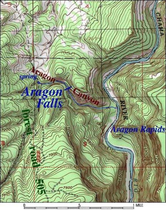
GPS coordinates- ±36°30.278’N 106°44.218’W unverified
flow- perennial spring fed
season- spring is best
accommodations- none – Chama Wild River
ownership- Santa Fe National Forest
access- ½ mile hike from river if floating
Chama Canyon or a ¼ mile hike from forest road 505
nearest town- El Vado is the set-in for
floating Chama Canyon, it’s 11 miles up stream (north).
fun fact- a beautiful falls over smooth
sandstone within a beautiful canyon of smooth sandstone…..!!!!!!
essay bro:
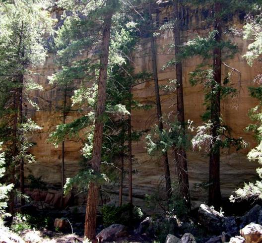
Chama Canyon’s “slickrock” sandstone framed
with thick dark Douglas Fir timber makes as beautiful of a canyon as I have
ever seen…. Aragon Falls just makes it better…..!!!!!!!! Aragon Creek is usually dry where it
conflues with the Chama River because immediately below the falls the water
flow soaks into the porous streambed.
Enhanced
National Geographic 7.5’ topo map
Send questions and
comments to doug.vivian@yahoo.com