Angostura
Falls
Angostura in english = narrow passage,
referring to the narrow, sheer-walled passage that the waterfalls are in.
See on youtube: https://www.youtube.com/watch?v=7glEo0sMNNk
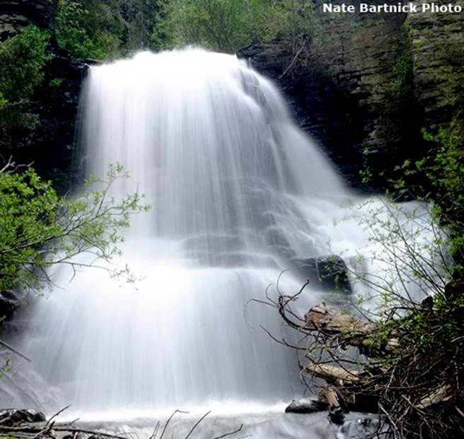
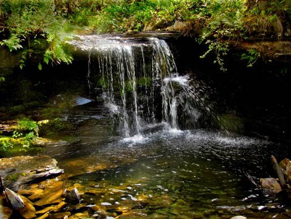
Seen here during high water
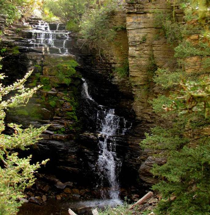
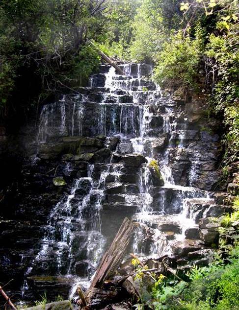
And here during low water
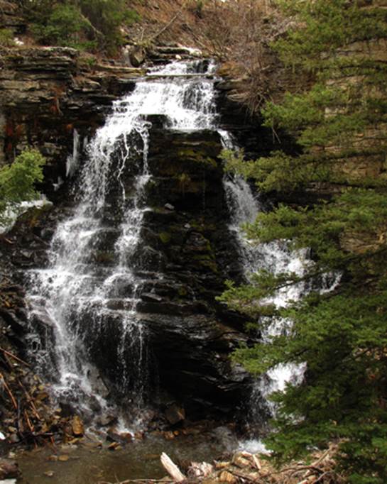
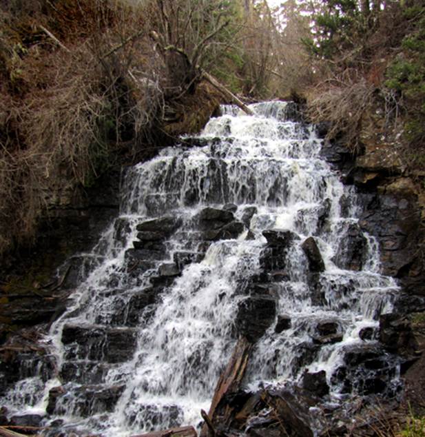
And here during medium
water
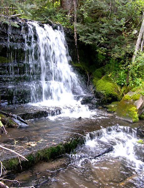
This is a favorite falls
of mine even tho this portion of it is only 30’
high... she dances purdy...!!! Angostura Creek flows as a normal tumbling
mountain stream before suddenly spilling over this cliff into an amazing slot
canyon...Angostura mean “narrow passage.”
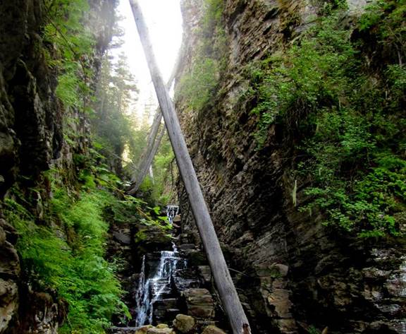
I group this waterfall along with a half-dozen other ones below...as all
one waterfall...Angostura Falls. It would
be excessive to name each individual drop.
These waterfalls, all lie within the same, unbroken mass of black
limestone bedrock. Therefore each
individual falls is in truth, a portion of...or as we say - one “tier” of
Angostura Falls. Angostura Falls has
several tiers. The upper tier, pictured
above, is the highest tier.
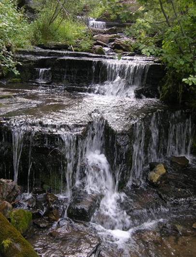
These two 15 to 20’ high
tiers seen below, are tucked into the crux of
100’-deep Angostura Slot Canyon. Everyone of the half-dozen tiers
can be seen, from and with, the other tiers near to it...a classic
“multi-tiered” waterfall approximately 100’ high.
...a small 7’ waterfall
one- half-mile upstream from Angostura Falls.
gps - 36°04.760’N
105°30.064’W @ 9700’
beta facts:
name- Angostura Falls
height- approx. 100’ total height of all of the
many tiers combined. The highest single
tier is the upper most tier - 30’ high.
elevation- 9600’
GPS coordinates- ±36°05.105’N 105°29.973’W
flow- perennial flowing cutthroat trout stream
season- May- June is best, but good thru October.
accommodations- none
ownership- Carson National Forest
access- a short 2-mile hike…and the last
hundred yards is off-trail descending downstream to the waterfall.
nearest town- Tres Ritos is about 4 miles northwest of here
fun fact- an awesome slot canyon - a WONDERFUL waterfall – a short hike – and several
other falls nearby.
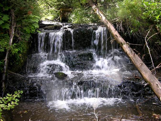
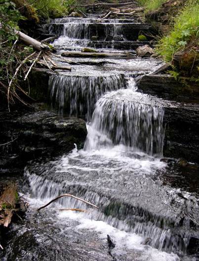
West
Fork Angostura Falls
25’ high West Fork Angostura Falls pictured
above is almost as nice as Angostura Falls but without a slot canyon. All of the many waterfalls on Angostura Creek
have a unique beauty because exposed black limestone bedding-planes cause the
water to bounce and dance. All of these
photos were taken in mid-August of very dry 2012.. I’m
anxious to see more water flowing strong again during early June snow-melt next
year.
This 10’ to 15’ high waterfall is a couple
hundred yards upstream. West Fork Angostura Falls is not a tiered waterfall
like Angostura Falls is... because these falls cannot be seen from each other and
they’re not within one continuous mass of bedrock.
...and another nice
one, the same size, a short ways farther upstream.
This is a wonderful waterfall hike that I
will return to time and time again. This
canyon has a lot of what I call “ledges”
of black limestone...and more ledges....up to
6 feet high each.
beta facts:
name- West Fork Angostura Falls
height- 25’ with many more lesser waterfalls very
nearby.
elevation- 9400’
GPS coordinates- 36°05.535’N 105°30.186’W
flow- perennial flowing cutthroat trout stream
season- May- June is best, but good thru October.
accommodations- none
ownership- Carson National Forest
access- about a 2-mile hike…plus some serious
bushwhacking.
nearest town- Tres Ritos is about 3 miles northwest of here
fun fact- a nice waterfall – a short hike –
and several other falls nearby.
essay bro
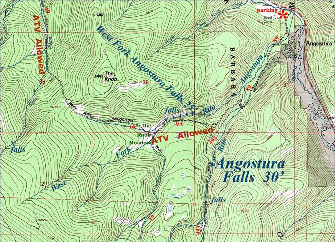
You will easily see the Forest Service
parking lot at Angostura, immediately across the creek from Highway 518. It is best to park here and walk a mile up
the road to the trailhead because there is no room to park above and many
people live along this road, which serves as their driveway. Unfortunately, hikers have to share parts of
this trail with ATVs...but it is a beautiful hike. This is where you park when visiting
Angostura Falls and/or West Fork Angostura Falls.
When hiking to Angostura Falls
you need to follow Trail #493 which allows no motor-vehicles. This trail rises high above the stream until you can no longer hear or
see it. About 2 miles from your car the
trail will drop back down to the creek.
Here is where you leave the trail, and follow the Rito
Angostura downstream a short ways to this amazing waterfall.
When hiking to West Fork Angostura Falls
you need to follow Trail #9A. The ATV trail. This
trail does a quick double switchback that shows on the map below. Then it rises high
above the stream until you can no longer hear or see it. About 2 miles from your car the trail will
drop back down to the creek at a beautiful place called The Knob Meadows. Here is where you leave the trail to follow
the West Fork Rito Angostura downstream. A one-mile bushwhack will provide you with a
wonderful waterfall hike. You might want
to wear a long sleeve shirt and pants for protection from stickery
underbrush.
Enhanced
USGS 7.5’ topo map
Send questions and comments to dscott@TheMarbleSculptor.com