Agua
Caliente Falls
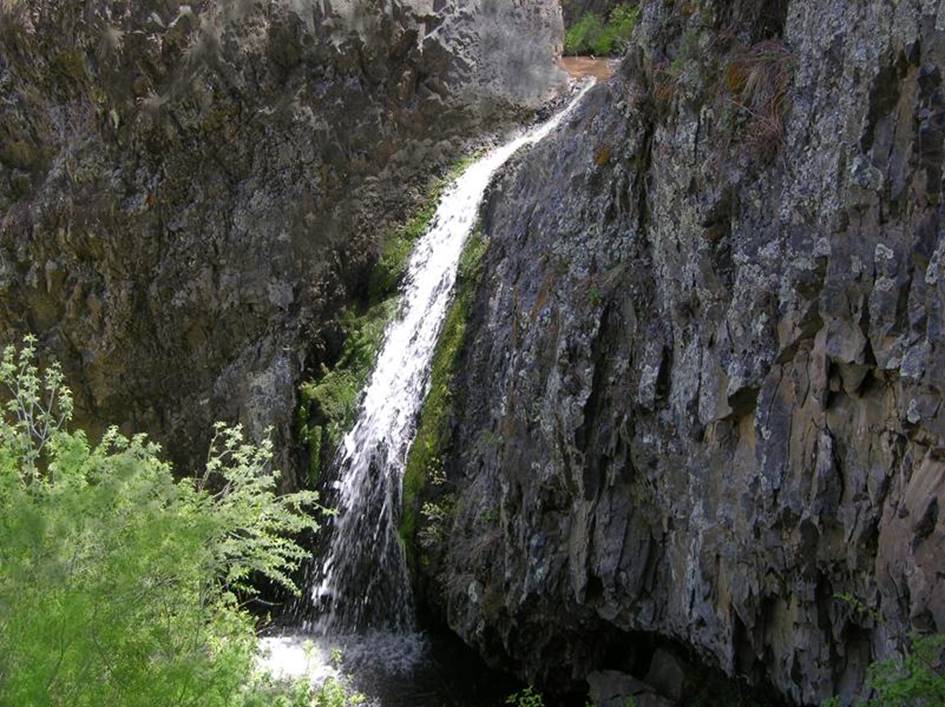
25’ high Agua Caliente Falls
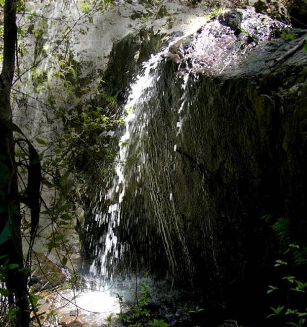
16’ high Upper Agua Caliente Falls
beta facts:
name- Agua Caliente Falls
height-25’
elevation-6900’
GPS coordinates- ±36°15.388’N 105°45.504’W
flow-perennial
season- April has the most water flow but
anytime is fine
accommodations- restrooms at the visitor
center, also a café in Pilar and campgrounds nearby
ownership- public - BLM
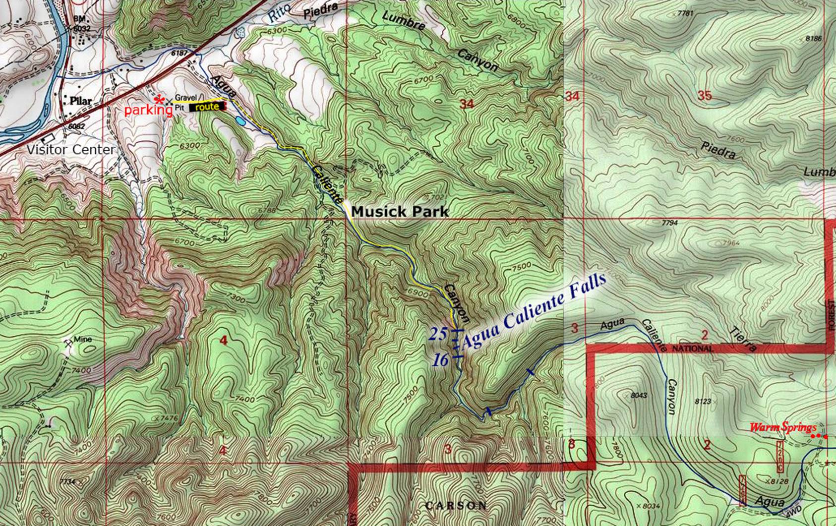
access- 2 mile hike from the Gravel Pit Area
nearest town- Pilar is about 2 miles
northwest of here
fun fact- It surprised me to find a 25’
perennial flowing waterfall 2 miles from Pilar, NM
But there are two more waterfalls
upstream from these two falls... that have not yet been documented...! ! !
essay
bro
This canyon has amazing beauty... well
worth a hike... often…!!! AND… who
know how high and/or how beautiful the upper two waterfalls will be….???
The Yellow line below shows a
route to Agua Caliente Falls... this is NOT a trail.
Right-click-save-as
on our map below to have your own hand-held copy during your hike...! ! !
Enhanced
USGS Topo
Send questions and comments to dscott@TheMarbleSculptor.com