Wolf
Creek Falls
See video on Youtube: https://www.youtube.com/watch?v=LMjXNtDnaYU&list=UUCJsfIZ3DXVpmoXu2d487VQ
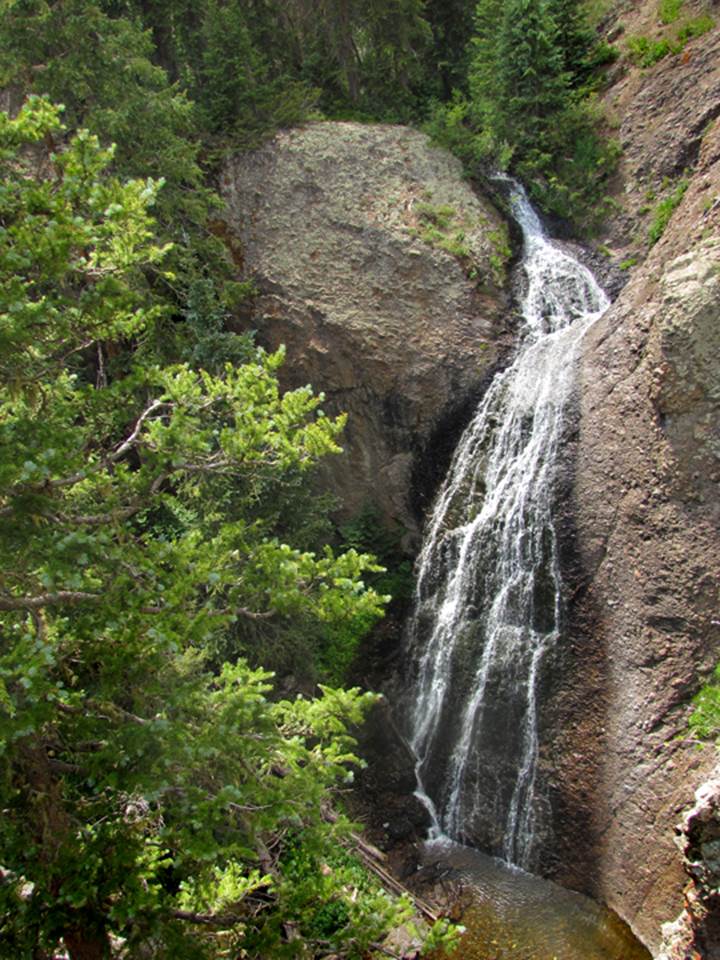
The photo above shows the 70’ high lower
tier of Wolf Creek Falls …near Cumbres Pass northeast
of Chama, NM
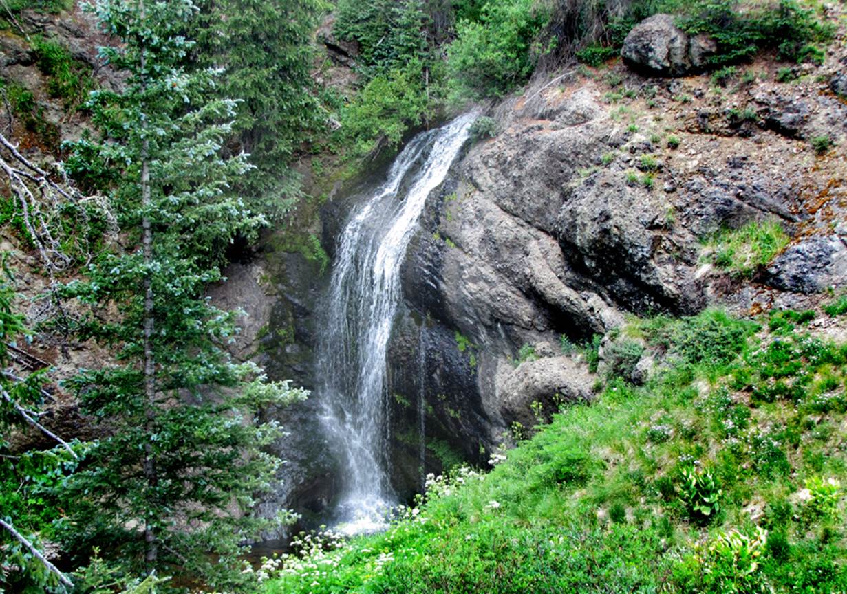
The photo below shows the 40’ high upper
tier of Wolf Creek Falls
…these two tiers are about 50 yards apart
…while hiking the Colorado Continental
Divide Trail about 2 miles or so above the Trailhead at Cumbres
Pass… look for this scene shown in this photo below
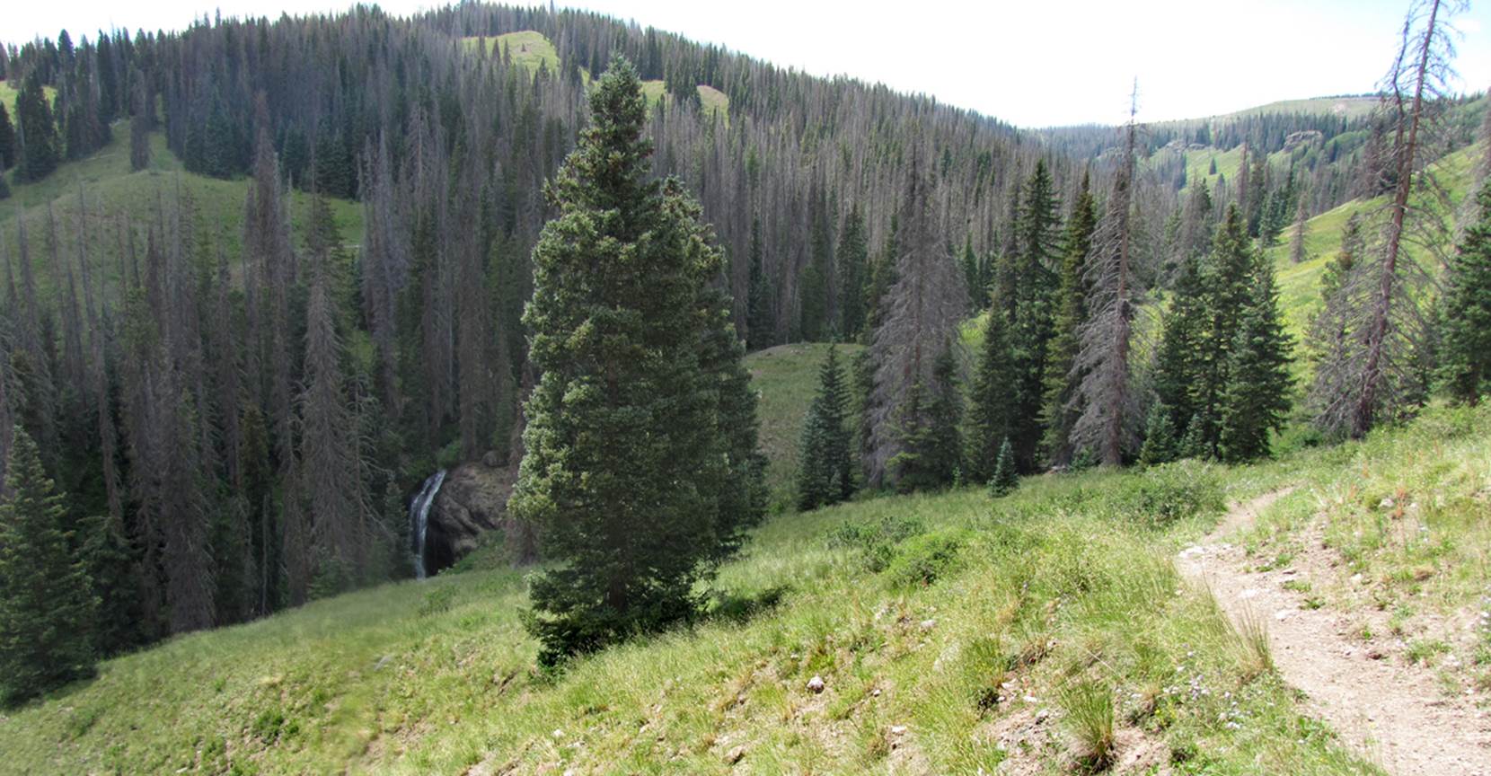
Notice the trail on your right and the
upper tier of Wolf Creek Falls on your left …walk down that grassy slope and
enjoy a set of amazing waterfalls…!!!
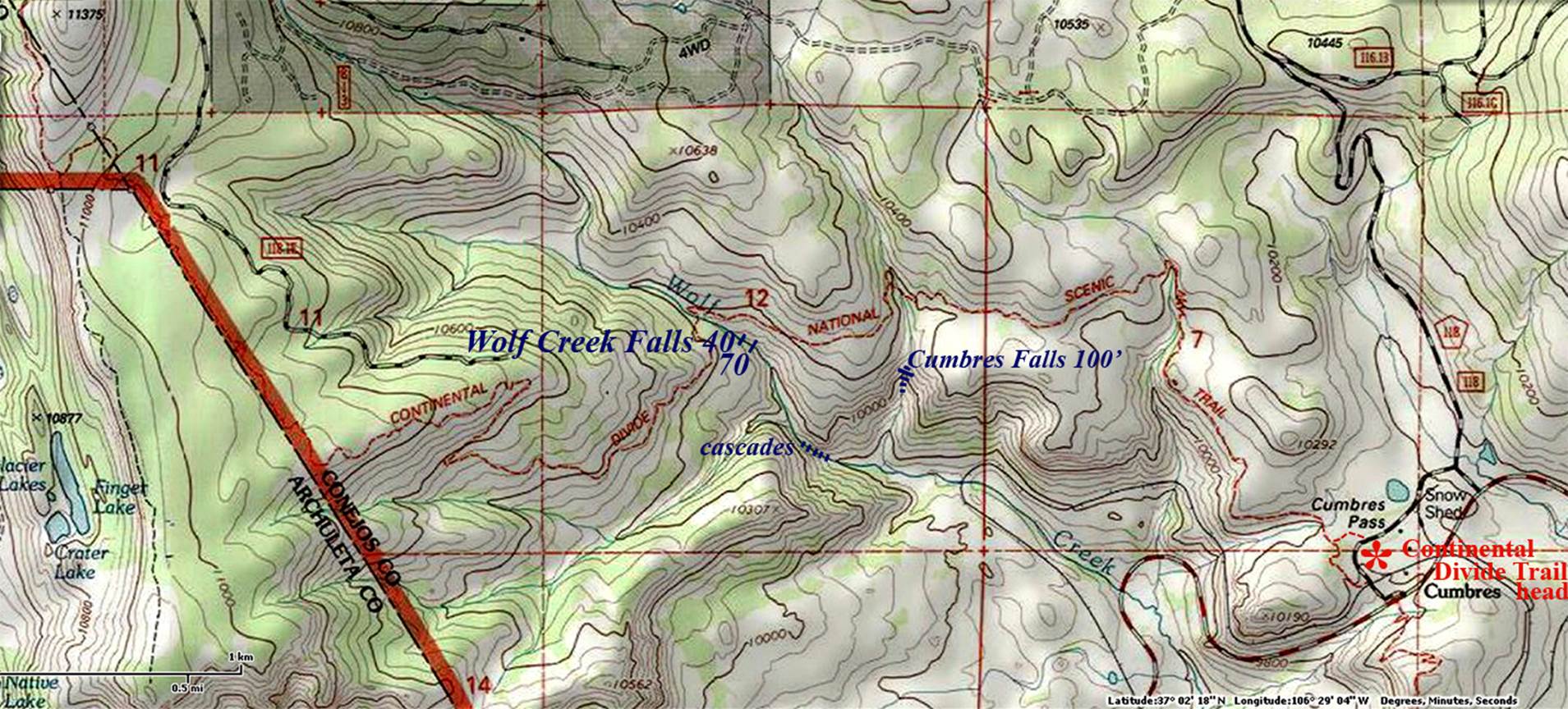
beta facts:
name- Wolf Creek Falls
height- upper tier is 40’ and the lower tier is
70’
elevation- 10,100’
GPS coordinates- ±37°01.584’N 106°28.589’W
flow- perennial trout stream
season- summer and fall
accommodations- restrooms at the trailhead 2.5 miles
behind you
ownership- Rio Grande National Forest
access- hike the Colorado Continental
Divide Trail north of Cumbres Pass for about 2.5
miles then veer off the trail and enjoy these wonderful waterfalls
nearest town- Chama, NM is about 10 miles south of
here
fun fact- this is among the most beautiful
trails I have ever hiked
essay bro
right-click-save-as my map below so you can
print yourself a hard copy to carry with you …as my map are the only maps on
earth that show these beautiful waterfalls
Enhanced USGS topo map
Send questions and comments to dscott@themarblesculptor.com