Wishbone Falls
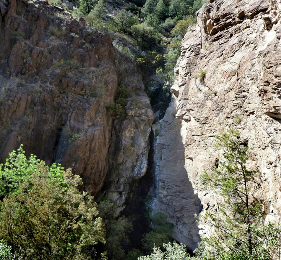
Wishbone Falls pours over a high
cliff, a half a mile up Wishbone Canyon, a tributary of the Gila River within
the Gila Wilderness
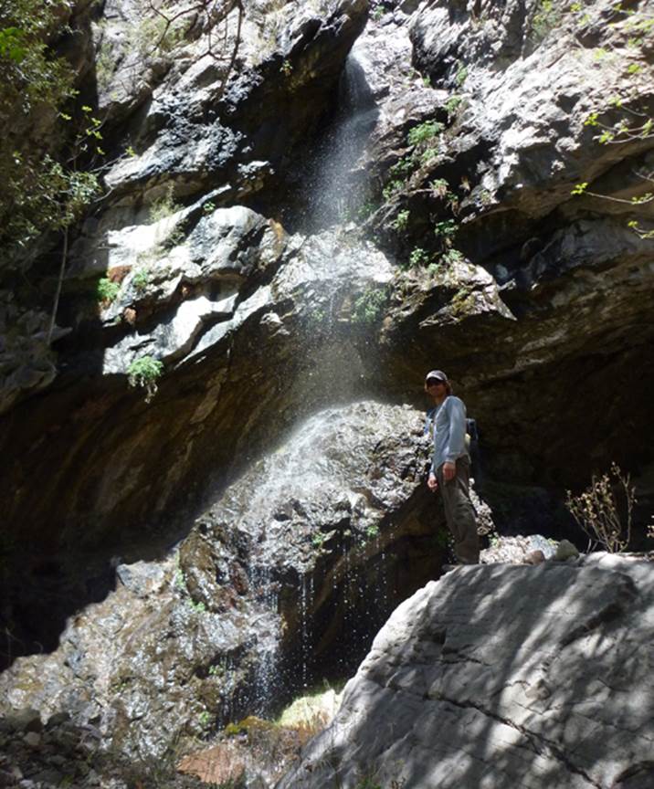
,,,it
is very rare that a visitor stands by the showered rock at the base of Wishbone
Falls -Andrew Monie
Photos
beta facts:
name- Wishbone Falls
height- 80 to 100 feet estimate
elevation- 5350’
GPS coordinates- ±33°04.916’N 108°25.805’W
flow- perennial
season- most of the year, but spring may be best
if the Gila River is not too high for hiking upstream
accommodations- none… wilderness
ownership- Gila National Forest / Gila Wilderness
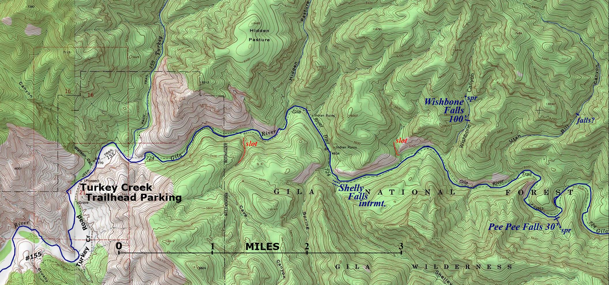
access- is in on Turkey Creek Road 155 and hike
5.4 miles up the Gila River on Trail 724 –then a
trail-less half mile north/up Wishbone Canyon to the falls
nearest town- Cliff and Gila are about 14 miles
southwest of here
fun fact- ...you found a goodern Andrew
essay bro:
Andrew Monie is a
Fisheries Biologist for New Mexico State Dept of Game
and Fish. He found Wishbone Falls while
inspecting Wishbone Canyon for possible fish habitat. He found it to have perennial flow but quite
difficult and expensive to stock.
Enhanced
USGS 7.5’ topo map
Send questions and
comments to doug.vivian@yahoo.com