Three
Rivers Waterslides
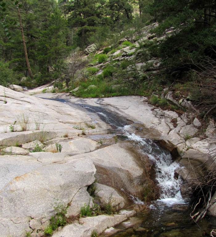
...a 20’ high, 60’ long section of the
Three Rivers Waterslides
A couple more sections of the Three Rivers
Waterslides
Clean Bedrock… perfect for sliding… but
don’t cry to me when you get hurt. This
is a “BigBoy-Sport.”
beta facts:
name- Three Rivers Waterslides
height- about 100-some-feet in many tiers
elevation- 7900’
GPS coordinates- ±33°24.500’N 105°50.821’W
flow- perennial trout stream
season- May thru October
ownership- Lincoln National Forest
access- 3 or more miles up Three Rivers Trail
#44. You’ll see them right beside the
trail for a quarter-mile or so…
nearest town- this falls is 15-miles east of Three
Rivers near Alamogordo
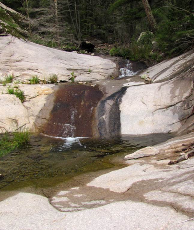
fun fact- ...these are smooth waterslides…
need I say more...???
another interesting thing is that the Three Rivers
Creek goes underground for about a half-mile between 3 Rivers Waterslides and
Fall Creek
Enhanced
USGS 7.5’ topo map
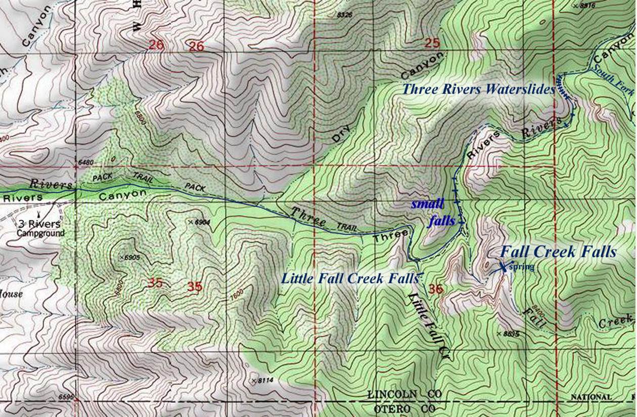
the thin, dotted red section lines above show
one mile squares
Send questions and comments to doug.vivian@yahoo.com