Sebadilla Falls
There are several waterfalls here and I have yet
to photograph all of them during a time of good waterflow
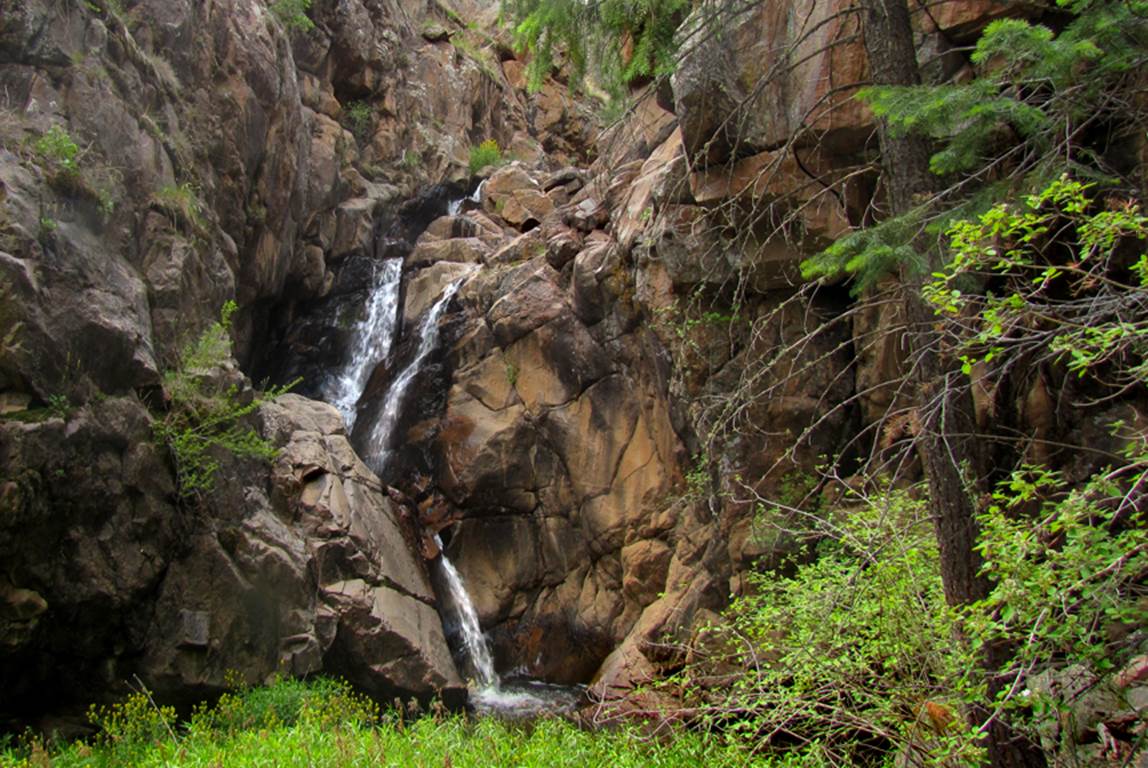
Pictured below is one of the upper Sebadilla Falls that is about 25’ high. This photo is from June 3rd,
2017 -see map below
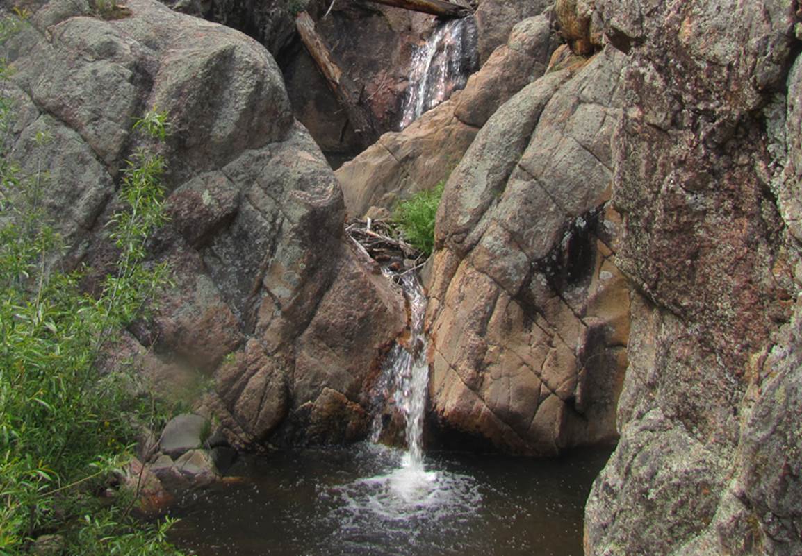
...and this next photo below shows the 2
tiered -20’ high- Sebadilla Falls that is about 100
yards upstream from the main big high Sebadilla Falls
The photos below where taken on July 10,
2017
This area had received average or better
precipitation until mid-May..... then no measurable
moisture until July 11 (the day after these photos were taken)
Therefore both of the photos below show
extremely low water-flow and zero white frothy dancing waters...
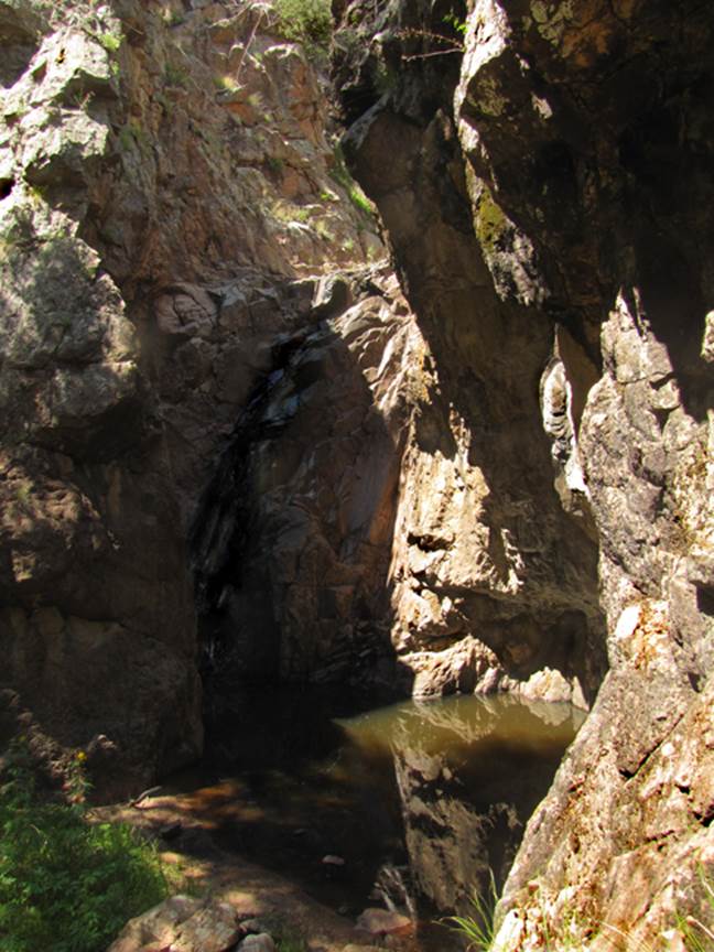
The photo above shows 40’ high Sebadilla Falls with just enough water-flow to darken the
granite bedrock surface
Sabedilla Falls is one of the more beautiful
waterfalls in New Mexico. The rock
formations surrounding it are quite unique, but visit Sebadilla
during the month of May.
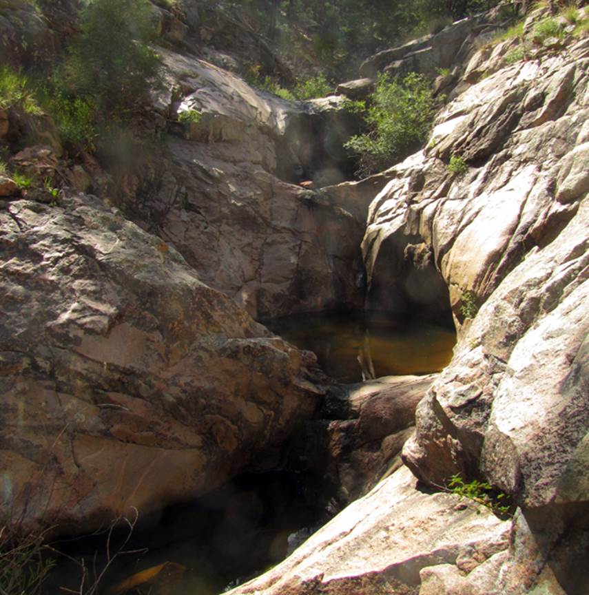
The
photo below was shot the same dry day as the photo above
It
is of the upper most waterfalls of Sebadilla Creek
–see map below-
Each
of the 3 tiers shown below are about 10 to 12 feet
high
beta facts:
name- Sebadilla Falls
height- many falls are here, up to 40’ high
elevation- 7500’
GPS coordinates- ±35°31.695’N 105°29.460’W
flow- we think this stream is perennial, but it
flows strong every year during the month of May
season- May is best
accommodations- none
ownership- Santa Fe National Forest
access- Forest Road 83 east of Pecos, NM then
south on Forest Road 200
nearest town- Pecos is about 11 miles west of here
fun fact- this place is definitely
“off-the-beaten-path”
essay bro
Sebadilla Falls is about 11 air-miles east of Pecos,
NM. Forest Road 83 is a good strong dirt
road, but FR 200 is almost a 4WD road and requires a high clearance
vehicle. ±35°31.600’N
105°30.200’W is the GPS cords for where a faint 4WD road turns east off from
Forest Road 200. You can walk
from here or drive this faint 4WD road until fallen trees stop you, and hike in
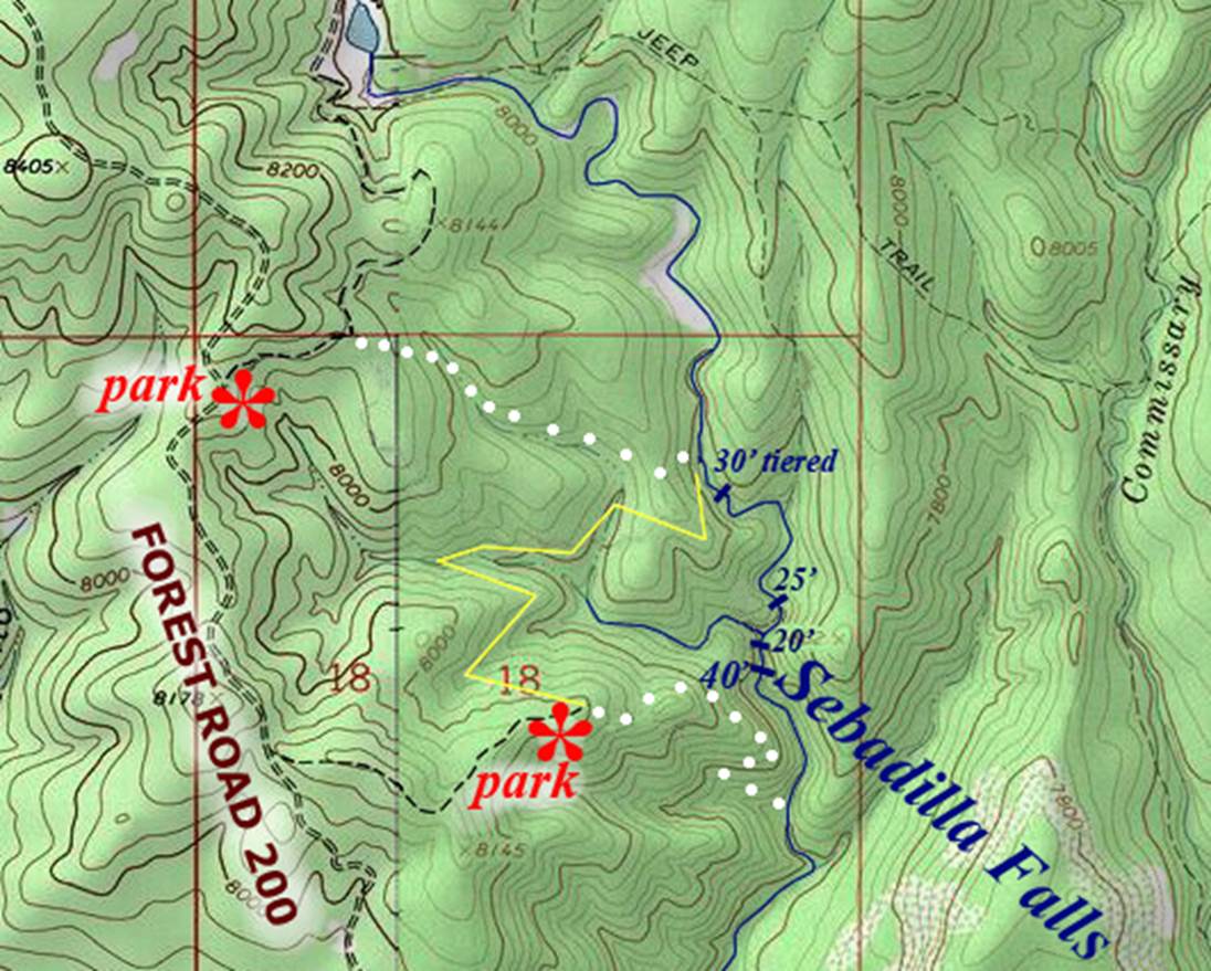
from there. See the map below. I visited all 4 of these waterfalls from the
downstream end hiking upstream. But
doing so you must climb
around, numerous sheer cliffs.
By avoiding the sheer cliffs ropes are not needed. This is difficult all-fours, scrambling/climbing with some, mild exposure.
On the map below the routes shown with round white dots are direct routes to access to and from Sebadilla Creek. A thin yellow line shows the route to use to connect the upper falls with the lower parking area. During the month of May your effort to visit this place will be well worth it.
Our maps are
the only maps on earth that show what we show.
Please feel free to “right-click-save-as” on any and all of our maps to
save a copy of our map-file to your desktop.
This will allow you to print a hard copy to hold in your hand while
hiking in the field
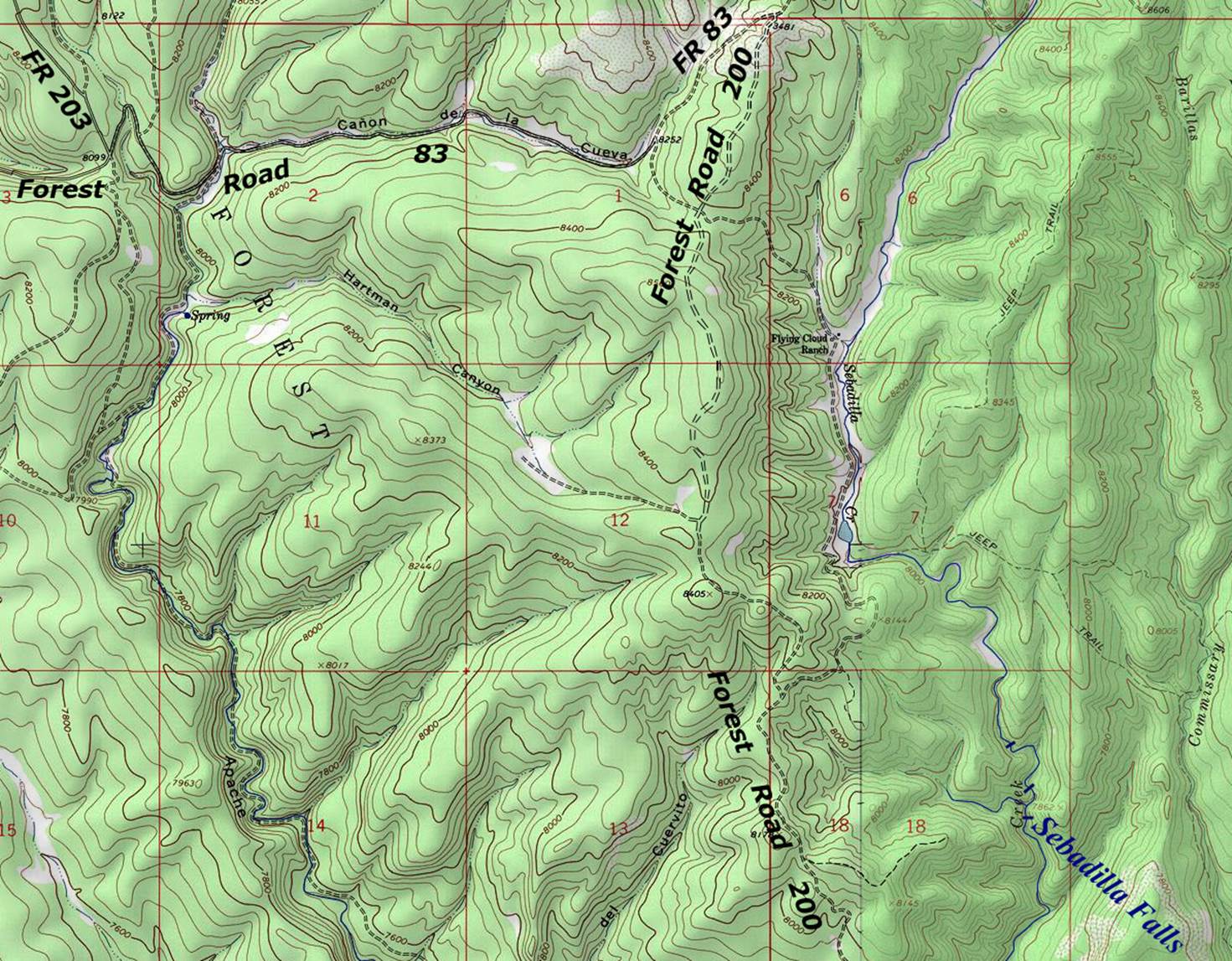
Enhanced USGS topo map
Below is a larger area map showing the roads leading to the access
points
Send questions and comments to art@DougScottArt.com