Palomas Falls
Spanish Palomas = Dove in English
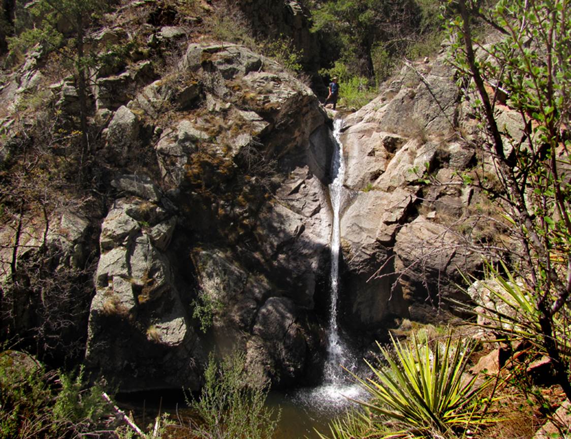
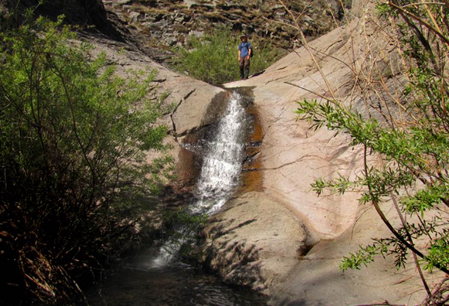
Nate
Bartnick stands atop 40’ high Palomas Falls at 7600’ on South Fork Palomas
Creek in New Mexico’s amazing Black Range
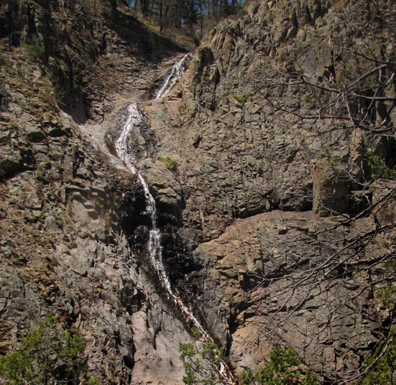
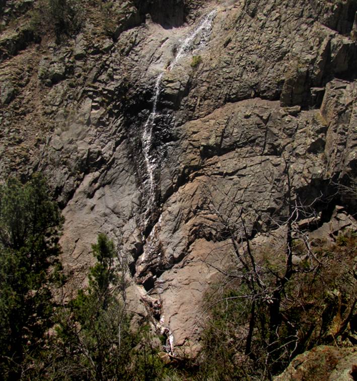
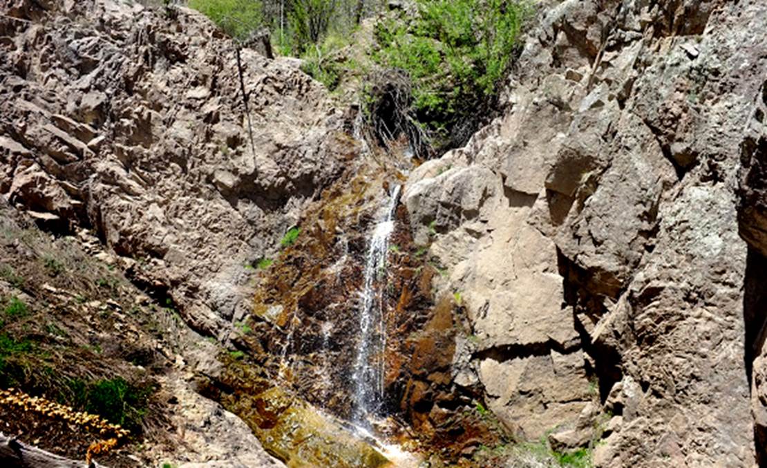
The two photos below show both
the upper and lower portions of 250’ high Upper Palomas Falls at 8000’ on South
Fork Palomas Creek
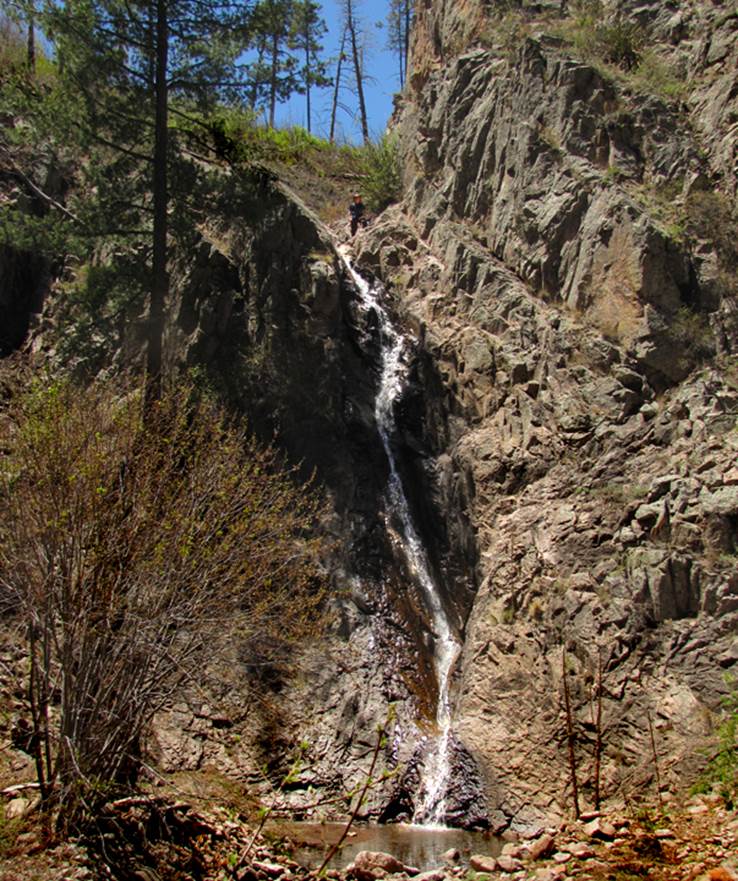
In
the photo below, Nate scaled cliffs 50 feet high to reach the top of Rebekah’s
Falls... also on South Fork Palomas Creek
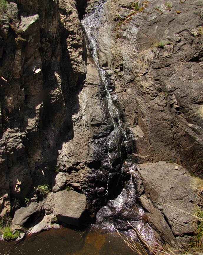
The photo below shows 15’ high Lower
Palomas Falls at 7450’ elevation –see the map below
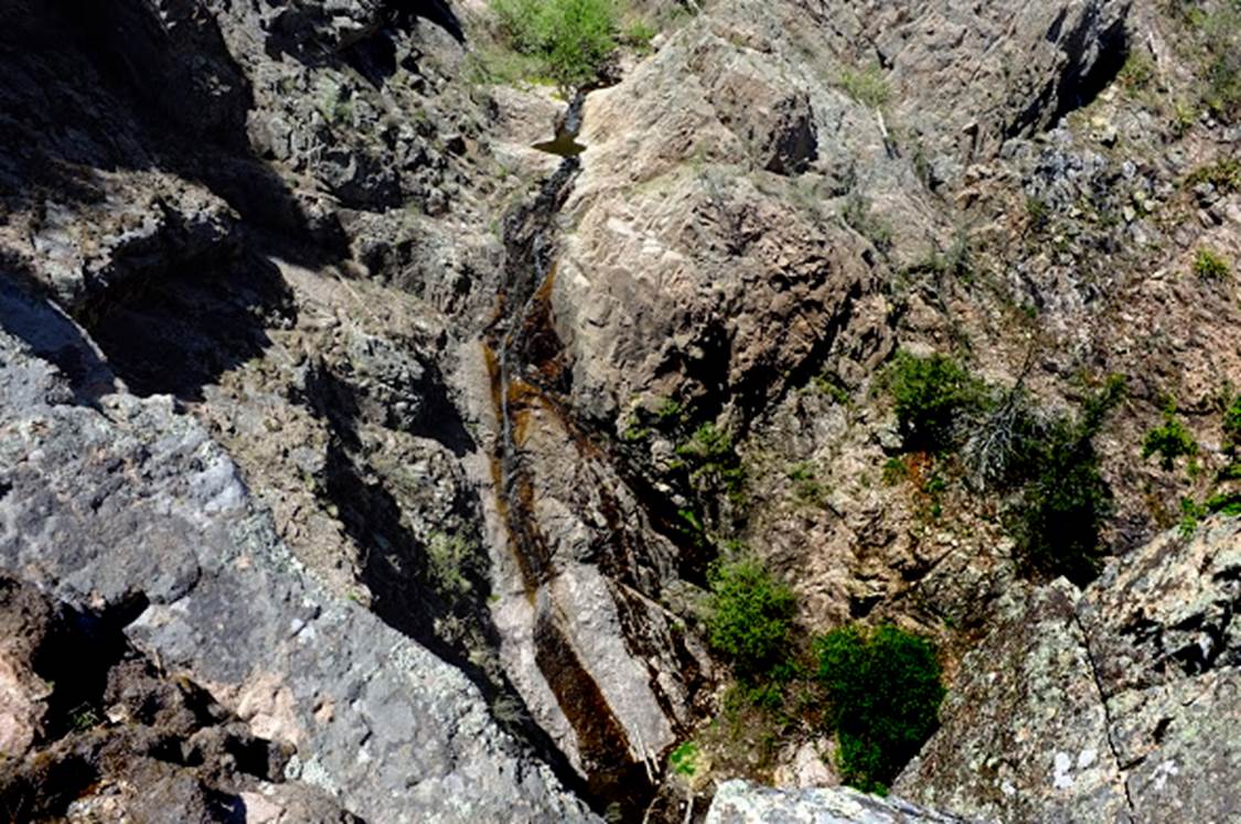
A nice series of cascades 200’ high are on
the North Branch of South Fork Palomas Creek... the waterfall in the photo
below is the finale of these cascades
–all of these images were
taken during a dry time of low water flow altho... not an extreme drought-
These lower photos below are
shot by my friend Nate Bartnick
This first Nate Bartnick photo is of the
100’ high drop that begins the Upper Palomas Cascades on the North Branch of
South Fork Palomas Creek
His second photo here is of a small
waterfall immediately upstream from Rebekah’s Falls on the South Fork Palomas
Creek
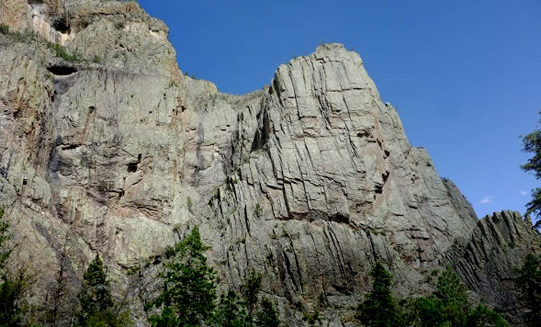
This third photo shows the 1000 foot high cliffs of South Fork Palomas Canyon near
it’s Maple Canyon confluence –this is an astounding place...!!!
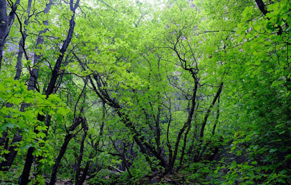
His last photo is the Maple Grove of Maple
Canyon –this grove is solid maples for 1/4 of a mile and is surrounded by sheer
canyon walls several hundred feet high
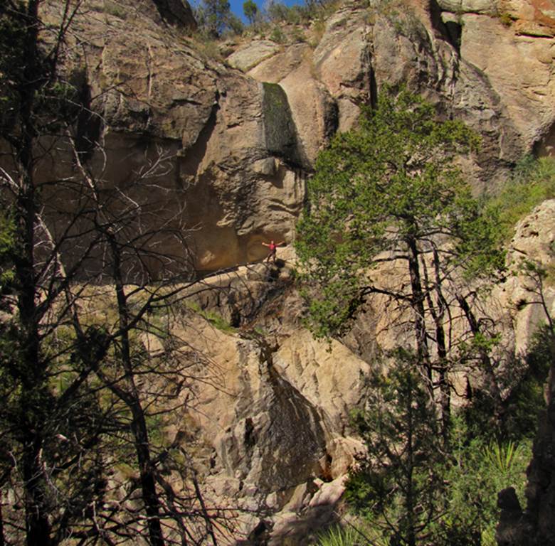
Nate stands with outstretched arms, getting
a shower under the free-falling portion of 100’ high Maple Canyon Falls. This photo depicts a dry time with small
trickling flow.
beta facts:
name- Palomas Falls, Upper Palomas Falls,
Lower Palomas Falls and Upper Palomas Cascades
flow- perennial except possibly during
extreme drought
season- March, April, September, October
and November
accommodations- none – Aldo Leopold
Wilderness Area
ownership- Gila National Forest
access- Gila National Forest Road 157 to
Hermosa. Then a 4WD road up South Fork
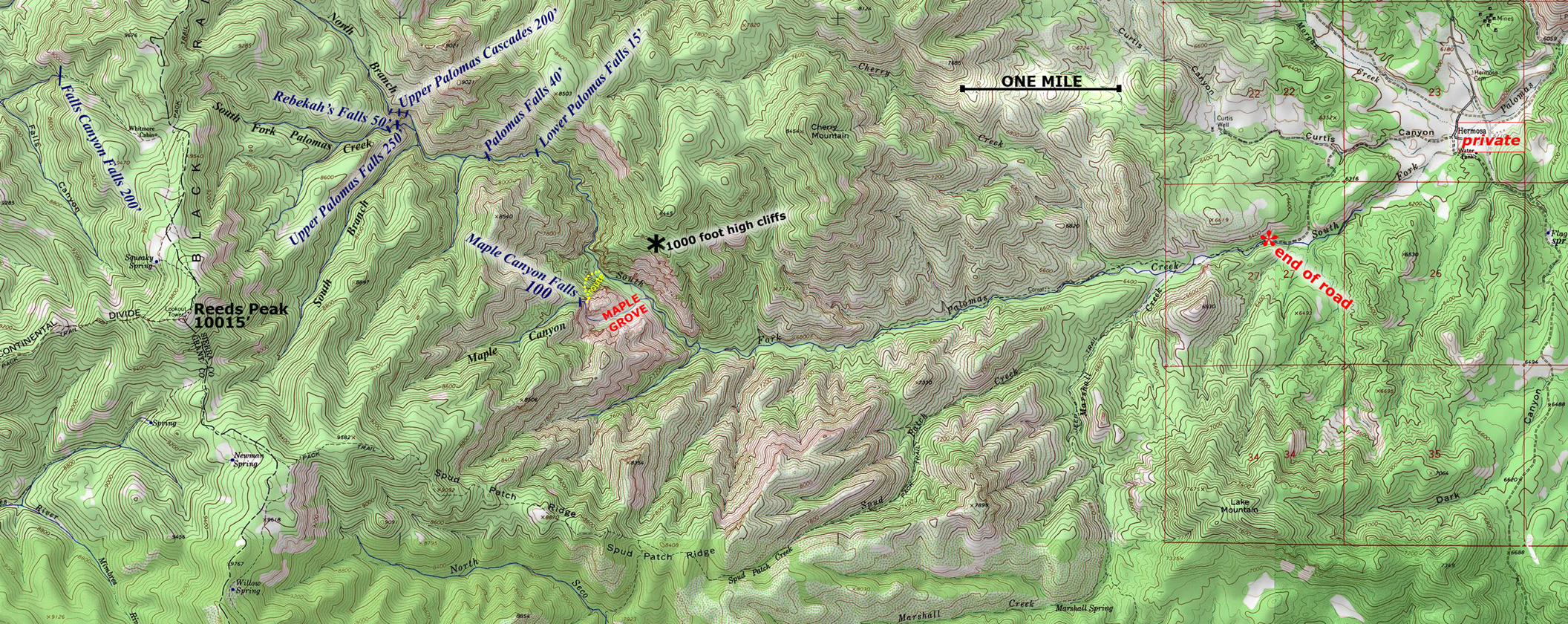
Palomas Creek, followed by 5.5 miles of hiking to Palomas Falls –see map below:
nearest town- Winston is about 17 air-miles
northeast of Palomas Falls
fun fact- NOBODY GOES HERE...!!!
essay bro:
The South Fork Palomas Creek Canyon is
extraordinaire... with un-comparable beauty...
Forest
Road 157 from Winston to Hermosa is about 20 miles of dirt, but it is graded to
be quite smooth. Then the 2 miles of 4WD
road getting into South Fork Palomas Creek, above Hermosa, is exciting..... but
the hiking up to Palomas Falls is quite easy and often having remains of an old
trail complete with occasional rock cairns.
We consider going all the way to the highest waterfalls... to be an epic
16 mile, round-trip, day-hike...!!!
Even
the scramble up the sharp, rocky, razor-back ridge between Upper Palomas Falls
and Upper Palomas Cascades is quite hike-able.
It is the only way we found to access Rebekah’s Falls and it provides
splendid continual views of both of the high waterfalls on both sides of the
ridge. The Upper Palomas Cascades on the
North Branch are within such a rugged and steep gorge that ropes and technical
rock-climbing equipment are mandatory.
Lower Palomas Falls is at 7450’ elevation
with approximate GPS cords: ±33°09.360’N
107°49.255’W
Palomas Falls is at 7600’ elevation with
approximate GPS cords: ±33°09.344’N
107°49.538’W
Upper Palomas Falls is at 7450’ elevation
with approximate GPS cords: ±33°09.500’N
107°50.020’W
Rebekah’s Falls is at 8100’ elevation with
approximate GPS cords: ±33°09.472’N
107°50.105’W
Upper Palomas Cascades are at about 8000’
elevation with approximate GPS cords: ±33°09.550’N
107°50.074’W
Right-click-save-as
on the map below and print yourself a hard copy to have in your hand when you
take this hike
This map is
the only map on earth with this information
Enhanced
USGS 7.5’ topo map
Send questions and
comments to art@DougScottArt.com