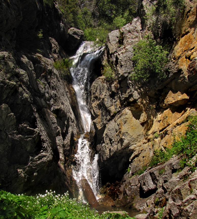
Middle
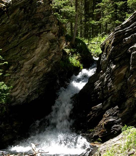
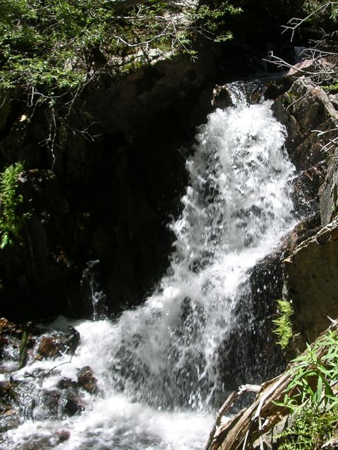
Casa Falls
...is 35’ high…!!! …and it
is a wonderful hike destination, three and a half miles one way, all on Trail 266.
This 25 footer is a few
hundred yards farther upstream…
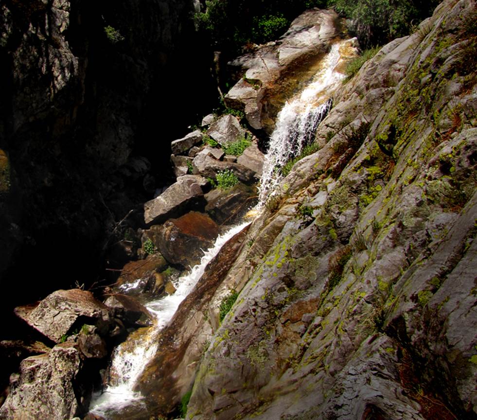
…and another fine 25’ falls about mile
above...
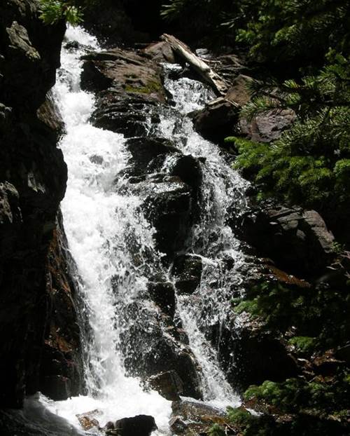
See photos of other nearby
Middle Fork Casa Creek waterfalls at the bottom of this page
beta facts:
name- Middle Fork Casa Falls
height- 35 feet high
elevation- 9800 feet
GPS coordinates- ±35°59.848’N 105°29.349’W
flow- a fine perennial trout stream
season- May thru Oct… earlier is best flow… but
you may have snow
accommodations- none – Pecos Wilderness
ownership- public – Santa Fe National Forest
access- 3.5 miles on Trail
#266
nearest town- Mora is about 15 miles east of here
fun fact- you will see no road signs telling
where you are or where you’re driving... I’m told the locals use these for
firewood
essay bro:
Middle Fork Rio de la Casa is an extra nice
waterfall hike because of the luxury of having Trail 266. It takes you all of the way from your wheels
to the falls. Middle Fork is the only
one of these “waterfall-filled” Rio de la Casa Forks that does have a
trail. The GPS cords for the trailhead
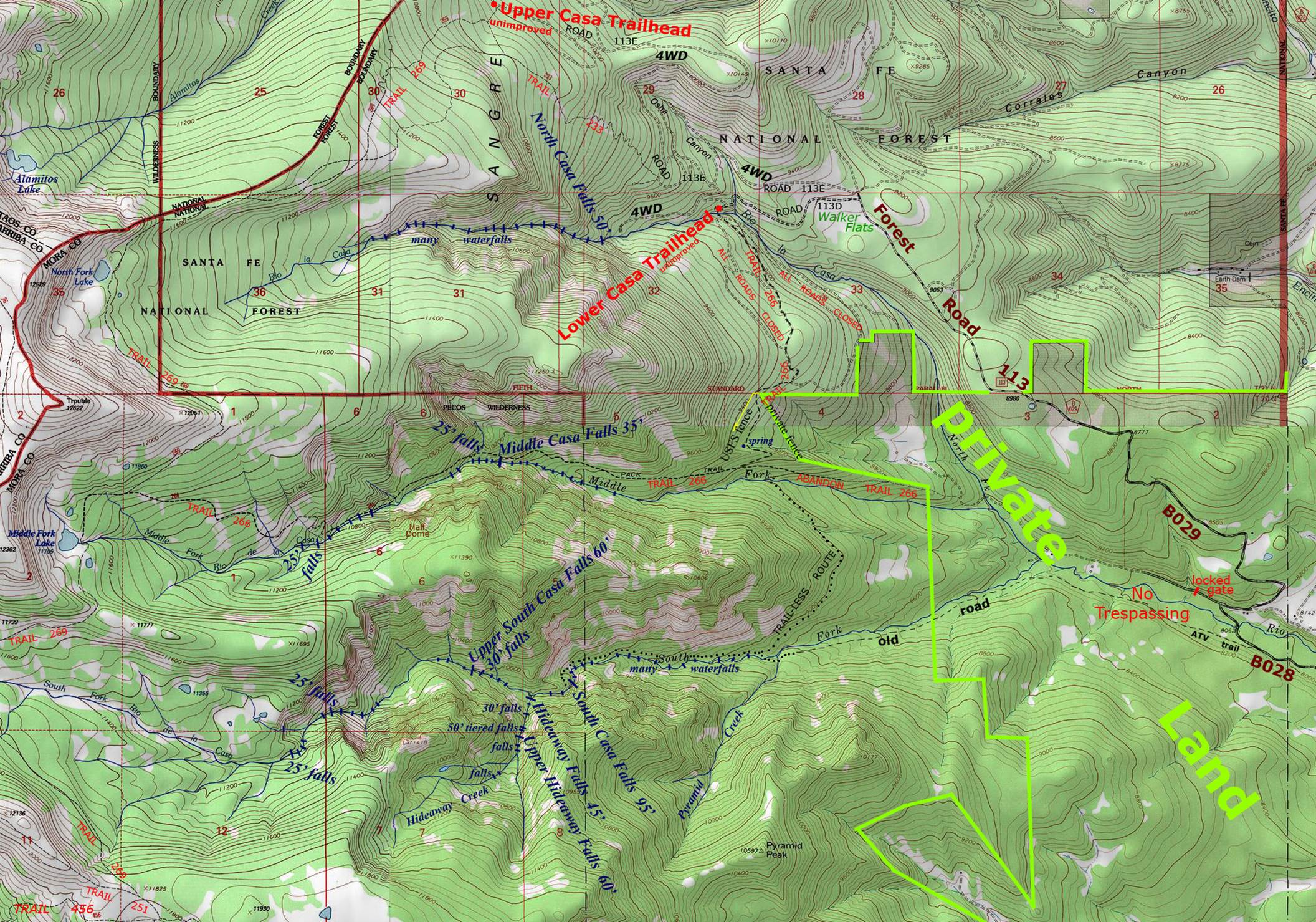
is ±36°00.930’N 105°28.307’W
Take County Road B028 from Cleveland, NM to
County Road B029. When B029 ends,
continue straight on Forest Road 113 to Walker Flats (see map below). This is where the going will get sketchy as
I’m told that the locals in this area use forest road signs for firewood… so, you will likely have to go by feel from here. But the good thing is that you are
close. Walker Flats is on my topo map
below. Please right-click-save-as to
have your own updated and correct topo map.
Forest Road 113D (see map below) is now good enough for vehicles that
are not four-wheel-drive. Lower Casa
Trailhead is clean, wide and open. I
have had no trouble of any kind leaving my car parked here. This is where I begin my Rio de la Casa
waterfall hikes.
This Trailhead is the “blockade” for
several old and discontinued forest roads.
Take my topo with you and read it carefully as you hike, for there are
very few signs here. In your first
hundred yards an old road bed heads up the hill to your right. Take your left fork here. Then in another short hundred yards or so,
two old roads fork again… as you can see on my topo map below. Take your right-hand fork here. For about a mile and a half, Trail 266 is an
old forest road. Check your gps, because Trail 266 turns to your right to become a
single-track trail here at gps: ±36°00.196’N 105°27.881’W.
Years ago what used to be Trail 266 became
blocked by No Trespassing signs. This
new trailhead – “Lower Casa Trailhead” has become the access point for the
general public. The “Old Trail 266” and
the “New” Trail 266 join at 9186’ elevation and gps point: ±35°59.788’N 105°28.302’W. The “old” Trail 266 is quite wide here. The “new” Trail 266 is narrow here. The forest service has installed a small
“arrow” on a post that points back up Trail 266 towards your car. …when you reach this trail
junction you are 1.3 miles from Middle Casa Falls.
Middle Casa Falls are not marked in any
way. You must know when you are
there. One good thing is that you can
hear it. It is maybe 40 feet off the
trail at gps point: ±35°59.848’N 105°29.349’W.
Here you will find this beautiful waterfall pouring down into a deep
narrow ravine. This is a wonderful place
with amazing beauty. I will return here
time and time again.
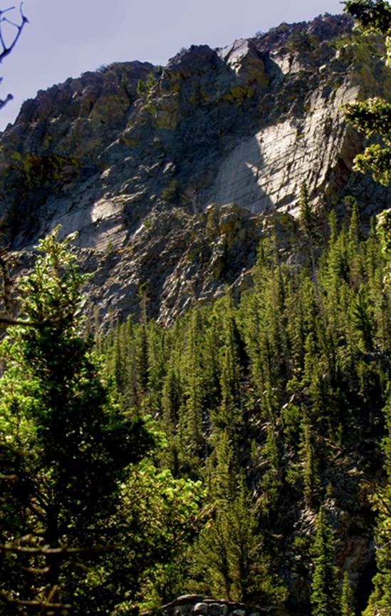
Solid granite, canyon walls mount up to
1600 feet overhead above you. Scroll down to the bottom of
this page to see a photo of New Mexico’s “Half Dome.”
Enhanced USGS topo map NORTH IS UP
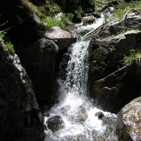
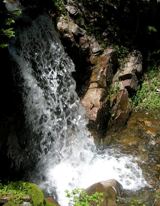
these waterfalls appear downstream from Middle
Fork Casa Falls in this order...
a 15 footer pours thru a slot in solid
bedrock
another 15 footer...
...a nice 20 footer...
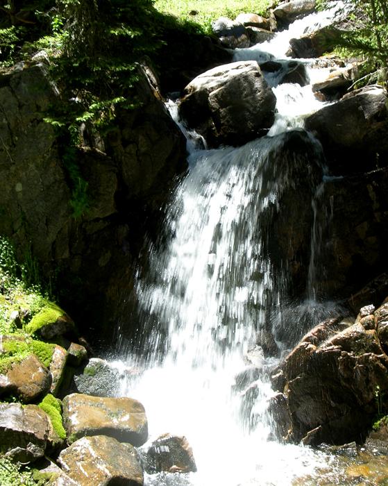
nuther 15’er
and 12’er...
And… here is a photo of New Mexico’s
version of “Half Dome” on the south wall of Middle Fork Casa Canyon…more than a
thousand feet overhead…
Send questions and comments to dscott@themarblesculptor.com