McKnight Falls
McKnight Falls is in McKnight Canyon however the stream is
East Fork Mimbres Creek
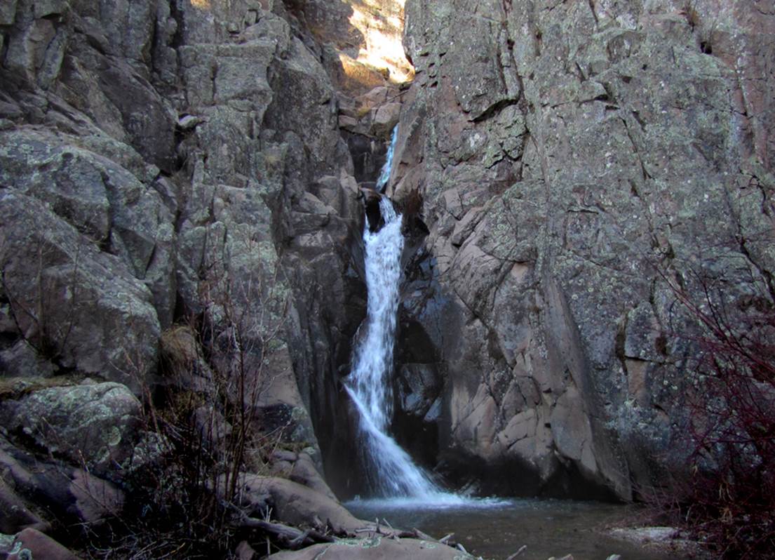
McKnight Falls pours thru a 30’
high gap in the bedrock
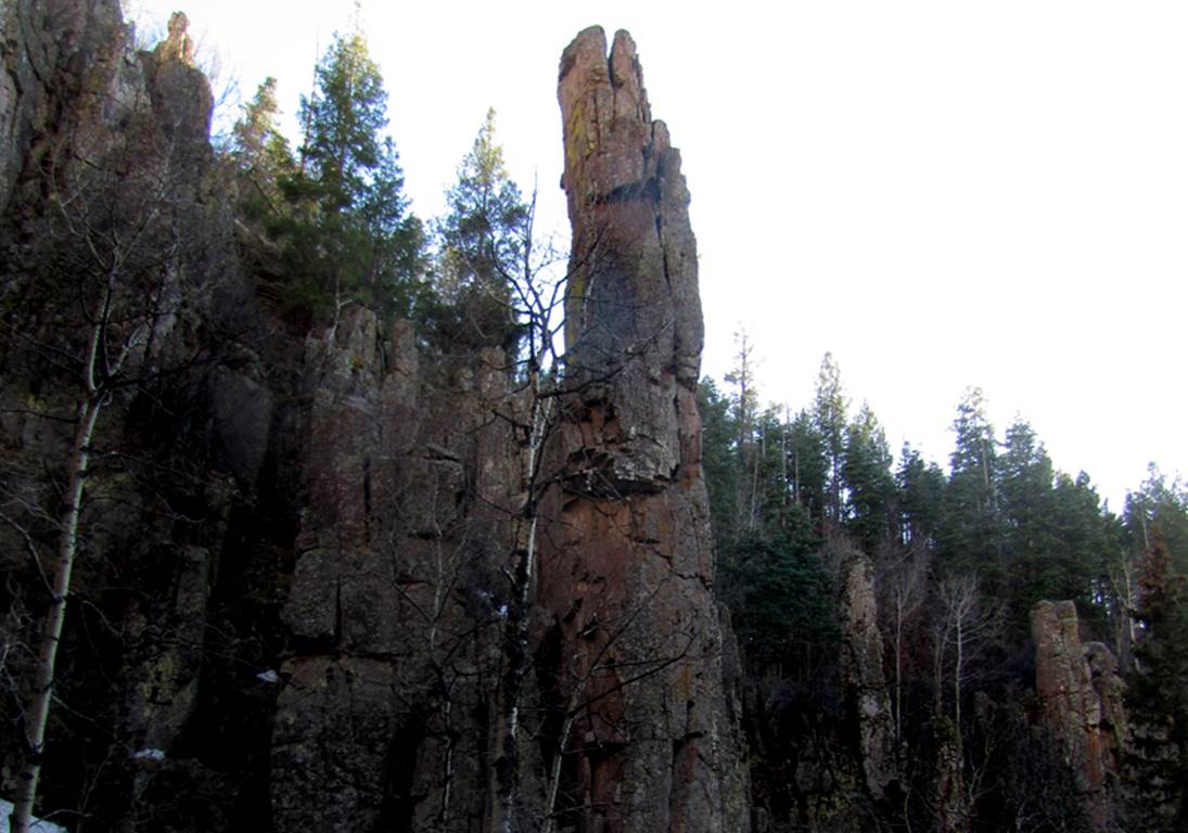
Amazing
stone pillars and spires abound, some are more than 100 feet high
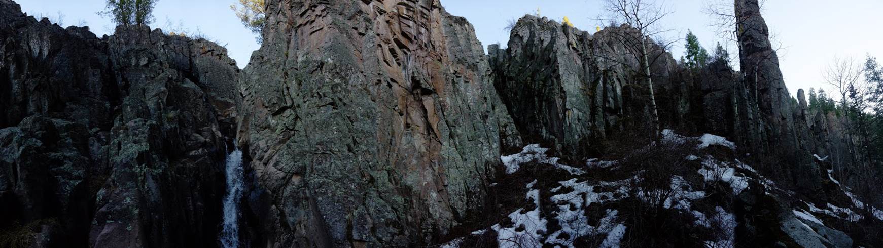
This fine, Nate Bartnick
panorama below causes the cliffs to seem more open than they really are, but it
shows that McKnight Falls is surrounded and enclosed within a cozy, amazing
alcove of solid stone.
beta facts:
name- McKnight Falls
height- 30’
elevation- 8250’
GPS coordinates- ±33°01.326’N 107°52.774’W
flow- perennial
season- it is best during March/April as
well as September into October
accommodations- none
ownership- Gila National Forest
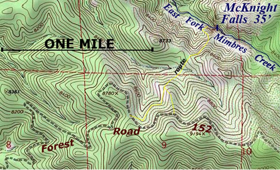
access- a 1.5 mile hike accessed from Gila
Forest Road 152 –park near GPS: ±33°00.853’N
107°53.333’W
nearest town- Mimbres, NM is about 15 air
miles southwest of here
fun fact- Extreme thickets of locust with
their painful thorns are an unbearable barrier... our clothes were shredded and
bloody...! ! !
...a 1.5 mile trail here would open this
splendor to all...
Enhanced
USGS 7.5’ topo map
Send questions and
comments to art@DougScottArt.com