Lost
Falls
There are many individual
cascades, cataracts and waterfalls on Lost Creek. They all have their own personalities. Several of these falls pictured below stack
up on top of each other to form one very high continual waterfall. This type of falls is called a “tiered
waterfall.“ See the map below.
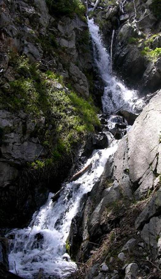
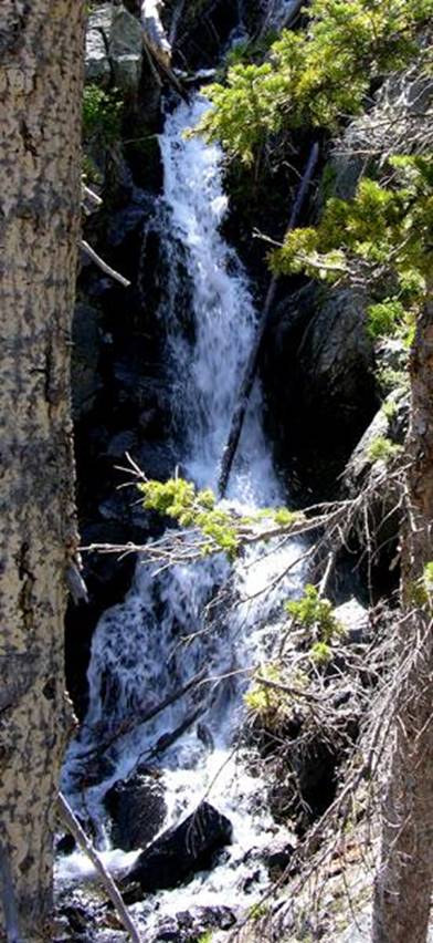
This 2-tiered, 60’ drop,
is what I call “Lost Falls”. Lost Falls
are found down within the middle of upper group of cascades on Lost Creek,
which is the stream below Lost Lake.
These next photos are
separate sections of “Upper Lost Creek Cascades” which drops a total of
320 feet continuous. Each of these
steeper falls… or tiers… are connected by cascades if not directly attached to
each other… end to end…!!!
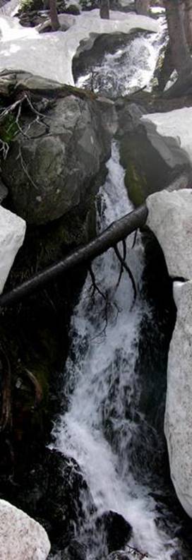
The
first tier is about 30’ high.
These second and third tiers are connected directly to each other… 150
feet high or more.
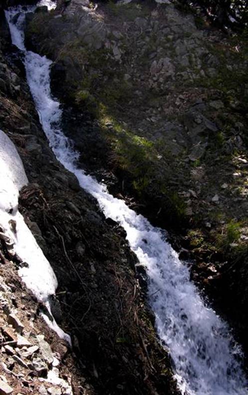
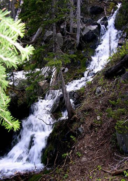
…a
40 feet high tier
This
photo below is 40 feet high Middle Lost Creek Cascades.
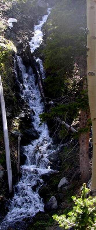
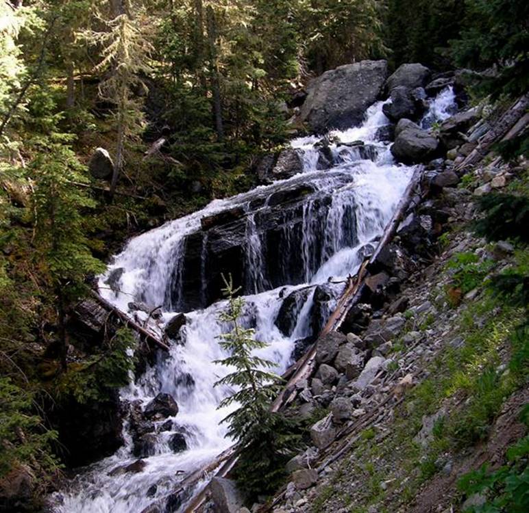
This final photo below is “Lower
Lost Falls” my favorite. It’s
about 35 feet high and is actually found in the lower portions of Wheeler Creek just before it conflues
with East Fork Red River. Wheeler Creek
has grown into a nice size trout stream at this point.
Assigning
heights to each of these waterfalls is truly impossible, as cascades cradle
them above and below.
ISN’T LOST CREEK A GOODERN’...
...CRAZY BEAUTIFUL...!!!
beta facts:
name- Lost Creek Falls
height- This 2 tiered, 60’ high waterfall is
within a 300’ high continuous cascade.
elevation- 11,400’ to 11,100’
GPS coordinates- ±36°34.651’N 105°24.123’W
flow- even tho water rarely flows out of
Lost Lake… strong perennial springs pour out below a short ways.
season- June thru Oct… early birds will
fight snowdrifts but will see the most powerful water-show.
accommodations- Wheeler Peak Wilderness
ownership- Carson National Forest
access- 5½ miles on Lost Lake trail #56
then downstream… and enjoy the water-show back to the trailhead
nearest town- Red River is about 9 miles
North of here
fun fact- people who never leave the trail,
never see these glorious waterfalls
essay bro
Upper Lost Creek Cascades are a very high
and beautiful cascades/cataracts/waterfalls…
How high… is hard to say.
They drop 300’ and cut thru one single mass
of bedrock.
Make yourself a copy of my map and please
enjoy all of the many waterfalls of the upper Red River.
They’re some of New Mexico’s best…!!!
Right-click-save-as
to make yourself a copy of our map below
To see a larger, updated and
more detailed map of this entire Wheeler Peak Area, click here: http://www.dougscottart.com/hobbies/waterfalls/TaosMtnsSEquad.htm
and here: http://www.dougscottart.com/hobbies/waterfalls/TaosMtnsMap.htm
Enhanced USGS 7.5’ topo map
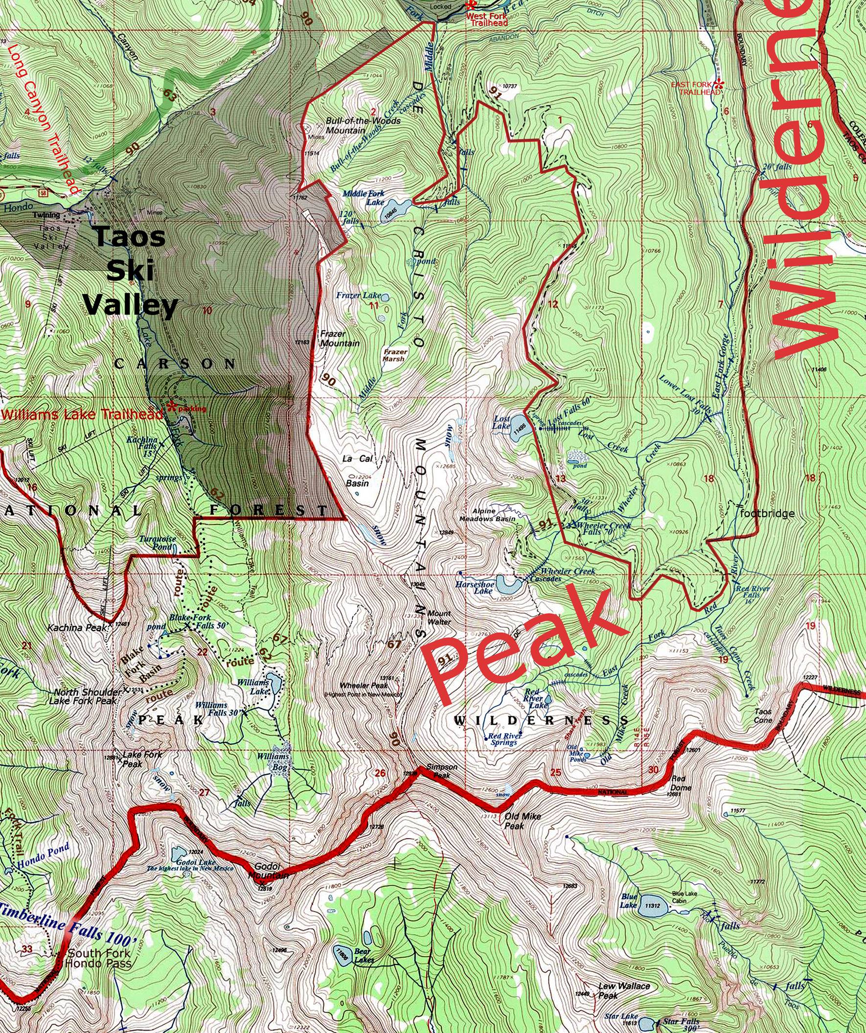
_______________ONE-MILE________________
Send questions and comments to dscott@TheMarbleSculptor.com