Joaquin Falls
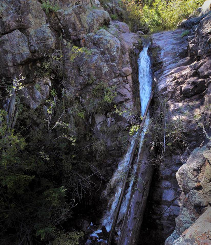
30’
high Joaquin Falls in the Jemez Mountains 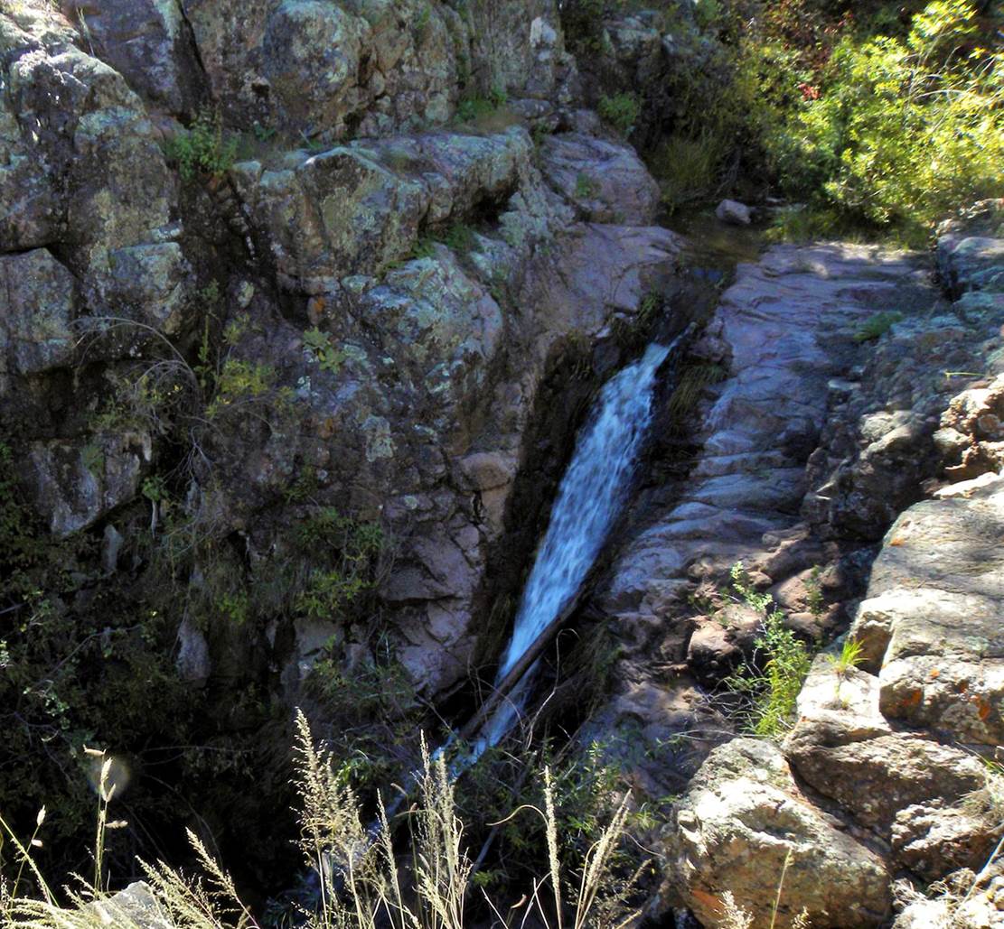
Unfortunately
floods have washed a huge heavy log over and into the falls...would someone
please move that out for me...??? Kenny Dillingham
Photos
beta facts: provided by Kenny Dillingham
whom I have lost contact with...(please contact me again Kenny)
name- Joaquin Falls
height- 30’
elevation- 7400’
GPS coordinates- ±35°47.269’N 106°48.861’W
flow- except during very dry times
season- Spring, Summer and Fall
ownership- Santa Fe National Forest
nearest town- Gilman is 6 miles southeast
of here
fun fact- not many people come to this
place...!!!
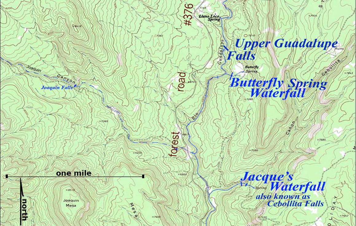
essay bro:
...a couple miles or more north of Jemez
Pueblo on NM Hwy 4, turn northwest on 485 which turns into Forest Road
376. Take 376 north up thru Gilman and
thru the famous Gilman “Tunnels” ...within another 5 miles or so stop at an old
discontinued forest road... park your wheels...an hike a short 1.7 miles west
up that road. The GPS cords here where
you park are: ±35°46.710’N
106°47.653’W Joaquin Falls cannot be
seen or heard from this old roadbed, so leave the road and follow Joaquin
Creek. This 30’ high waterfall is at
GPS: ±35°47.269’N 106°48.861’W
Juaqiun Falls appears in small print over
on the left side of the map below
Enhanced
USGS 7.5’ topo map
Send questions and
comments to doug.vivian@yahoo.com