Hondo Falls
Hondo means “deep” in
English. Hondo Falls are found high up
South Fork Rio Hondo above “Taos East” Condos.
See the topo map near the bottom of this page.
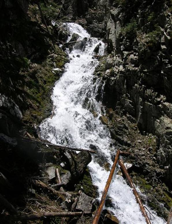
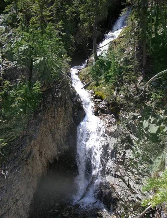
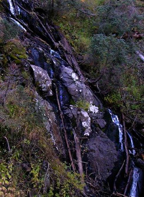
This photo shows an 80’ high
section of the very upper end of Hondo Falls at about 10,400’ elev.
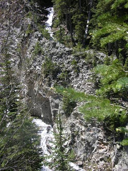
As Hondo Falls descends elevation it
becomes less of a waterfall and more like a cascade. These cascades are continuous and more than
400 feet of elevation drop, cutting thru one solid mass of granite bedrock the
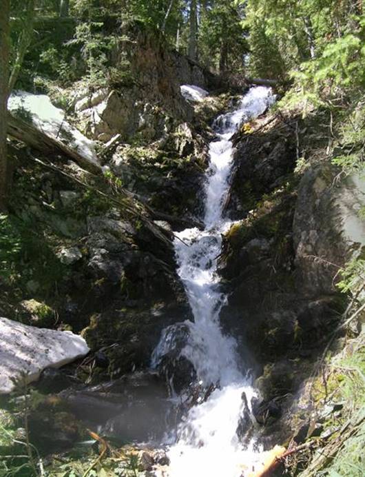
whole way. This photo below shows an 80’
high portion of Hondo Falls also within it’s upper
reaches.
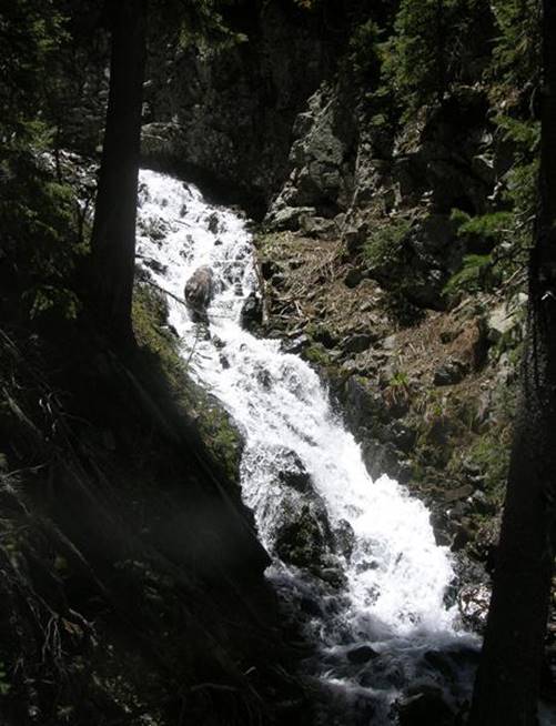
The
middle reaches of Hondo Falls here, become less steep.
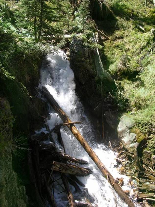
The lower reaches
of Hondo Falls appear in the lower part of the photo below while in the upper
part of this photo, Cataract Fork of the South Fork Rio Hondo is shown,
beginning it’s 50’ high “Lower Cataract Falls”.
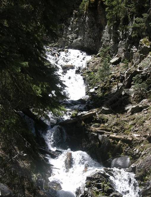
The Granite ridge between these two creeks is an amazing
out-cropping. Lower Cataract Falls is
shown in the next photo, below this photo.
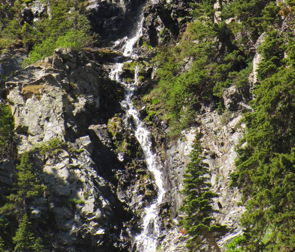
This photo below shows 50’ high Lower
Cataract Fork Falls who’s upper portion shows near the
top of the photo above.
A hundred yards or so upstream from this lower falls is another Cataract Fork Falls 50’ high
with 3 tiers.
25’ high Lower Hondo Falls is downstream
from Hondo Falls about one-third-mile at roughly 9800’ elev.
Timberline Falls 100’ high….!!!
See more photos at the bottom
of this page.
beta facts:
name- Hondo Falls
height- 400’ total elevation loss of the
entire cascades. The higher individual
waterfalls are about 60’ high.
type of waterfall- a tiered-cascade
elevation- 10,300’
GPS coordinates- ±36°32.916’N 105°27.768’W
flow- perennial
season-May thru Oct …earlier is better
accommodations- none
ownership- Carson National Forest
access- fairly difficult... ah... better
read the essay below
nearest town- Taos Ski Valley is about 3½
miles north of here
fun
fact- The South Fork Hondo
Basin is AMAZING…!!!
essay bro
South Fork Rio Hondo is a wonderful –
WONDERFUL place...!!! The mouth of the
South Fork Rio Hondo is well-known because of commercial condominiums here
known as: “Taos East.” Book yourself a room there sometime… you’ll be
glad you did…!!! There
is a NO ENTRANCE sign here as shown in this photo below:
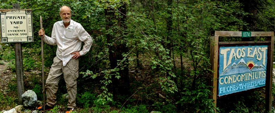
Stay out of
their yard…!!!
There
is a misunderstanding concerning public access here into the South Fork Rio
Hondo and on into the Wheeler Peak Wilderness. The truth is that public access has ALWAYS been
legal here. When I was young, 50 years ago, South Fork
Hondo Trail was open to the public and freely enjoyed by all. Access here has
NEVER been legally closed…!!!
South Fork Hondo Trail is grandfathered in. Public access here has a documented history. Stay on existing roads and trails.
Stay off of
their private property.
Also:
in May 2022- New Mexico Supreme Court
ruled that: All waterways in New
Mexico are Public Domain. Therefore,
wading up the stream bed is totally legal.
Immediately beyond the houses, you will
find “South Fork Hondo Trail.” It is no
longer maintained and fallen trees must be either climbed over, under,
sideways, down (the Yardbirds.) However,
navigation does get easier as you progress up the canyon into higher elevation.
About 3½ miles in, you will come upon a
very interesting “natural” blockade... the “Rock Fall”. The creek flows thru a short section of gorge
with sheer sidewalls almost 100 feet high.
This little box canyon is about 30 feet wide. A large portion of the southwest wall
recently collapsed completely filling the gorge from sheer wall to sheer wall
with rocks and boulders... 30 feet deep...
Scrambling up the Rock Fall is “do-able” enough. This rock fall has buried a waterfall that
was likely about 25 feet high.
Another fifty yards upstream is a beautiful
waterfall 25 feet high... Lower South
Fork Hondo Falls -see photo above. It is
fairly easy to get up and around.
About a third of a mile farther upstream is
a wonderful water-show... in fact... a double water-show... Two separate sets of waterfalls on two
separate creeks. The two largest tributaries
of this drainage join here. Both of
these creeks dance beautifully between sheer granite walls down splendid
cataracts, cascading for almost four hundred feet of elevation.
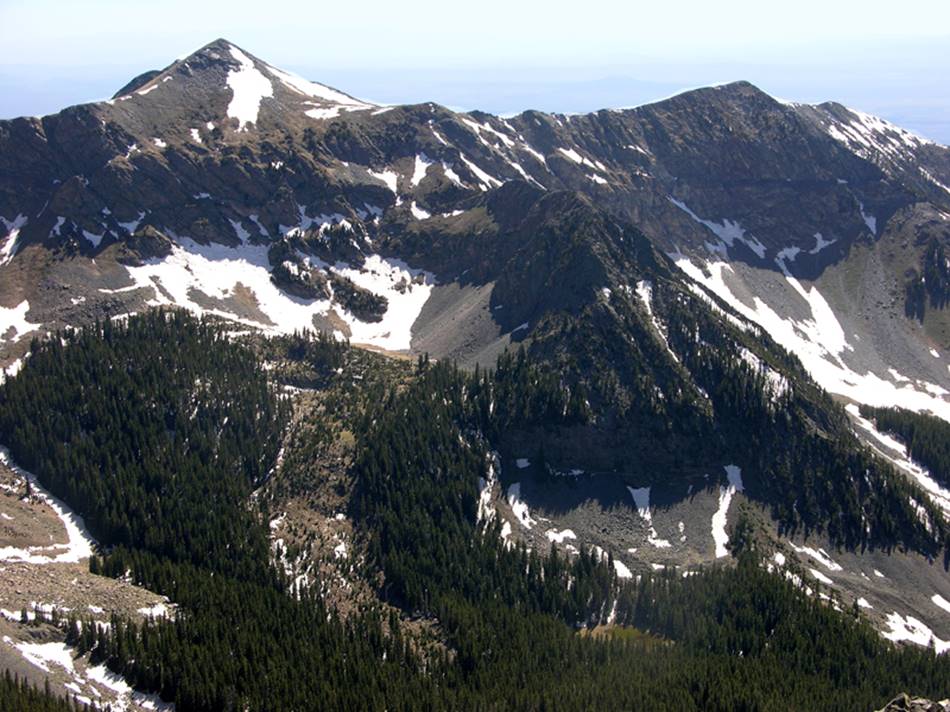
Take notice on the map below that the
northeast face of Vallecito Peak called Granite Wall,
is about 900 feet high and sheer. Has it
ever been climbed...??? Also notice the
two creeks called Rescue Creek on the map below. This is where the Taos Ski Valley Ski patrol
find those who ski too far out-of-bounds and end up on the wrong side of the
mountain. Broken Waters Creek flows down
from the Tummy of the Pregnant Lady Mountain.
Please see the photo at the bottom of this page and you will understand
why this mountain received the local nick-name: “The Pregnant Lady”.
Please do a right-click “save as” to print
yourself a copy of our map below as it is far more accurate than any other map
available.
Enhanced
USGS 7.5’ topo map
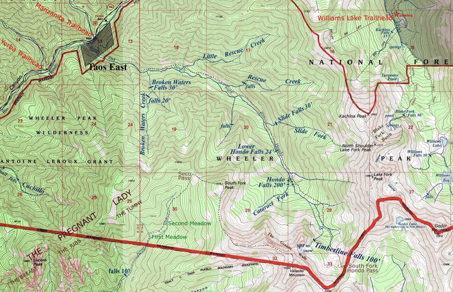
Thin
red lines above are one-mile squares
Click here to
see: more Wheeler Peak Wilderness maps
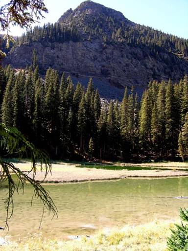
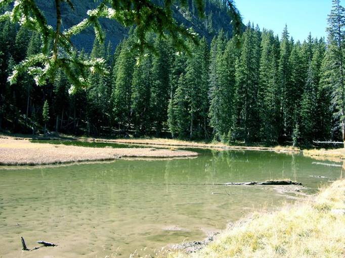
Here are two photos of South Fork Rio Hondo Pond where
the elk like to wade.
Avalanche Creek is full of huge spruce logs deposited
by many snow avalanches thru the years... but this 40’ high waterfall is nice
anyway...!!! This photo was shot during
a very low-water time. I’m sure that all
the exposed rock in this photo would be covered with beautiful frothy-white
waterfall foam during late May and early June snow runoff.
The Northeast Face of Vallecito
Peak… The “Granite Walls” can be seen here, just above timberline…and South
Fork Rio Hondo Pond can be seen in the thick timber near the bottom of the
photo.
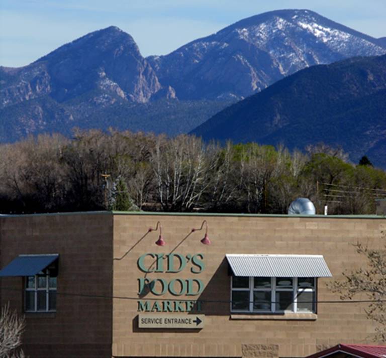
The Pregnant Lady Mountain as seen from Taos. She is lying on her back here beyond Cid’s Food Market. You can see her breast, ribs and tummy very well in this photo.
Send questions and comments to dscott@TheMarbleSculptor.com