Hollinger
Falls
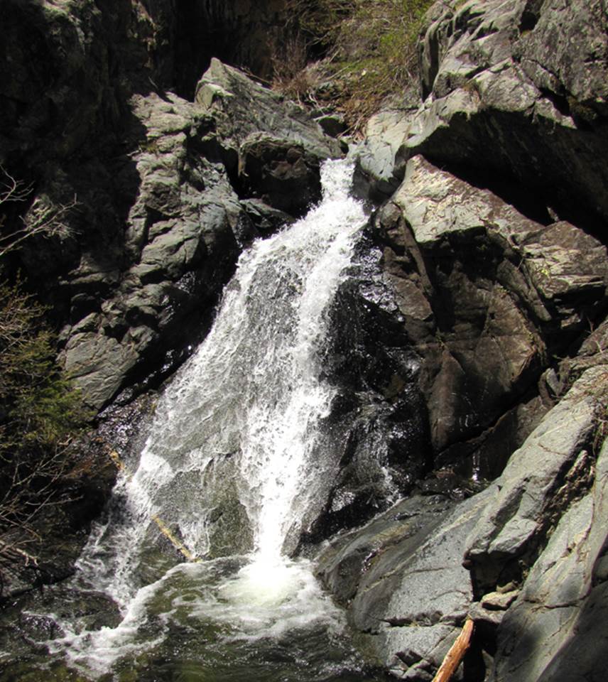
Hollinger Falls is a 50’ high tiered
waterfall. This is the 20’ high lower
tier
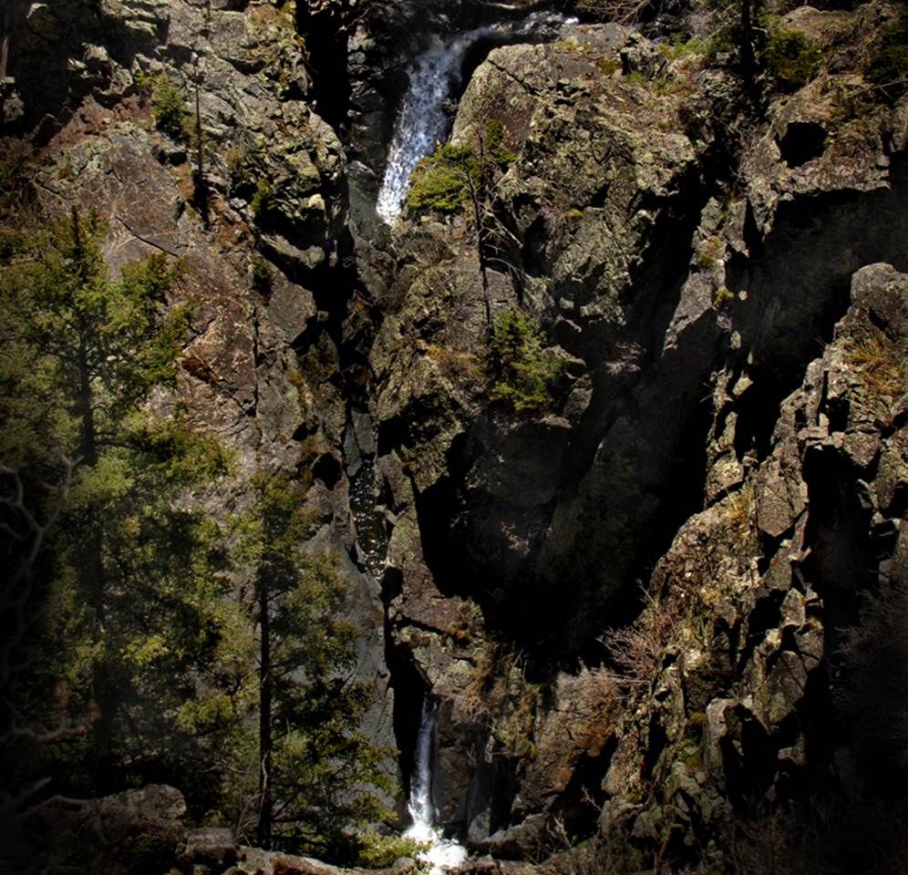
The
30’ high upper tier, pictured here, falls down thru an amazing slot of solid
granite, with a calm pool in the middle
beta facts:
name- Hollinger Falls
height- 50’ high with two tiers… 20’ and
30’
elevation- 9200’
GPS coordinates- ±35°46.673’N 105°30.725’W
flow- perennial trout stream
season- summer and fall
accommodations- Pecos Wilderness Area
ownership- Santa Fe National Forest
access- 8 miles upstream from El Porvineer
Trailhead. The last mile has no trail
nearest town- Las Vegas is about 20 miles
southeast of here
fun fact- sheer granite walls rise hundreds
of feet straight up out of this waterfall
essay bro
Hollinger Creek is the largest
tributary-source of Porvineer Creek. It
drains the northeast slopes of Elk Mountain.
You will find this waterfall within the far eastern portion of the Pecos
Wilderness Area.
Because of government budget cuts the
Forest Service cannot maintain as many trails as it used to. As you can see by the map below Hollinger
Canyon Trail is no longer maintained. We
are loosing this trail…and several others.
The only way this trail is to be saved, is for you and I to use it. Get off of your beep go hike it man…!!! It is beautiful…!!!
Enhanced USGS topo
map
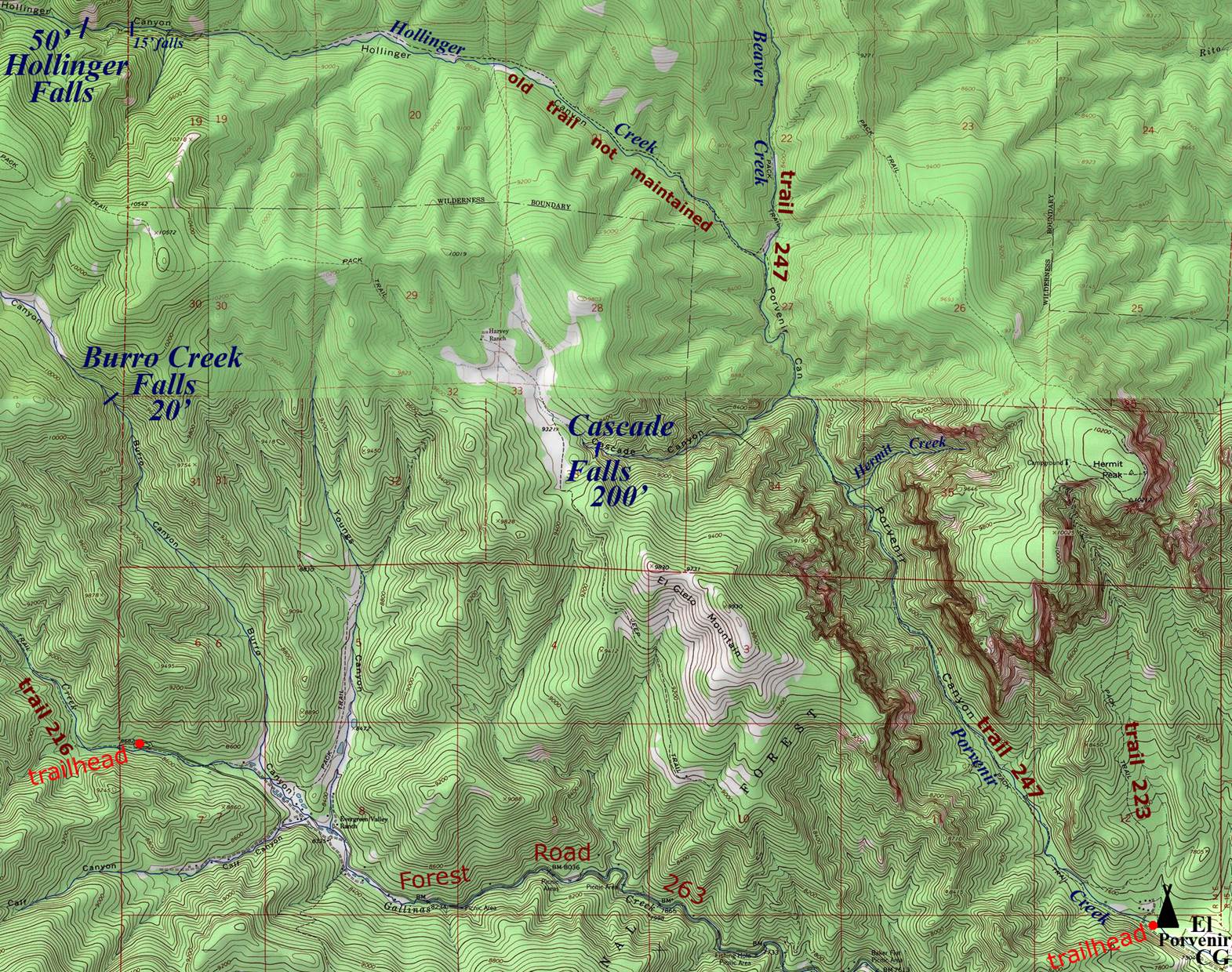
_________one
mile_________
Send questions and comments to dscott@themarblesculptor.com