Deadman Falls
See on youtube: https://youtu.be/XGJfP3AFfzM
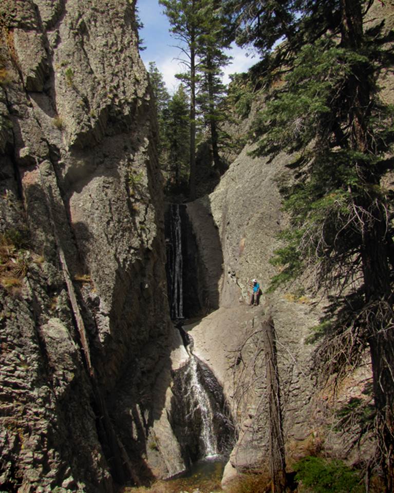
Deadman Creek pours over 60’ of solid bedrock amidst tall
Douglas Fir trees, high in New Mexico’s Black Range
Nate
Bartnick stands on a dangerous ledge at Deadman Falls
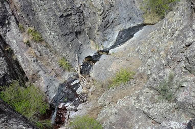
Cascades
flowing over clean bedrock continue below Deadman Falls
 Nate
Bartnick Photo
Nate
Bartnick Photo
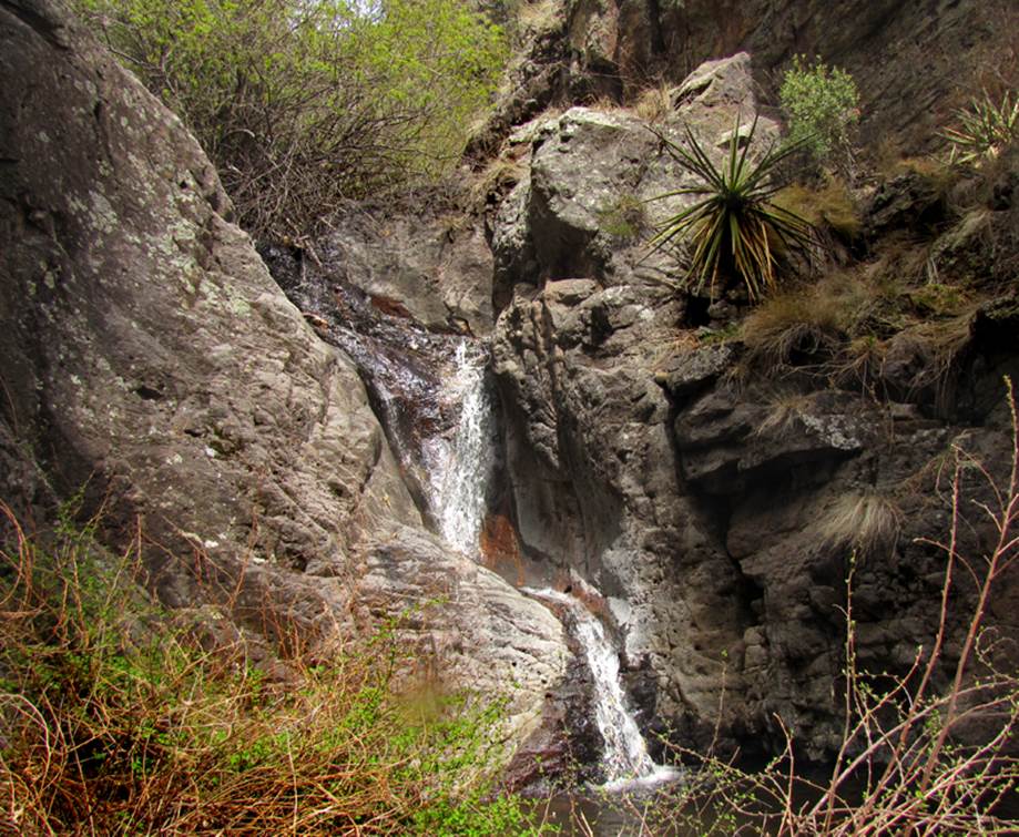
The
lower most tier of Deadman Falls is this sweet 20 foot
drop following a long string of beautiful cascades
beta facts:
name- Deadman Falls
height- 60’ main falls with 100’ more of cascades
and smaller falls below it
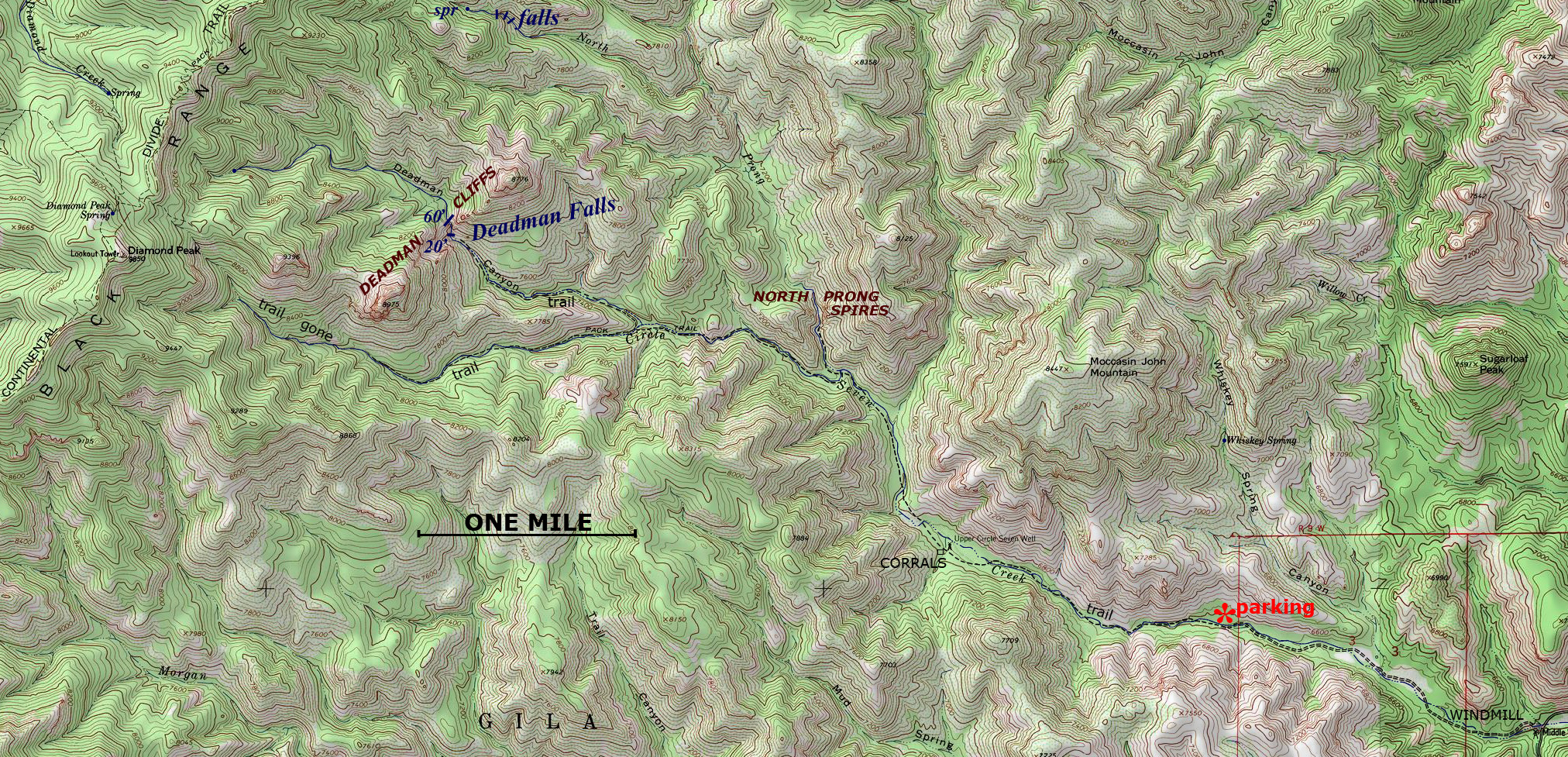
elevation- 7800’
GPS coordinates- ±33°13.883’N 107°49.200’W
flow- we believe it to be perennial
season- late February thru April ...and September
thru October
accommodations- none – Aldo Leopold Wilderness
ownership- Gila National forest
access- a 4.5 mile hike in from Circle Seven
Trailhead on Forest Road 730 via Forest Road 157
nearest town- Winston is 15 air miles northeast of
here
fun fact- be one of the scant few to visit
Deadman Falls...
essay bro:
If you cannot climb up and around that
first 20’ waterfall, then you must scramble about 100’ elevation up the open
rock-slide/boulder-field that is just to your right of the falls...until you
can look down a clear dirt slope that allows you to see Deadman Creek and
easily walk 50 feet down to it. At this
point on the creek you are maybe 100 feet downstream from the main Deadman
Falls. We found the hike and the
scramble in the cliffs to be quite easy.
When these photos were taken, both Circle
Seven Creek and Deadman Creek were intermittent. Some places they were flowing good and other
stretches were bone dry. But the waterfalls
were flowing fine.
This following web-page is the only
existing indicator I know of for showing how “wet” the Black Range is. Clicking on this web-page provides the
real-time, up to date, surface water stream-flow chart for the Mimbres River. The Mimbres River has its source in the Black Range.
http://waterdata.usgs.gov/nm/nwis/uv/?site_no=08477110&PARAmeter_cd=00065,00060
Our photos above were taken on March 26,
2016 with the Mimbres River Gauge reading 20 CFS. I would not be surprised at all if Deadman
Falls flows fine whether this guage has any flow or
not... but I do not know this for certain.
Enhanced USGS 7.5’
topo map
Send
questions and comments to art@DougScottArt.com