Church Falls
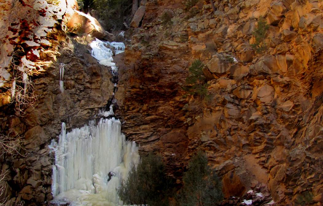
100’ high Church Falls overlooks the town
of Jemez Springs
beta facts:
name- Church Falls
height- 100’
elevation- 7600’
GPS coordinates- ±35°47.409’N 106°39.770’W
flow- perennial
season- anytime but early December is when I was there
shooting the photos on this page
accommodations- Jemez Spring has it all hey...
ownership- Santa Fe National Forest
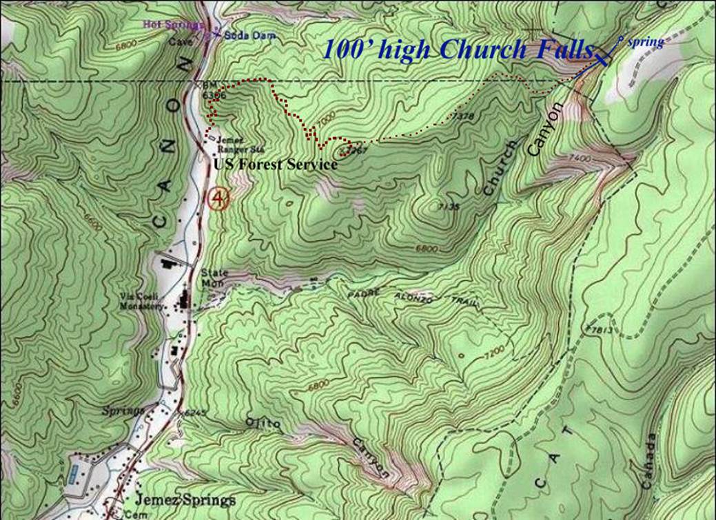
access- 1m trail above the US Forest Service
the ridge then a trail-less mile and a half to the falls. It get steep and
ruff near the end, but waterfalls are like that.
nearest town- Jemez Springs is about 2 miles
southwest of here
fun fact- this place is way beautiful. I will return.
essay bro
December 13,2013 I
parked my wheels at the Jemez Springs Forest Service Ranger station and took an
afternoon hike. I was oblivious to the
existence of the nice little trail I found walking just west of their large
garage building. It is steep but it is a
great trail that goes exactly right to get to Church Falls. After a long mile on that trail you peak-out
on a prominent ridge that heads toward the deep cut of the Church Creek Box
Canyon. See the photo below. Church Canyon shows to your left in this
photo. You can faintly see some white
ice on the cliff in the shade.
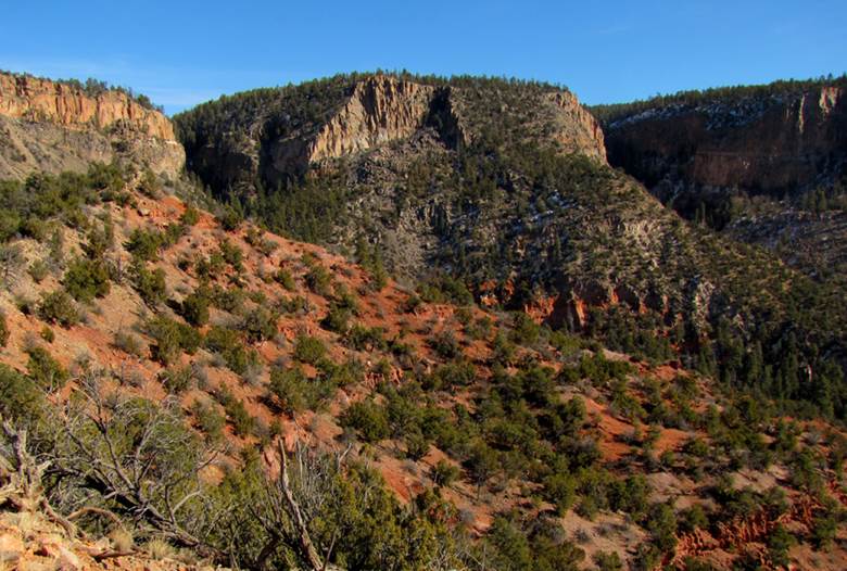
This photo was taken from that ridge. The game trails are fairly good along the
ridge so follow them to the beginning of the steep cliffs. As you cut over to the falls you will likely
be more comfortable loosing some elevation for easier
walking. Then the scramble up Church
Canyon is steep with many very large boulders.
This is a beautiful place. In
fact... awesome...!!! The spring-flow
waters trickled, splashed and laughed down the cliff face, half the time
covered-with-ice. I feel like a mid-November
to mid-December hike is the best because the ice build-up contributes to the
size and beauty of this wonderful waterfall.
Tiny little Church Creek soaks into the earth a short ways below the
falls, leaving a dry creek-bed.
The month of May during a wet year could
provide a fabulous, thunderous, exciting, dancing watershow...!!!!
If you ever notice that Church Creek is
flow strong under the bridge down in town... then a hike up to the falls may be
extra special.
Enhanced
USGS 7.5’ topo map
Send questions and comments to dscott@TheMarbleSculptor.com