Chamisa Vega Falls
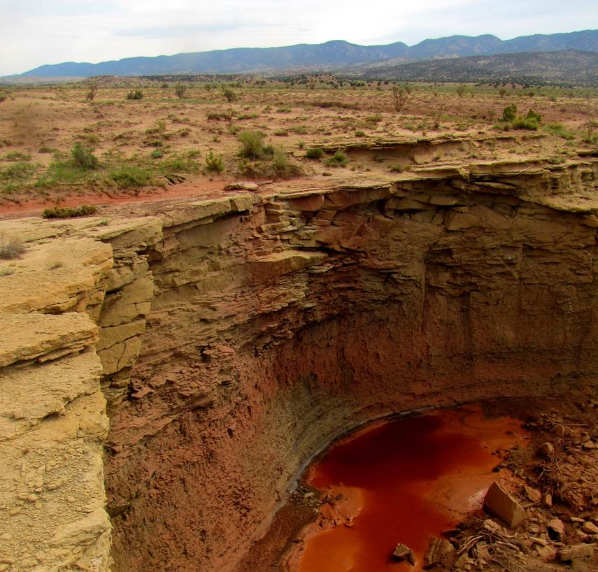
Chamisa Vega Falls is
shown on USGS Topo Maps with a spring...
THERE IS NO
SPRING HERE AND THERE IS NO WATERFALL HERE...!!!!
This is a dry pour-over that flows only after a thunderstorm...
GPS coordinates- ±35°40.551’N 106°56.457’W
ownership- Zia Indian Reservation
nearest town- Jemez Pueblo is about 14
miles east of here
fun fact- most roads on the Zia, have no
trespassing signs up... this road does not.
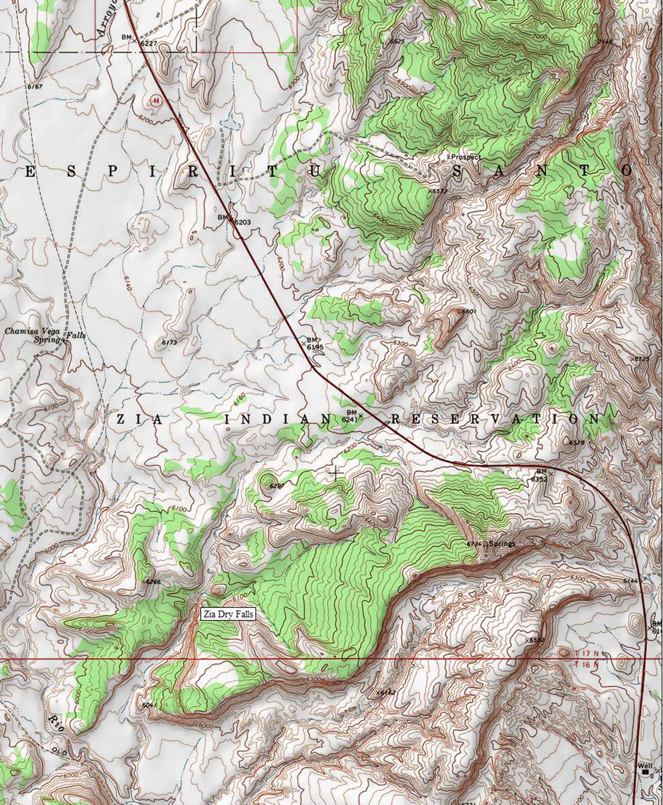
Chamisa
Vega Spring is found on the left-hand side of the map below...But what I
believe will turn out to be a prettier and a higher “Dry Pour-over” will be
what I call “Zia Dry Falls” (about a mile-and-a-half south) shown in the lower
portion of my map below.
Enhanced
USGS 7.5’ topo map
Send questions and comments to dscott@TheMarbleSculptor.com