Bull Creek Falls
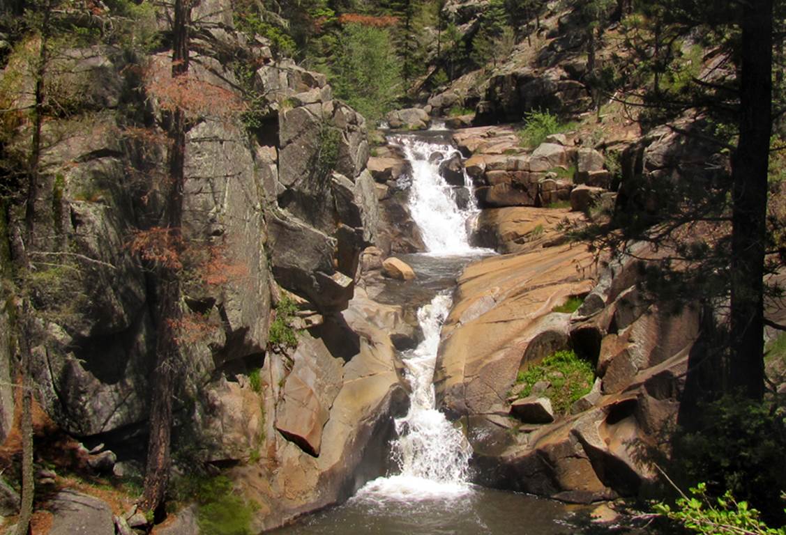
......40’
high Bull Creek Falls has 2 tiers of 20’ high each......
...and
downstream a short ways is this delightful 8’ high waterfall shown in the photo
below
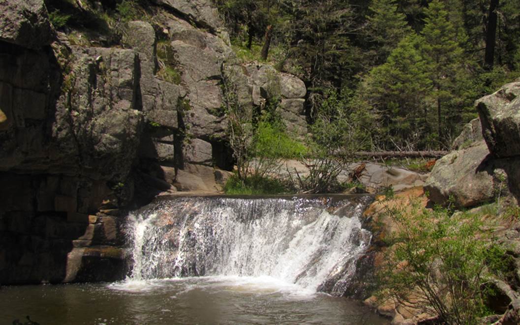
This
falls amazed me that it appears so full, white and wide... for such a small
stream. How can this small amount of
flowing water look so big and full- 8’ high and 30’ wide...it is very
special...! ! !
beta facts:
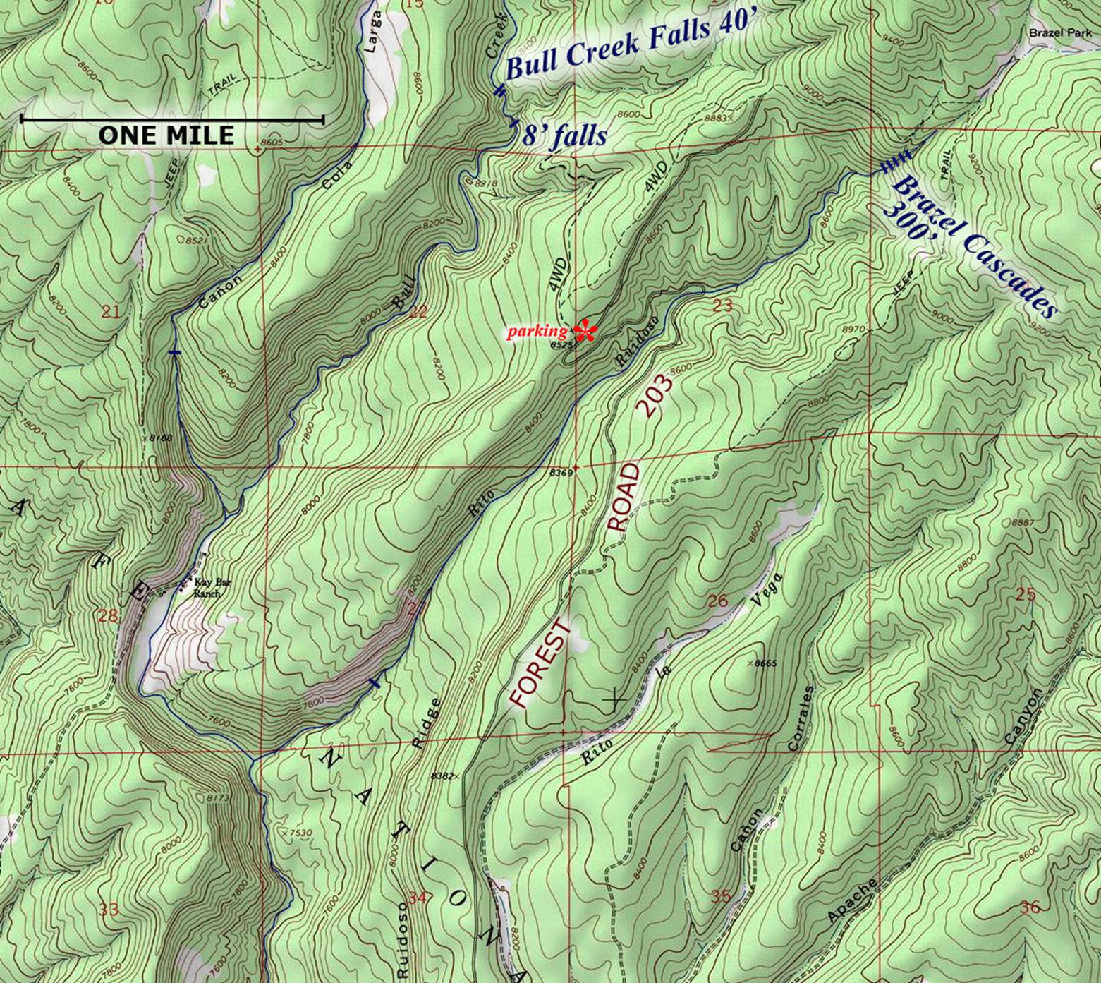
name- Bull Creek Falls
height- 40’ w/ 2 tiers
elevation- 8250’
GPS coordinates- ±35°36.720’N 105°32.927’W
flow- perennial
season- the month of May is best... as soon as the
forest roads open in the spring but later is okay too...
accommodations- none
ownership- Santa Fe National Forest
access- Santa Fe Forest Road 203
nearest town- Pecos is about 8 miles west of here
fun fact- This is a very special place that I
plan to return to often
essay bro
Forest Road 203 is a rough road for being a
2WD road. Often there are many mud
puddles and some of them are a foot or more deep, but most of them have bedrock
under them and are not as difficult as they appear. ±35°36.019’N
105°32.627’W is the GPS cords at where a 4WD road climbs up to the left of FR
203. I park here and hike this 4WD road
over to the hill above the 8’ falls. It
is obvious that others drive the 4WD road.
The climb down from the 4WD road to the 8’ falls is steep but a very
do-able and I think it is a fairly easy off-trail descent. The GPS cords for dropping down from the 4WD
road are near: ±35°37.964’N 105°32.583’W –see map below.
This area is a favorite of
mine and I wonder if Bull Creek ever goes dry here. I think not and I hope not. I plan to return to Bull Creek Falls quite
often. There are great over-nite camp-sites here.
You should also plan to visit 300’ high Brazel
Cascades while you are in this area. It
is a short easy one mile walk up Rito Ruidoso from
where FR 203 crosses it. –see map below.
2 other, small waterfalls are
marked on this map below... do you think they really do exist...? hmmmm.....
I wonder.......
Our maps are
the only maps on earth that show what we show.
Please feel free to “right-click-save-as” on any and all of our maps to
save a copy of our map-file on your desktop.
This will allow you to print a hard copy to hold in your hand while
hiking in the field
Enhanced USGS topo map
Send questions and comments to art@DougScottArt.com