Toltec Gorge
ACA Canyon
Rating – 2C III
…at this high elevation snow melt
causes the flooding way more than summer rains ever do
THE ONLY MONTHS IT IS SAFE TO ENTER THE TOLTEC GORGE
IS AUGUST, SEPTEMBER AND OCTOBER
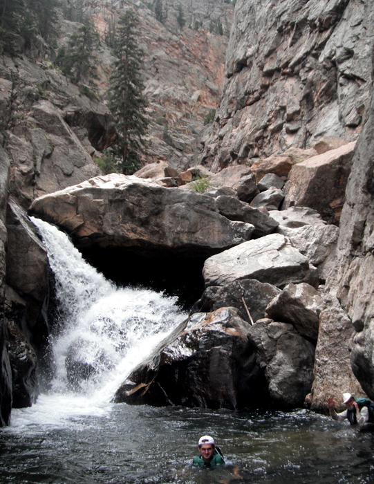
Anthony, Rorke and I swim-hiking... ah... er...
just because we’re stupid enough to do this... ah ... does NOT mean you
should...!!!
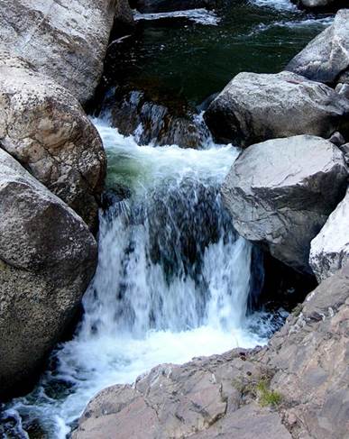
This 25 foot high
waterfall is the highest one we found in the Toltec Gorge.
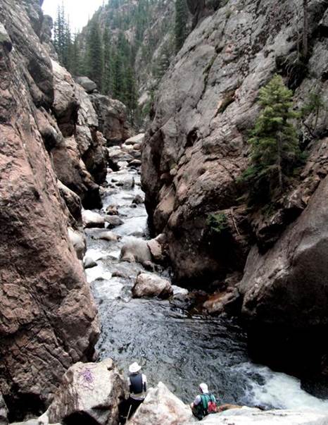
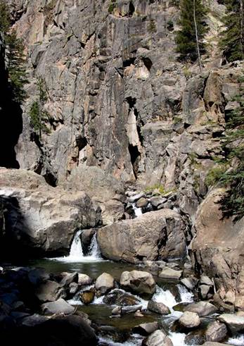
Long sections of DANGEROUS
swims thru rocks, rapids and waterfalls make this a
life-threatening but beautiful experience.
WEAR A
LIFE-JACKET...!!! and even tho
we didn’t... you should WEAR A HELMET...!!!
Often we were forced to
leap off waterfalls and swim the rapids below... as the ONLY WAY THRU...!!!
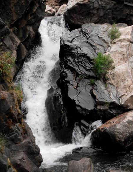
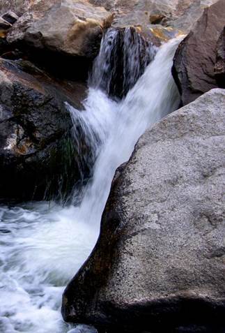
...a beautiful
20’ high waterfall in the upper part of the gorge.
…a 15’ high “twin” waterfall
…a 15 footer
…‘nuther 15 footer
SEE THIS ON YOUTUBE: https://www.youtube.com/watch?v=fXZ5X_bwDpA
beta facts:
name- Toltec Falls
height- 25’
elevation- 9150
GPS coordinates- ±36°58.926’N 106°18.369’W
flow- healthy trout stream
season- AUTUMN ONLY AVOID HIGH WATER…!!!!
accommodations- nothing… totally nothing… no help of any
kind… even in an emergency…!!!
ownership- Carson National Forest… Cruses Basin
Wilderness Area
access- 8 miles-no trail-steep
bush-boulder-and-cliff plus a dangerous and life-threatening “swim-hike”…!!!
nearest town- Osier Train Station, Colorado
fun fact- This is an extreme place.
essay bro:
This is a wonderful experience... but very
DANGEROUS...!!! A person could easily loose their life in the Toltec Gorge... but even a sprained
ankle is a MAJOR PROBLEM in this place.
We swim-hiked the river from the ford below Osier down to the end of the
gorge, where we
hiked up a steep grassy slope 1000’ elevation to the tracks and cross-tie-walked back to our wheels...
all in one hard day…maybe 8 or 9 miles round trip. No car shuttle is necessary.
Enhanced
USGS 7.5’ topo map
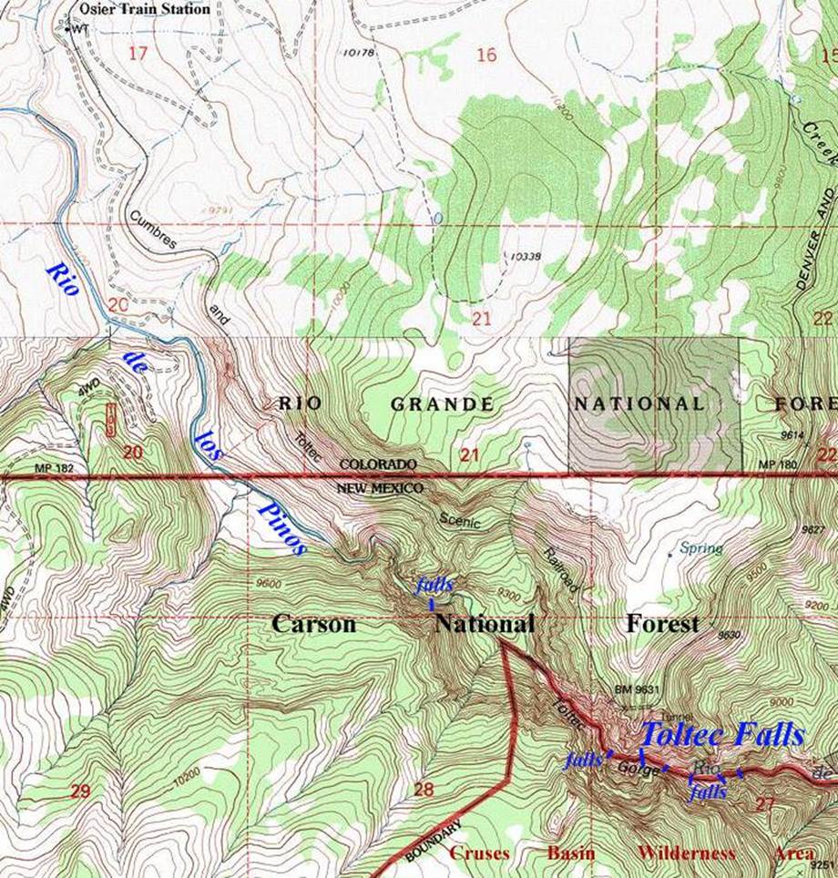
_________________one
mile_________________
Send questions and comments to art@DougScottArt.com