Pinabetoso Canyon
English = “Having many Douglas Fir trees”
I like this name and it is quite true
This slot canyon is found in West Pinabetoso Canyon see map below
ACA Canyon
Rating – 3A II
Experienced Canyoneers Only
requires a
full range of technical canyoneering equipment with multiple rappels…!!!
NEVER ENTER ANY
SLOT CANYON WHEN HEAVY RAIN IS IN THE FORECAST…!!!
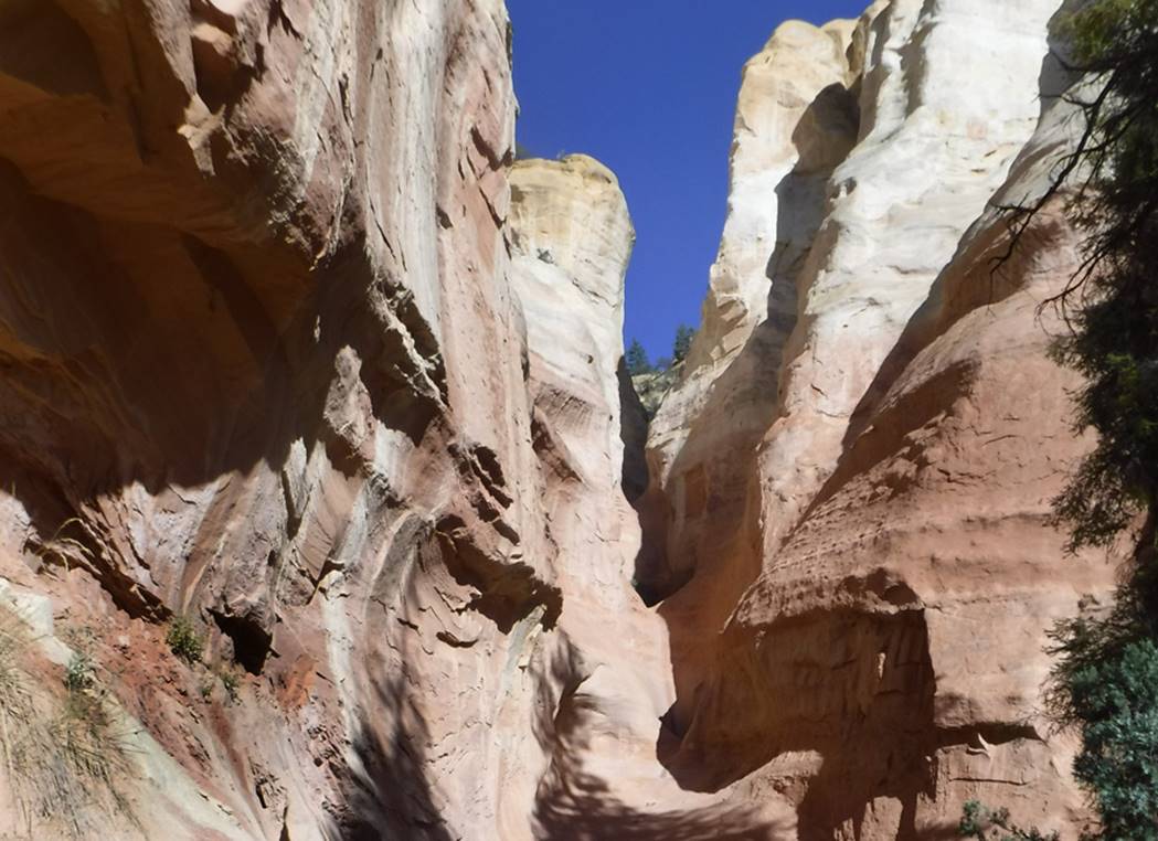
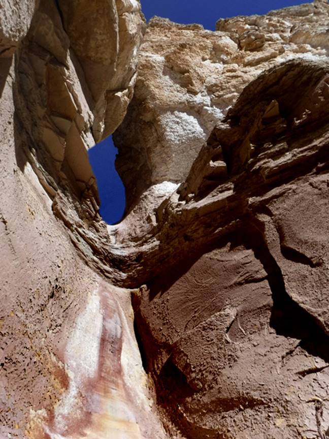
Pinabetoso Canyon has a short steep
slot-canyon section cut into Endrada Sandstone that is quite sculpted and
beautiful. This is a view from the lower
end looking up. The short drops seen in
this photo are up to 40’ high, but have no anchors, therefore this last rappel
is about 250 feet. However, please bear
in mind that as far as we know this canyon is yet to be descended. Alone, I
have thoroughly scouted it. If we can
make a descent soon, we would likely bring a 300’ rope or more…!!!
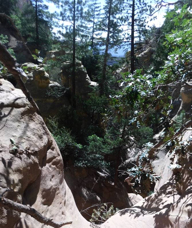
The photo below is looking downstream from
above the upper most rappel, which is 35’-ish.
As you can see in this photo, the upper end of this slot canyon is quite
opposite to the lower end. It is full of
vegetation and a much more open canyon, with anchors abounding….. very
interesting…!!!
As you are walking up the ever-narrowing
canyon bottom and nearing the lower end of the slot canyon, you will come to
this place shown in the photo below.
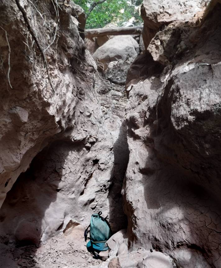
Notice that I placed my REI day pack in
this photo, to display “size” proportion.
Here at my day pack you must climb a nine foot high, very sheer and
narrow, vertical slot composed of hard dirt.
Then as you see in this photo, you must duck under a fallen log…
followed by a pile of extremely large boulders…
It is immediately after these boulders that one can ascend a quite steep
gully, heading west or to your left… all the way to the top of the ridge, maybe
600 feet above. While walking upstream,
near the slot canyon side of the top of that ridge crest… a half dozen or more
hand-stacked rock cairns will lead you to a natural opening (trail if you
will…) steeply descending to the top of the first rappel. Start your descent here.
or…
See on our map below that we show a yellow dotted line - “route” - going from the
highest point of the two-track dirt road, where you see the word “parking”
written in red… follow that route north up to the
upper most rappel and enjoy your descent of the slot canyon without going to
the bottom until after your descent. As
you near the top of the slot canyon you will see the rock cairns mentioned in
the paragraph above. This route could be
blocked by cliffs. It has never been
done.
…more photos
below the map…
beta facts:
name- Pinabetoso Canyon
length of slot canyon- maybe a quarter mile
or less
elevation- 8300’at the top down to about
8000’at the bottom
GPS coordinates- ±36.217210° -106.759955° -near the upper end…
flow- intermittent
season to visit- most anytime except winter
may have ice & NEVER
ENTER ANY SLOT CANYON WHEN HEAVY RAIN IS IN THE FORECAST…!!!
accommodations- none
ownership- Santa Fe National Forest
access- is from State Hwy 96… see the map
below
nearest town- Gallina is about 5 miles west
of here
fun fact- This is a beautiful Entrada
Sandstone Canyon well dressed with Douglas Fir trees…!!!
Text
Exit Hwy 96 near GPS - ±36.199953° -106.757715°. These 4WD roads are serious, very deeply
“rutted” –BAD roads, requiring 4WD with extra high clearance. Bring a shovel along- you may need it. In fact if these roads are muddy from resent
rains…??? I wouldn’t drive them. The mud here can get extremely deep and
sticky. I usually park just over the top
of the pass, about one mile in from Hwy 96.
The road gets way worse descending the steep grade ahead. Only drive in as far as you deem safe.
I have done the scouting and there is no
sign of anyone ever descending Pinabetoso Slot Canyon. There are likely a half dozen or more rappels,
the highest of which will most certainly be less than sixty feet high. However, because there are no anchors in the
lower portion of this slot canyon, you will likely need to set up a double-rope
250 foot rappel, possibly a 300 footer.
This should allow rappelling those last 30 and 40 foot high drops (seen
in the photo at the top of this page) from your last available anchor above.
As you can see on the map below… there are
several more similar slot canyons (marked with red lines) right nearby. However, they are much shorter and
steeper. AND….. East Pinabetoso Canyon
holds the beautiful Entrada Enclave and Todilto Natural Arch. See the photos below our map.
Right-click-save-as
on our map below, to print your own “hand-held” copy for your hike
Enhanced USGS topo map
The Red Lines depict
sections of “slot canyons”
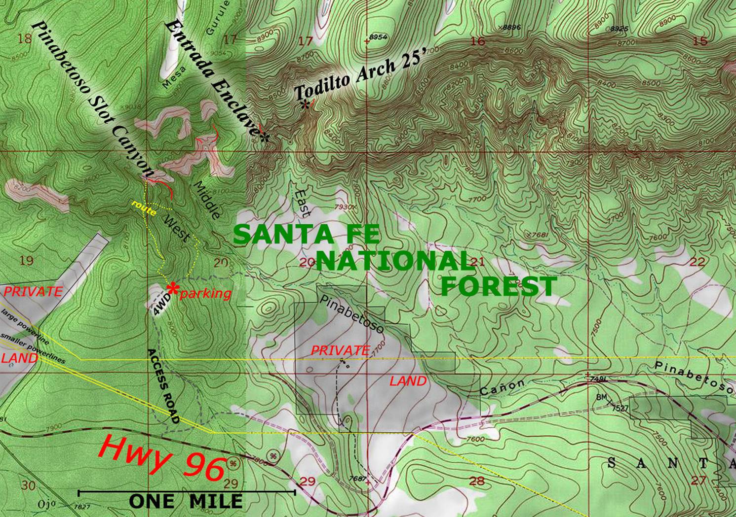
SCALE = the thin red section lines on the
map above are one mile squares
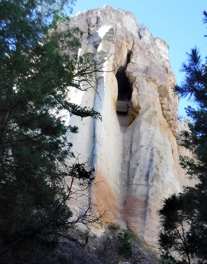
25’ high Todilto Arch appears near the top of the map above – It
is found within the Todilto Geological Formation (Gypsom)
GPS: ±36.221144°
-106.745656°
Shown below is the Entrada
Enclave – 100’ high opening surrounded by Entrada Sandstone more than 300’ high
-see map above
This formation is likely
to soon form a wonderful natural arch… but not during our life time.
GPS: ±36.219531°
-106.748774°
Back to New Mexico
Slot Canyons
Send questions and comments to dscott@themarblesculptor.com