Garcia
Falls Canyon
ACA Canyon
Rating – 2B II
NEVER ENTER
ANY SLOT CANYON WHEN HEAVY RAIN IS IN THE FORECAST
Someone
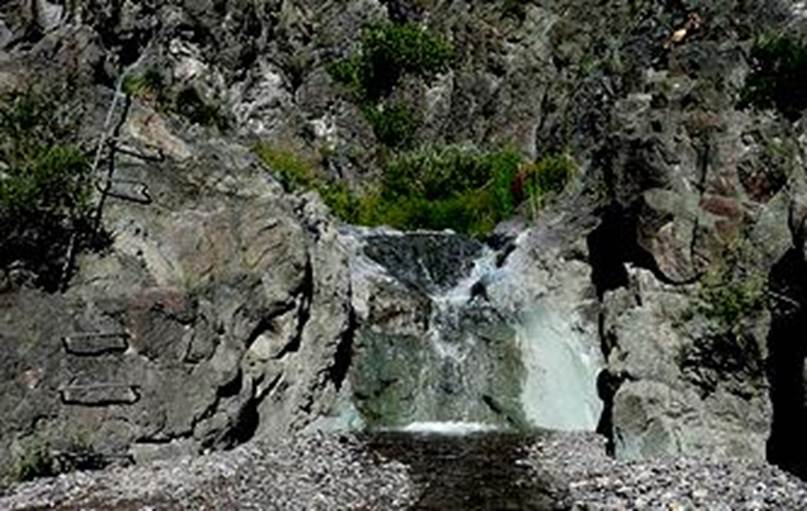
built a metal foothold ladder up Garcia Falls #1, the lowest in Garcia Falls
Canyon
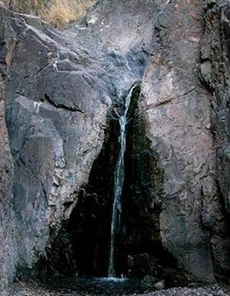
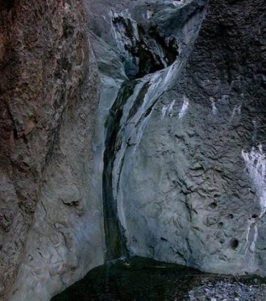
20’ high falls in Garcia Falls Canyon 40’ high falls in Garcia Falls Canyon
beta facts:
name-Garcia Falls Canyon
height- several falls here but the highest
is 40’
elevation- 6200’
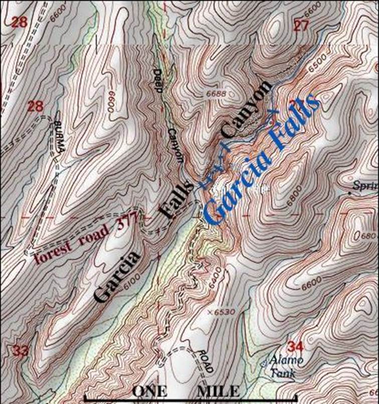
GPS coordinates- ±33°29.666N 107°27.133’W
flow- perennial - small desert spring flow
except during wet times
season-any time
accommodations- none… and no camping
allowed between road and falls.
ownership- public Cebola National Forest
access- 100 yard hike from forest road 377
nearest town- Monticello 10 miles to the
south on forest road 377
fun fact- water only flows over each falls
and soaks into the earth between each falls.
essay bro:
It is very common for a waterfall to be
named “So-and-so Canyon Falls”. Even
among New Mexico Waterfalls, there is Manuel Canyon Falls, Double Canyon Falls
and others. But in this case the forest
service maps as well as the usgs topo maps list this place as Garcia Falls
Canyon. I like this… and here is
why. This is an AMAZING CANYON. This is an amazing “slot” canyon.
Garcia Falls Canyon is a great Slot
Canyon. Garcia Falls Canyon has
everything that a perfect slot canyon needs.
It is very sheer, narrow and deep.
It has flowing water and many waterfalls. The highest falls we found were about 40’
high and understand that this is an extremely dry “desert” place. Not much vegetation here.
I am not your best rock climber but sheer
wall rock climbing maneuvers are necessary to traverse Garcia Falls
Canyon. Hmmm…
I’m gonna guess you will have to do a 25’ high 5.3 route to pass the second
falls. Be safe… but have fun… and
by-the-way the usgs topos show the spring wrong, so make a copy of my map below
to take with you. We felt it was quite safe to
be these minor climbs without a rope… just scrambling…
To find this place you will need a Cibola
National Forest map of the Magdalena Ranger District. Your Garcia Falls Canyon road is forest road
377 also called “Burma Road”. Have a
“slot” of fun…!!!!
Enhanced National Geographic 7.5’
topo map
Send questions and comments to dscott@TheMarbleSculptor.com