Cañon Ventana
del Cielo
English= Sky Window Canyon
ACA Canyon Rating – 3A II
Experienced Canyoneers Only
requires
technical canyoneering gear and rope…!!!
However, hikers can visit both the upper and lower parts of this
slot canyon scrambling on foot without ropes or gear
Which BTW. . . is a great adventure of its own. . .
NEVER ENTER ANY
SLOT CANYON WHEN HEAVY RAIN IS IN THE FORECAST…!!!
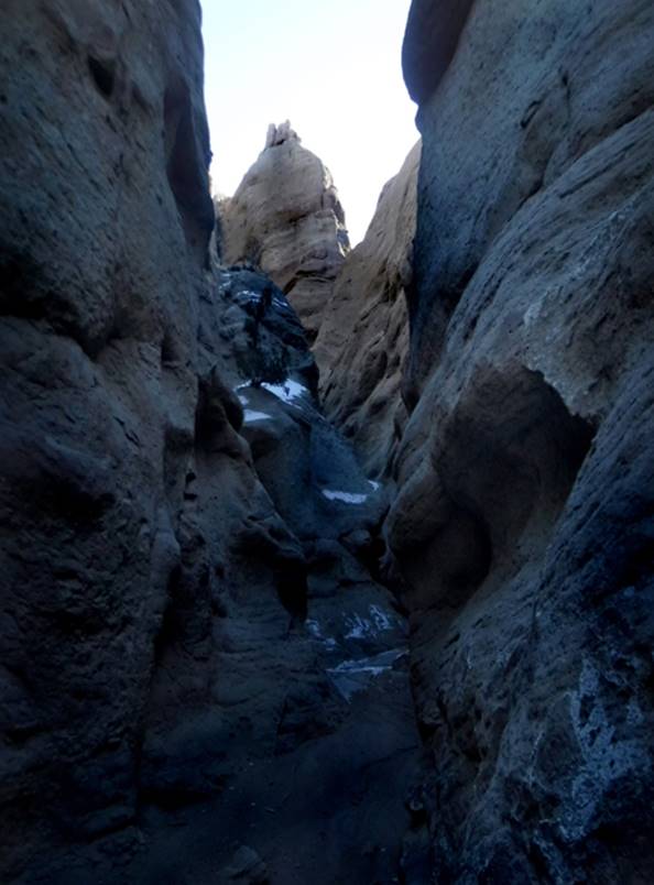
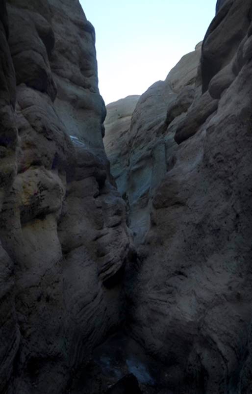
Cañon
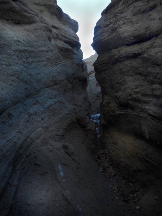
Ventana del Cielo has a fine one quarter-mile long slot canyon section cut into
solidified volcanic ash
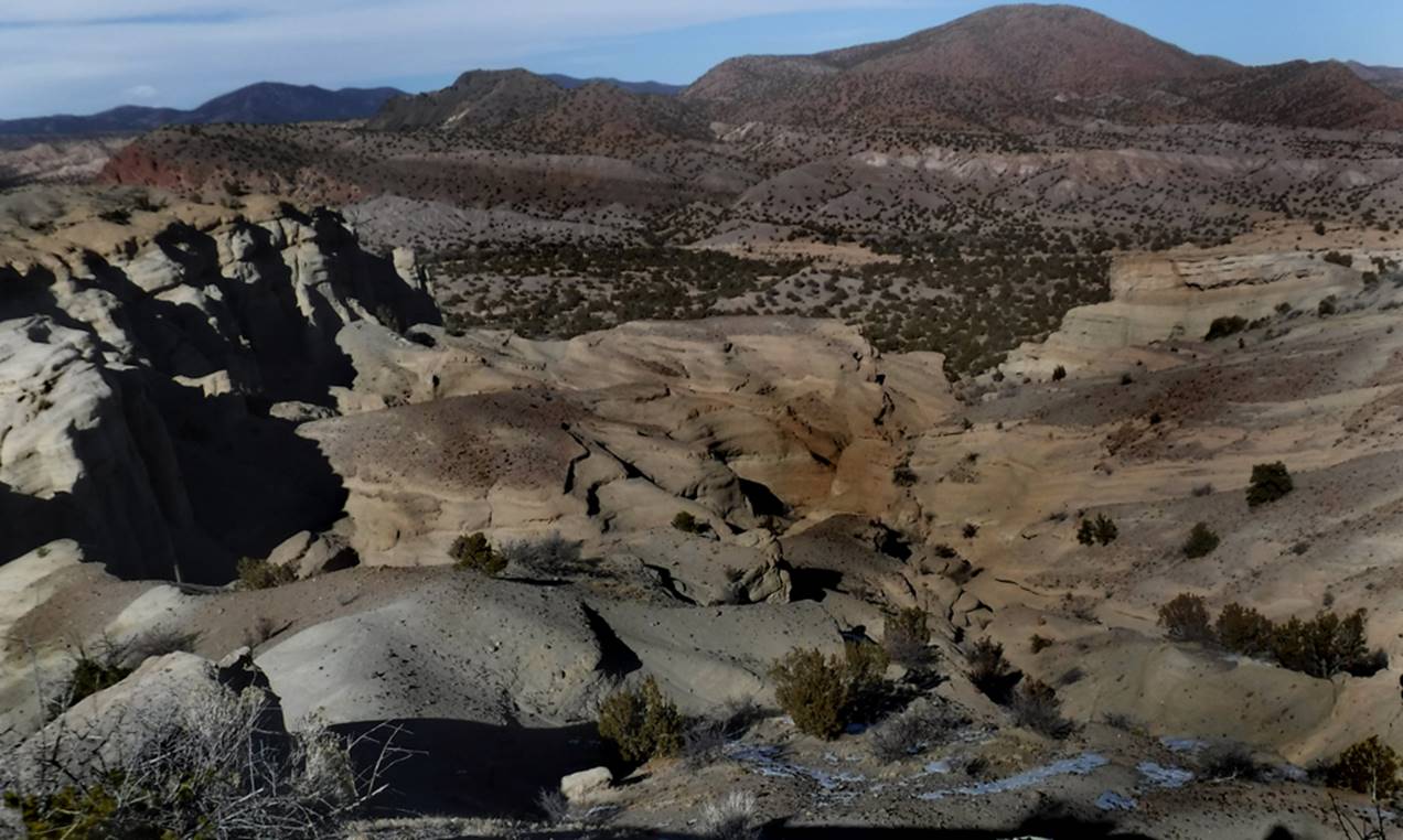
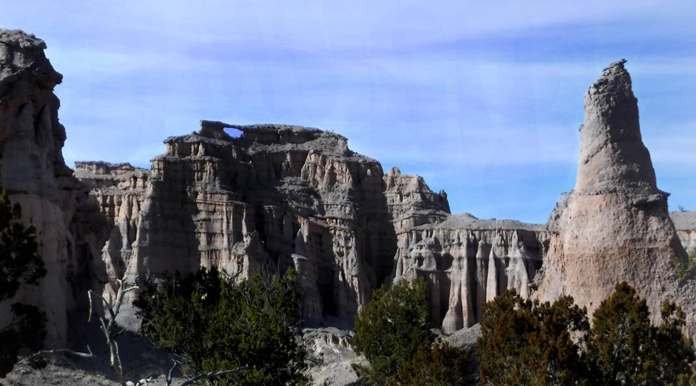
Ventana del Cielo slot canyon rests in this
basin of clean bedrock… the suggested parking is among the low land juniper
trees near the center of the photo below
Suggested routes to and from the slot
canyon provide splendid views of “Ventana del Cielo” - an amazing 35’ wide
natural arch almost 400’ overhead…”Sky Window”
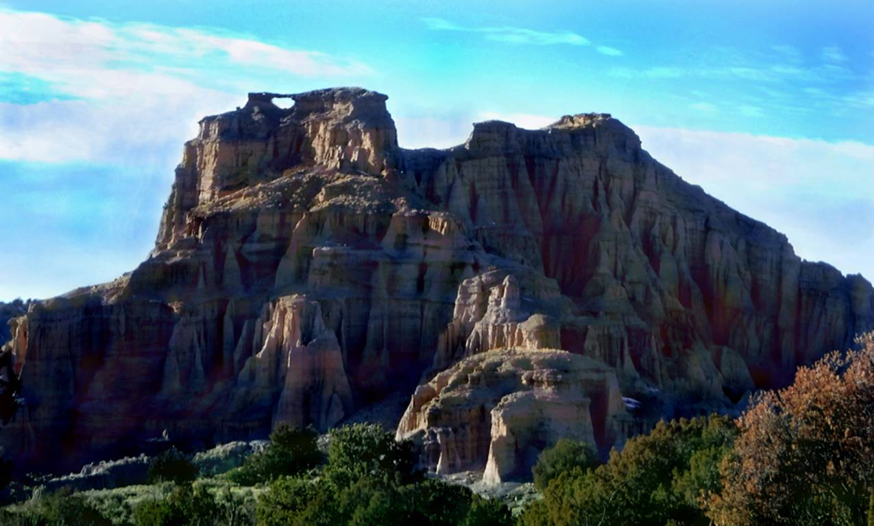
“La Ventana del Cielo” or = “Sky Window” is
at 36.290160 -106.094670
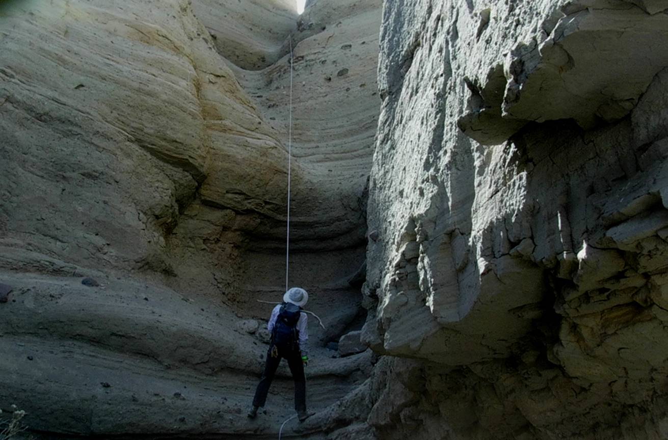
We did 3 rappels: 10’, 60’ & 30’ -the first two rappels can be done as one 90’
rappel
This entire area hosts wonderful badlands
with extreme topography
“La Ventana del Cielo” or = “Sky Window” is
at 36.290160 -106.094670
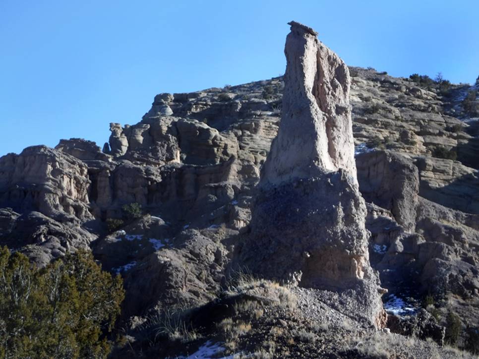
This Balanced Rock is at GPS: 36.287717
-106.094468

Balanced Rock Rorke
Murphy Photo
beta facts:
name- Cañon
Ventana del Cielo -in English = Sky Window Canyon
length of slot canyon- maybe a quarter mile
elevation- 6630’at the top, down to about
6450’ at the bottom
GPS coordinates- ±36.285345 -106.089660
season- most anytime, some of these photos
are from January 19, 2022… However, a winter descent will be hampered with snow
and dangerous ice
accommodations- none
ownership- BLM public lands
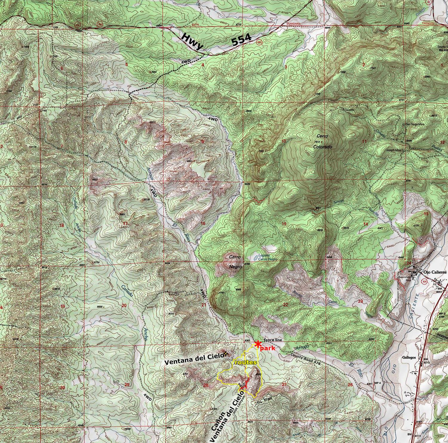
access- is from Hwy 554… see the map below
nearest town- Ojo Caliente is about 3
air-miles northeast of here
fun fact- This is a GREAT slot canyon with
an AWESOME natural arch
. . . !
! !
access and description
here is a detailed access description
drive southwest on an unmarked 4WD dirt road from Hwy 554 at: 36.344672 -106.099390
continue straight at: 36.339393 -106.110749 -altho- a left here does connects back to this same road, however, this way has difficult, deep, soft sand
veer left at: 36.337787 -106.116299
continue straight at: 36.309087 -106.101521 -the difficult, deep, soft sand road joins back in here…
continue straight at: 36.300230 -106.098670 -a right turn here goes west over to Canada Ancha
we park our wheels
here at: 36.292129 -106.088408 near a section boundary, fence-line
refer to the second
map below… at the bottom of this page.
Altho
during times low water flow, fording the Ojo Caliente in a 4WD is quite doable
– 2.5 miles due east of Ventana del Cielo via County Road #478
Our first
scouting visit here, January 19, 2022.
We returned March 26, 2022 with ropes or gear. We have navigated all of the access routes
shown on the map below. They are
adequate. However, if you are doing a
non-technical visit, I recommend going up the east-side route and down via the
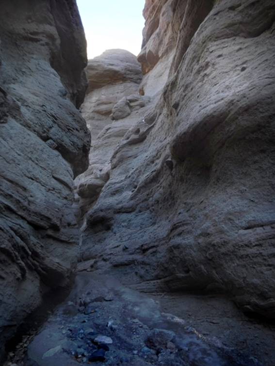
west-side. Also scramble up into the
slot from the opening at the lower end… until turned back by a 30’ sheer
mandatory rappel.
Our return was a leisure
stroll down that same sandy arroyo-bed, which led us directly back to our
wheels. Along our way we enjoyed
fabulous, ever-changing views of the amazing- “Ventana del Cielo” – “Sky Window”
…refer to the
first map immediately below…
Right-click-save-as
on our maps below, to print your own “hand-held” copy for your hike
Enhanced USGS topo map
The Red Lines depict
sections of “slot canyons”
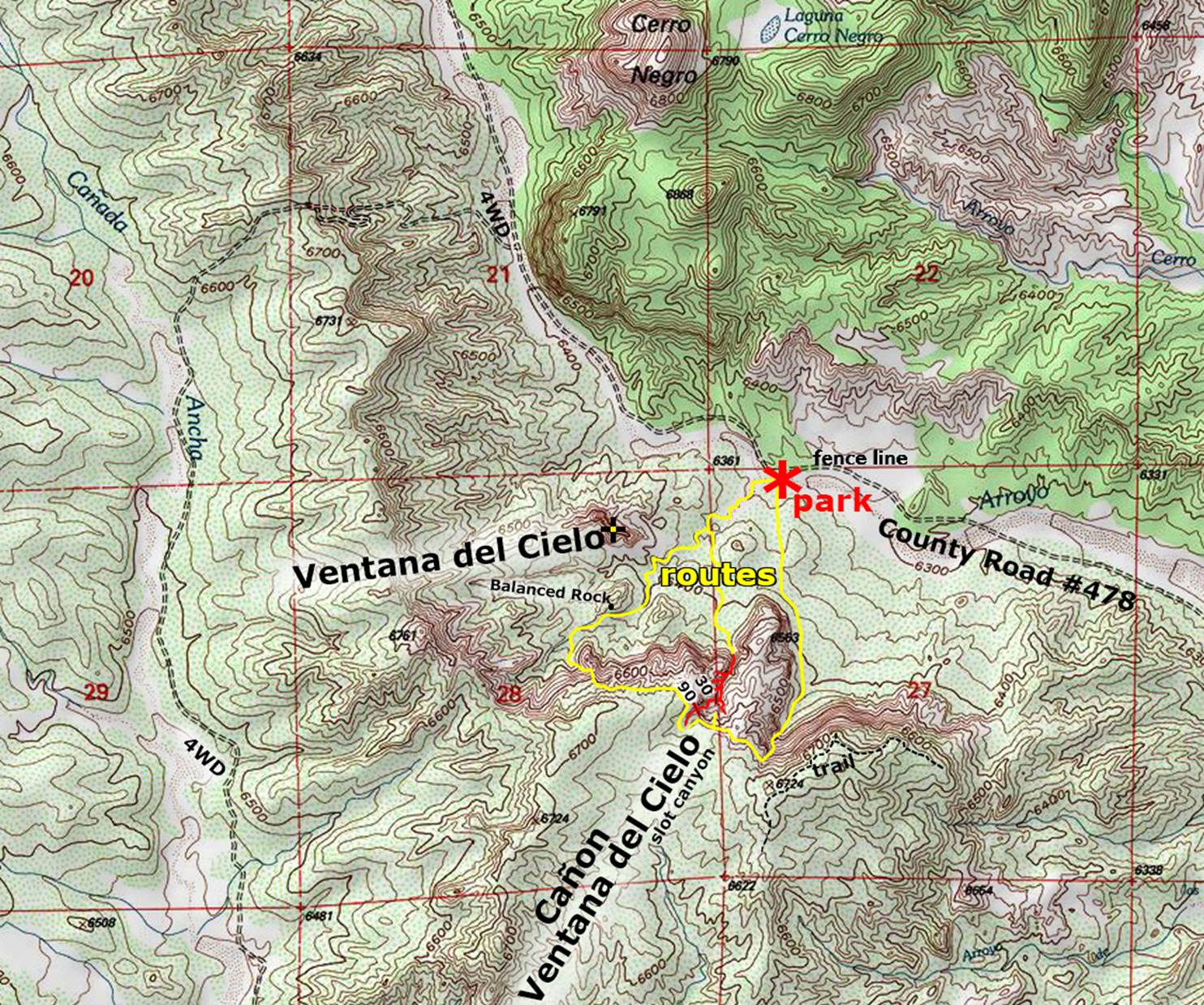
This
larger map below shows the access roads
Back to New Mexico
Slot Canyons
Send questions and comments to dscott@themarblesculptor.com