Walatowa Slot Canyon
ACA Canyon
Rating – 3A II
However...
most of these two slot canyons can be visited via scrambling rope-less
NEVER ENTER ANY
SLOT CANYON WHEN HEAVY RAIN IS IN THE FORECAST…!!!
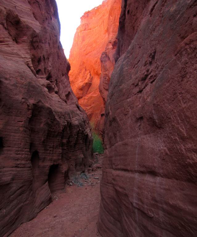
Beautiful Walatowa Slot Canyon
is now open to the public for a small $5 hiking
permit fee...! ! ! –see details below-
- see more photos
below –
This is a place that I plan to return to often
beta facts:
name- Walatowa Slot
Canyon
depth of slot portion- 200 feet
length of slot canyon- .2 mile ...while an upper
slot canyon above the main one is about .1 mile long
elevation- 6000’at the top down to 5700’at the bottom
GPS coordinates- ±35°39.157’N 106°42.932’W at the top and ±35°38.969’N 106°43.096’W at the downstream end
flow- intermittent –bone dry most of the time
season to visit- anytime
accommodations- available across the street at the Walatowa visitor center – where the $5 permit is purchased
ownership- Jemez Pueblo Land access and a little bit
of Santa Fe National Forest land appears at the extreme upstream end of this
canyon
access- is from across the street at the Walatowa Visitors Center … see the map below
nearest town- Jemez Pueblo is about 2 miles south
of here
fun fact- The opening of this area for public
hiking, is a very positive thing...! ! !
No matter what your personal beliefs are...
PLEASE...!!! respect this NATIVE LAND...!!!
-DO NOT LITTER-
... and purchase your
$5 hiking permit ...
It
is an extreme gesture of kindness that the Jemez Nation has opened this
wonderful area to public hiking. At this
special place nature displays extreme grandeur with astounding beauty. This is an area much larger than what first
meets the eye. Amazing beauty goes on
and on here....... This hike is an experience to be remembered for a
life-time. The earth here,
amazes me. You will think you are within
a National Park.....!
! !
Your
five dollar hiking permit is available at the Walatowa
Visitor Center which is directly across State Highway #4 from the Red Rocks
Trailhead. Hiking begins on a 2-track
dirt road. But keep an eye out, to your
right-hand side, for the foot-trail veers off from the road within a quarter of
a mile or less. In another quarter-mile
or so, the trail will split-right-and-left. This split is a loop trail,
that returns to it-self – either way.
Look for the trail to cross the road a couple more times thru-out this
loop. There are several nice footbridges
installed for comfortable arroyo crossings.
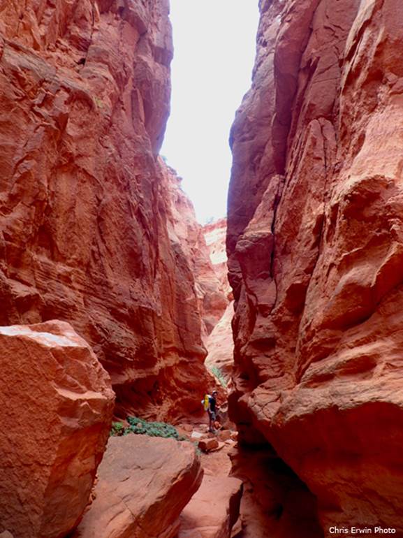
At
one point the trail dead-ends, heading upstream into a very deep and narrowing
canyon. From here... continue on
upstream, rough hiking and scrambling will take you up the usually dry
streambed into the main slot canyon.
This slot canyon will get deeper and more amazing the farther you go. A smooth, un-climbable, sheer wall, 80 feet
high will turn you around and head you back to the loop trail. Perhaps a couple hundred feet downstream from
this impassable sheer wall will be a difficult place to pass. It is a difficult boulder blockage about ten
feet high – straight up... however there is a steep scramble on your right-hand
side that allows the hearty sort continue on to the impasse turn-around chamber
above........
After
returning back to the loop trail and continuing on, a steep and difficult
“off-trail” scramble near ±35°38.820’N
106°43.186’W lifts one above the cliffs to hike along the rim above the slot
canyon and into the upper slot canyon above.
This is extremely difficult and to be attempted only by expert
mountaineers.
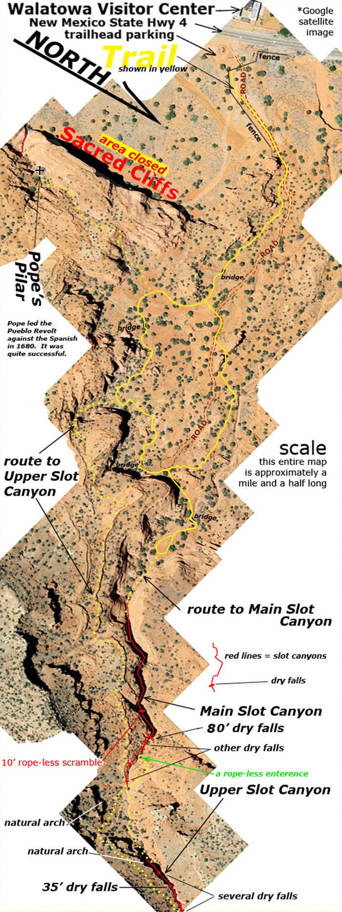
-Right-click-save-as
on our map and print a hard copy to take in hand with you on your hike-
Enhanced GOOGLE
Satellite map
The Red Lines depict
sections of “slot canyons”
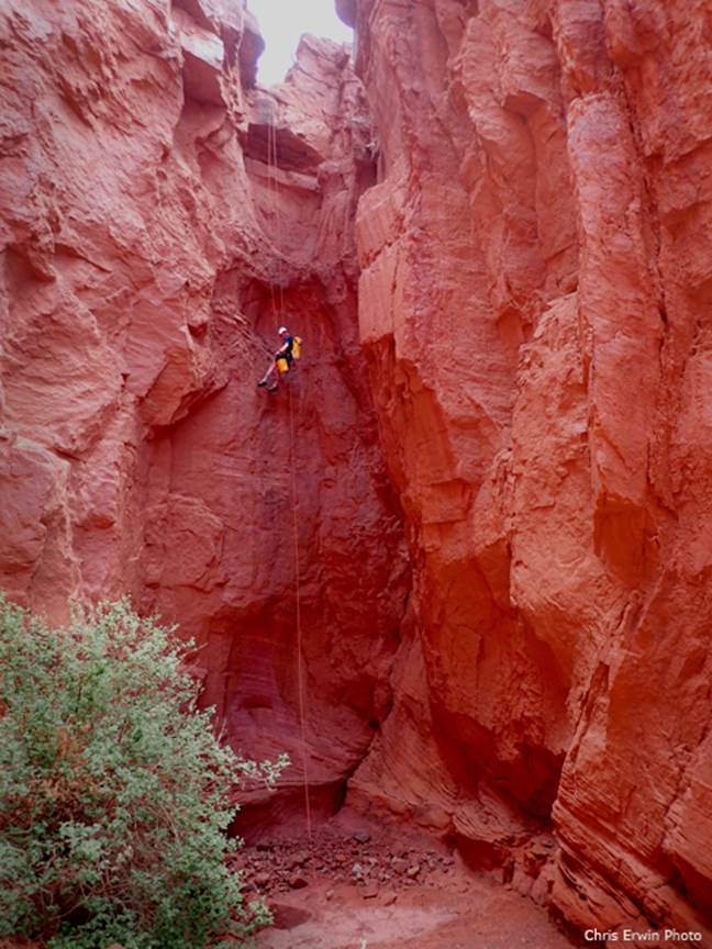
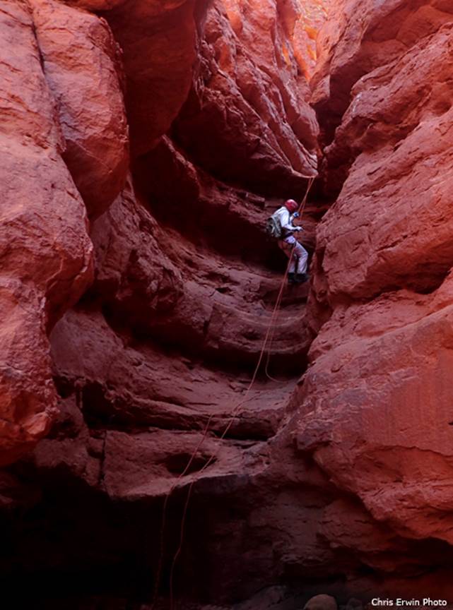
The
only total descent of both slot canyons that anyone knows of was Chris Erwin
and Doug Scott on Monday May 8, 2017.
We
saw no evidence of any previous rappels anywhere. The photos below show Chris on the 80’ rappel
and Doug on the 35’ rappel.
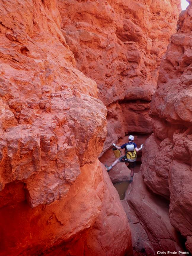
Chris
straddles a waterpocket in the upper slot
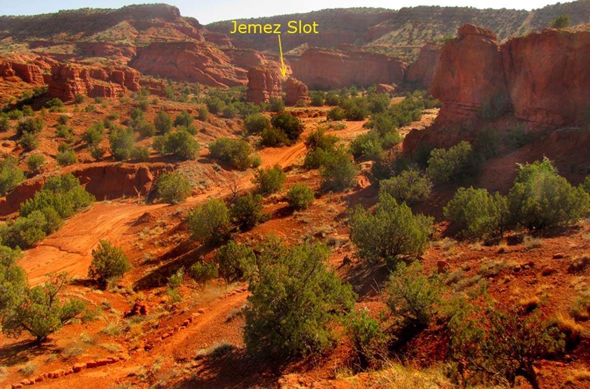
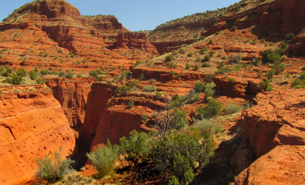
The
photo below shows the dirt road about ¼ mile from the
start of the trail. Also visible, the
trail is lined with rocks in the lower left-hand corner of this photo and the
slot canyon is noted just beyond the two buttes near the top of the photo.
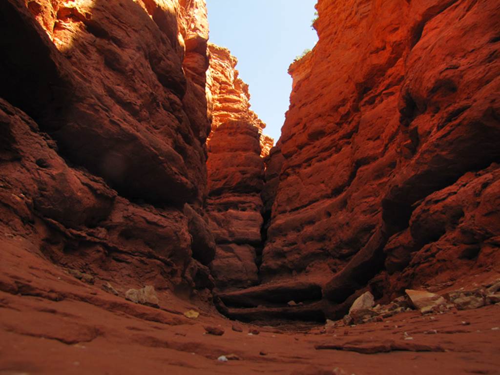
The
Upper Slot Canyon gets extremely narrow in it’s upper portions where more technical drops
hideout.....
Walking
this flat rock ledge up above the rim of the main slot canyon, leads you past a
natural arch and on to the upper slot canyon
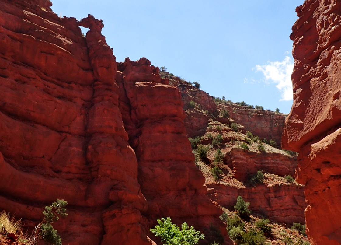
This
small natural arch shown below, appears along the
east-side of the canyon cliffs, just downstream from the Upper Slot Canyon: ±35°39.050’N 106°42.960’W.
The opening is maybe two or two & a half feet wide
Another
natural arch- very small, but very beautiful appears next to the loop trail,
about ¼ mile south of the main slot canyon
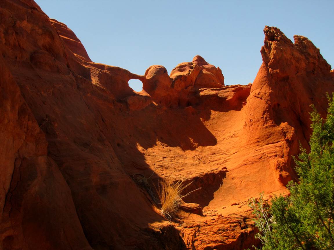
Below
is the nicest of the three natural arches that we saw there, it is in the wide
part of the upper slot canyon. The
opening is maybe 3 feet.
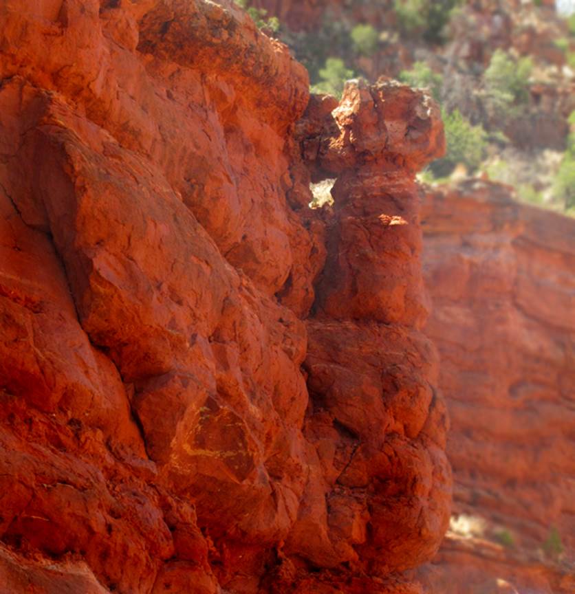
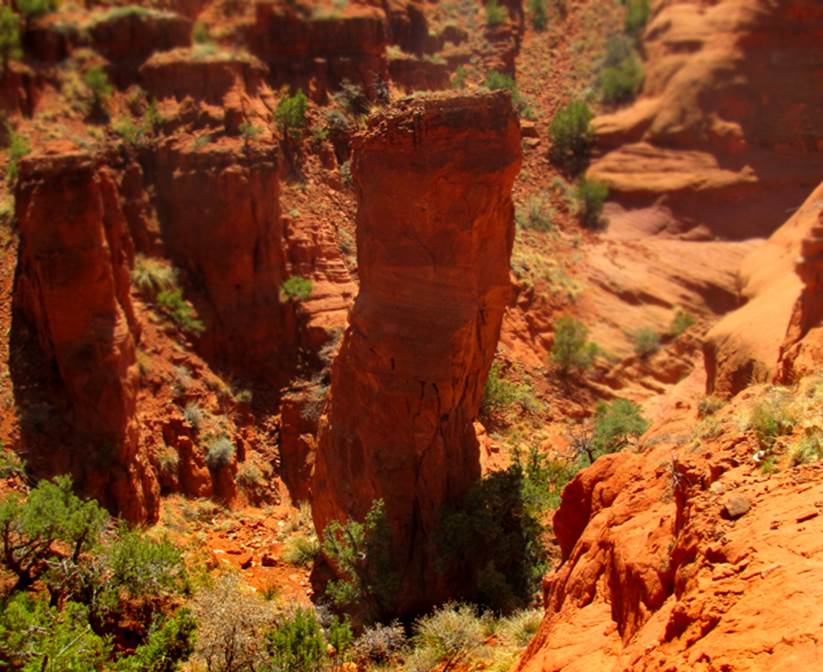
Some
locals tell me that this 40’ high pilar at- ±35°38.688’N 106°43.327’W - is a natural
occurring memorial to Pope’ –who led the Pueblo Rebellion in 1680
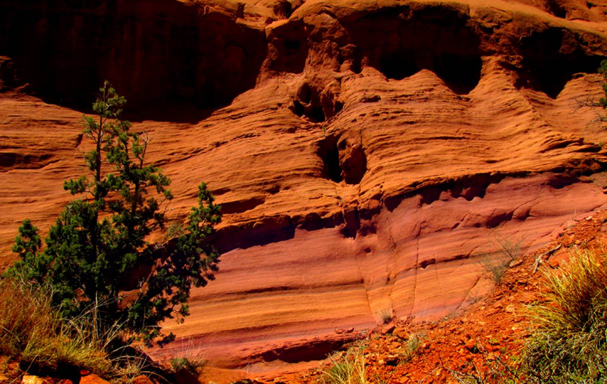
Here-&-there
is some of the most beautiful purple sandstone I have ever seen.......
Back to New Mexico
Slot Canyons
Send questions and comments to dscott@themarblesculptor.com