White Ridge Bike Trails Area
...has
3 narrow canyon areas-
East Gypsum Slot Canyon ACA Canyon Rating – 3A III
West Gypsum Gorges ACA Canyon Rating – 3A III
Travertine Maze ACA Canyon Rating – 3A III
NEVER ENTER ANY SLOT
CANYON WHEN HEAVY RAIN IS IN THE FORECAST…!!!
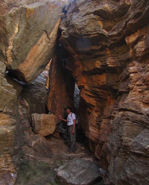
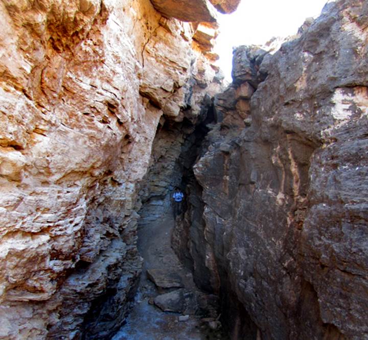
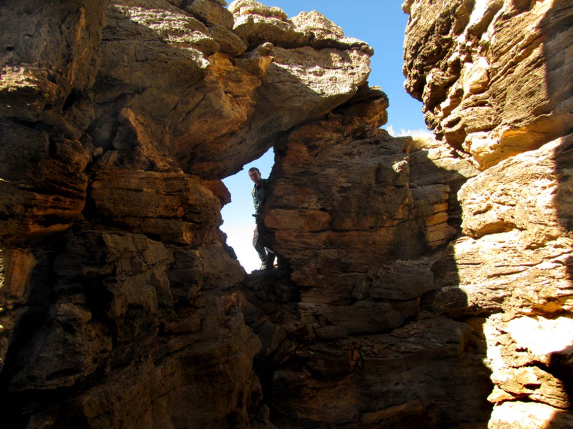
Gypsum Slot Canyon
One of the most narrow slot canyons in New
Mexico...!!!
This slot is solid alabaster... gleaming,
shining white...!!!
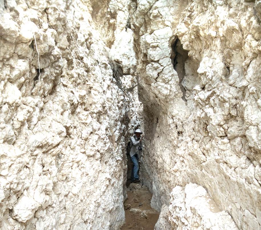
...in several places your ribcage barely
squeezes thru East Gypsum Slot Canyon. see the map at the bottom of this page
...small wonder that Gypsum
is being mined in this area... alabaster (which is pure gypsum) is
everywhere...!!!
beta facts:
name- Gypsum Slot Canyon
depth of slot portion- 30 to 40 feet
length of slot canyon- one/tenth of a mile or
such...
elevation- 5700’
GPS coordinates- ±35°31.652’N 106°49.550’W
flow- intermittent
season to visit- March, April, October and
November are best… NEVER
ENTER ANY SLOT CANYON WHEN HEAVY RAIN IS IN THE FORECAST…!!!
accommodations- NONE
ownership- mostly BLM
access- is from Cabezon
Road… see the map below
nearest town- San Ysidro
is about 7 miles east of here
fun fact- there are more good things here than
most people realize
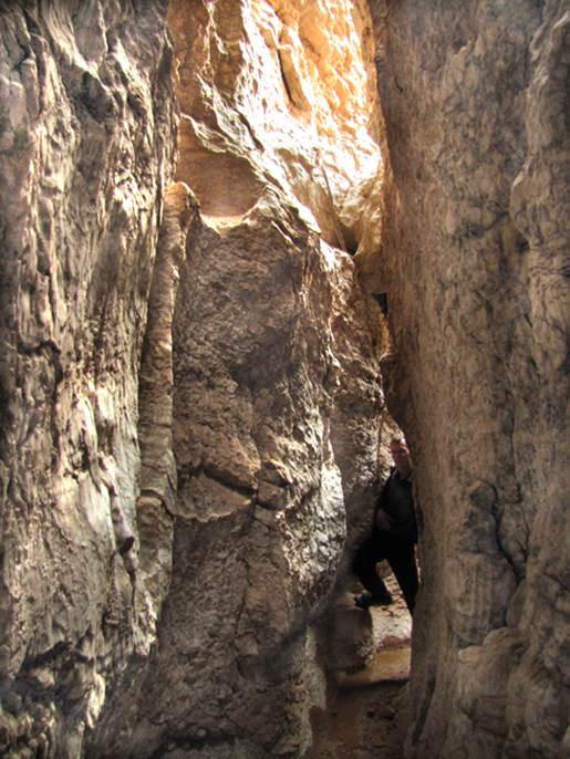
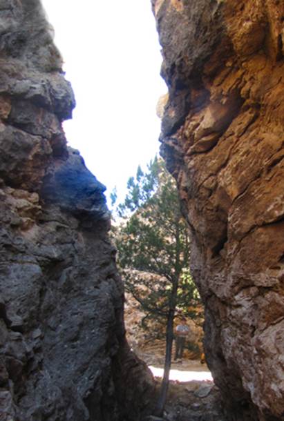
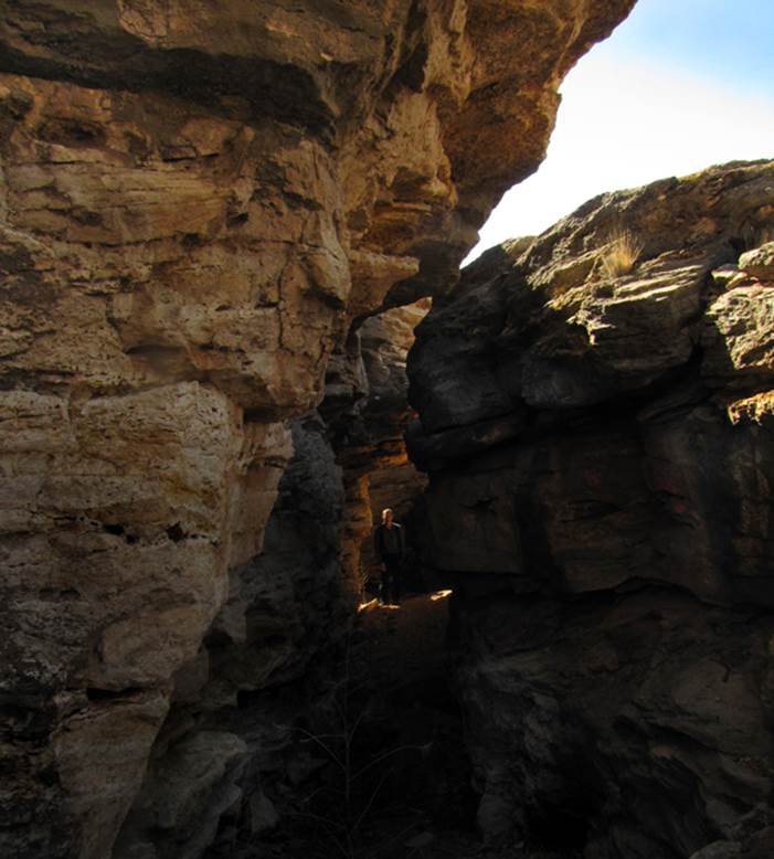
West Gypsum Gorges
There are 2 narrow
gorges or slot canyons –an upper and a lower gorge. See the map at the bottom of this page
This slot is solid alabaster... gleaming,
shining white...!!!
Spring fed Gypsum Creek flows perennial
thru this sweet slot canyon.
Both upper and lower West Gypsum Gorges are
slot canyons... marked as Upper and Lower Gypsum Gorge on the map at the bottom
of this page
beta facts:
name- Upper and Lower Gypsum Gorge
depth of slot portion- 30 to 40 feet
length of slot canyon- one/tenth of a mile each
elevation- 5700’ and 5800’
GPS coordinates for the lower gorge- ±35°31.895’N 106°50.714’W
GPS coordinates for the upper gorge- ±35°31.449’N 106°50.197’W
flow- some perennial spring flow
season to visit- March, April, October and
November are best… NEVER
ENTER ANY SLOT CANYON WHEN HEAVY RAIN IS IN THE FORECAST…!!!
accommodations- NONE
ownership- mostly BLM
access- is from Cabezon
Road… see the map below
nearest town- San Ysidro
is about 7 miles east of here
fun fact- these slot canyons make a great loop
hike
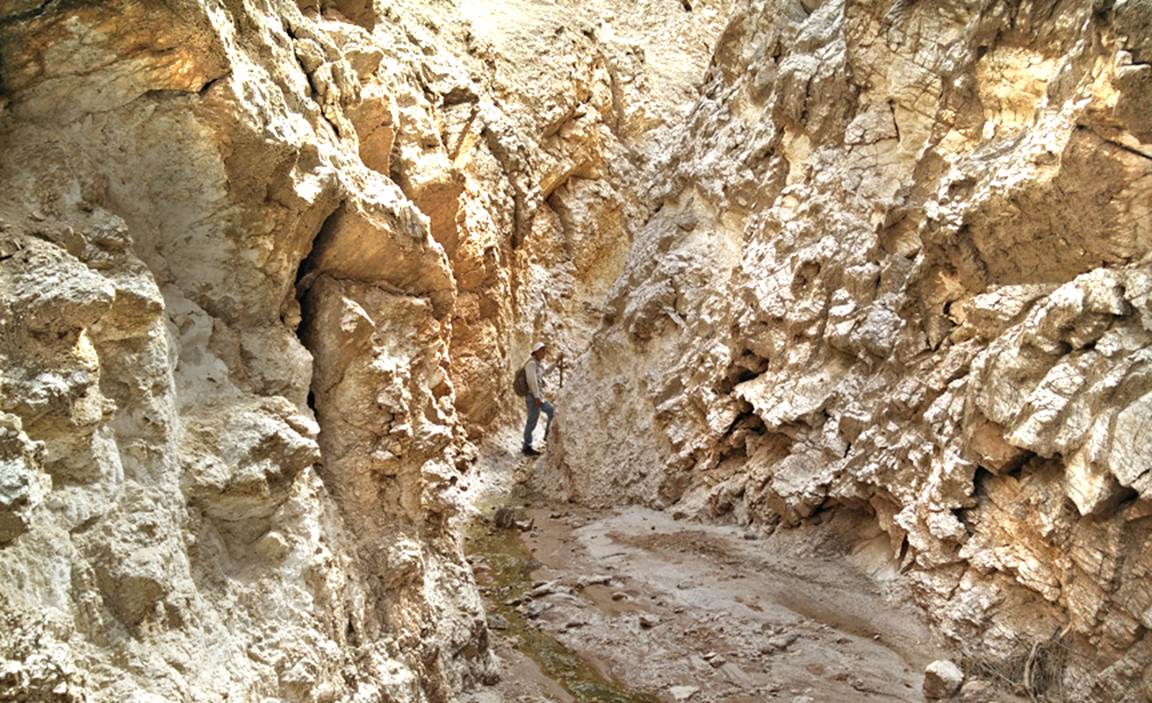
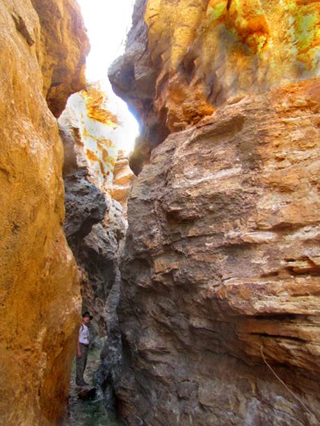
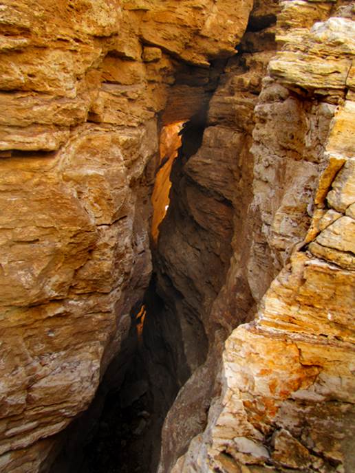
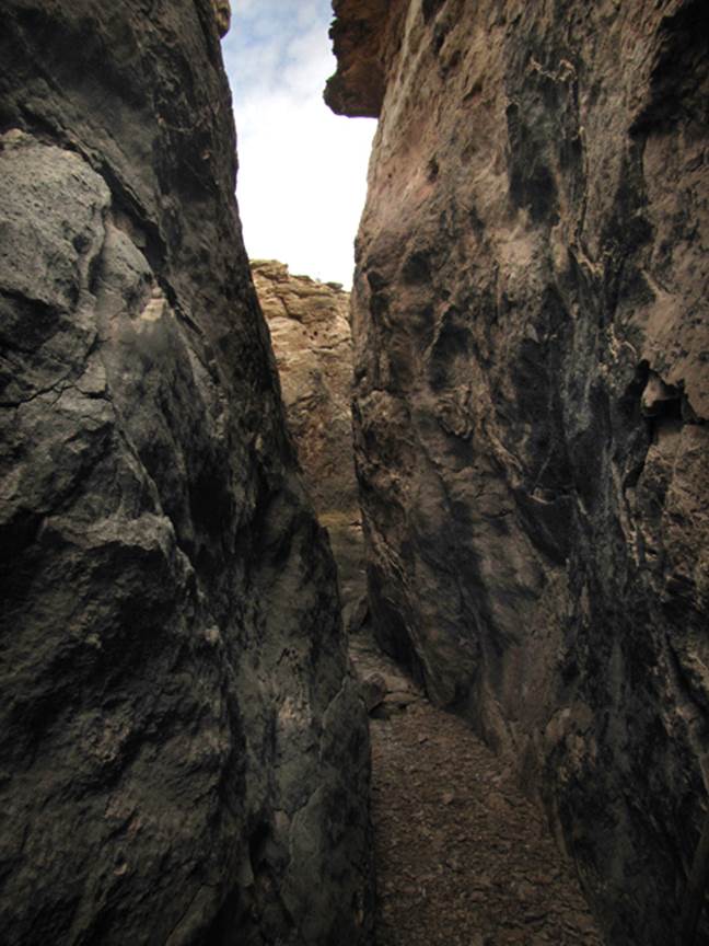
Travertine Maze
Also: Little Travertine
Maze and other special features in this area
Travertine Maze is a very special place –having
very narrow, meandering and inter-locking slot ravines within solid travertine
stone
Travertine Maze has the feel of slot
canyons, however these narrow slots are fractured and separated bedrock instead
of eroded canyons
Some of the passages pinch together tight
and require friction climbing twenty feet and more above the dirt floor
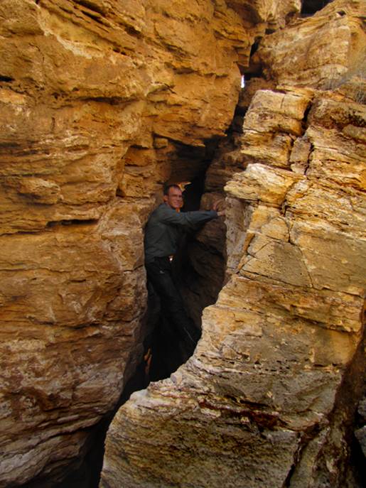
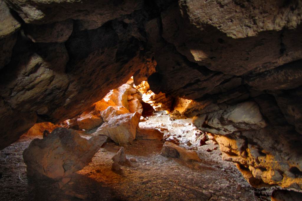
This side hallway below leads into a cave
with two separate forks, both requiring headlamps or
flashlights. One dead-ends at a larger
room deep inside the earth
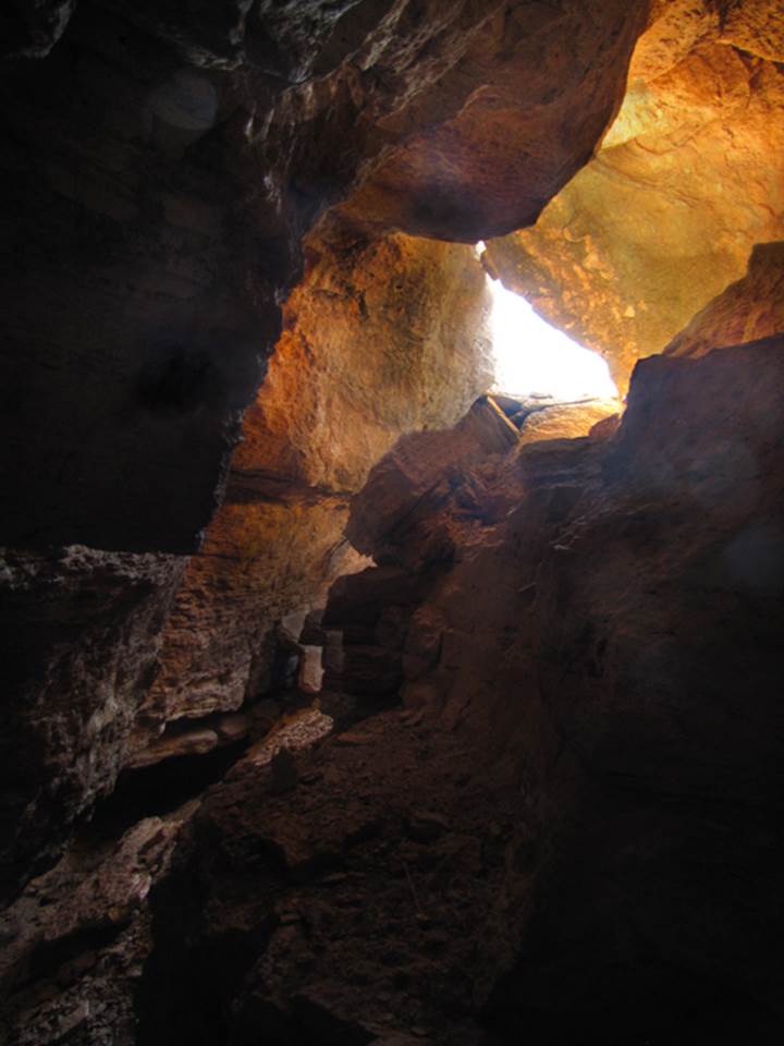
...another nearby cave southwest a short
distance from Travertine Maze begins in a dry sink-hole ±35°31.275’N 106°50.747’W.
Light glows from the openings at each end.
beta facts:
name- Travertine Maze
depth of slot portion- 30 to 40 feet
elevation- 5950’
GPS coordinates- ±35°31.317’N 106°50.765’W
flow- some perennial spring flow
season to visit- March, April, October and
November are best… NEVER
ENTER ANY SLOT CANYON WHEN HEAVY RAIN IS IN THE FORECAST…!!!
accommodations- NONE
ownership- mostly BLM
access- is from Cabezon
Road… see the map below
nearest town- San Ysidro
is about 7 miles east of here
fun fact- these slot canyons make a great loop
hike
Little Travertine Maze
GPS coordinates- ±35°31.112’N 106°50.765’W
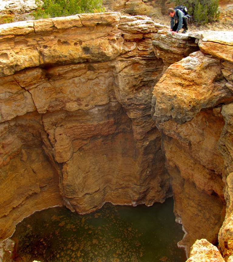
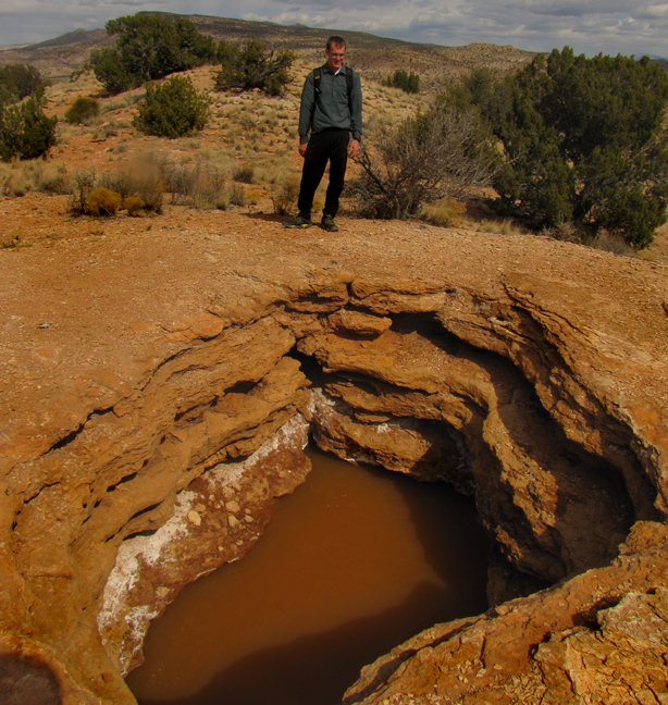
Devil’s Hole
This sink hole is amazing...
30’ across and 30’ down to the stinking alkali spring waters below... and who
knows how deep these waters are...!!!
GPS coordinates- ±35°31.546’N
106°50.799’W
...a geologist friend of mine
tells me these springs on top of this mountain are pushed upwards by deep
geothermal activity. The springs have
cooled since the heated magma that caused this upheaval has retracted deeper
into the earth. He explained that the white alkali build-up is geo-thermal
caused even though the springs have cooled as water must be heated before it
can ever absorb these impurities. Rain
water is never alkali.
Other nearby attractions
A
small alkali spring filled sink hole is at: GPS- ±35°31.744’N 106°50.809’W
There is a set of three short and narrow travertine ravines at
GPS: ±35°31.752’N 106°50.959’W
On the
map below they are marked in red with an x and the word “slots”
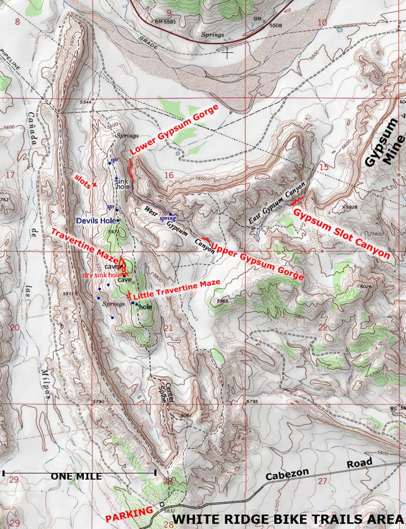
Enhanced USGS topo map
The Red Lines depict
sections of “slot canyons”
Right-click-save-as on this map below to keep and use
it…!!!!
Back to New Mexico
Slot Canyons
Send questions and comments to dscott@themarblesculptor.com