Poleo Canyon
ACA Canyon
Rating – 3A II
fun fact- this area is quite scenic and is suitable for casual hiking as well as technical canyoneering
NEVER ENTER ANY SLOT
CANYON WHEN HEAVY RAIN IS IN THE FORECAST…!!!
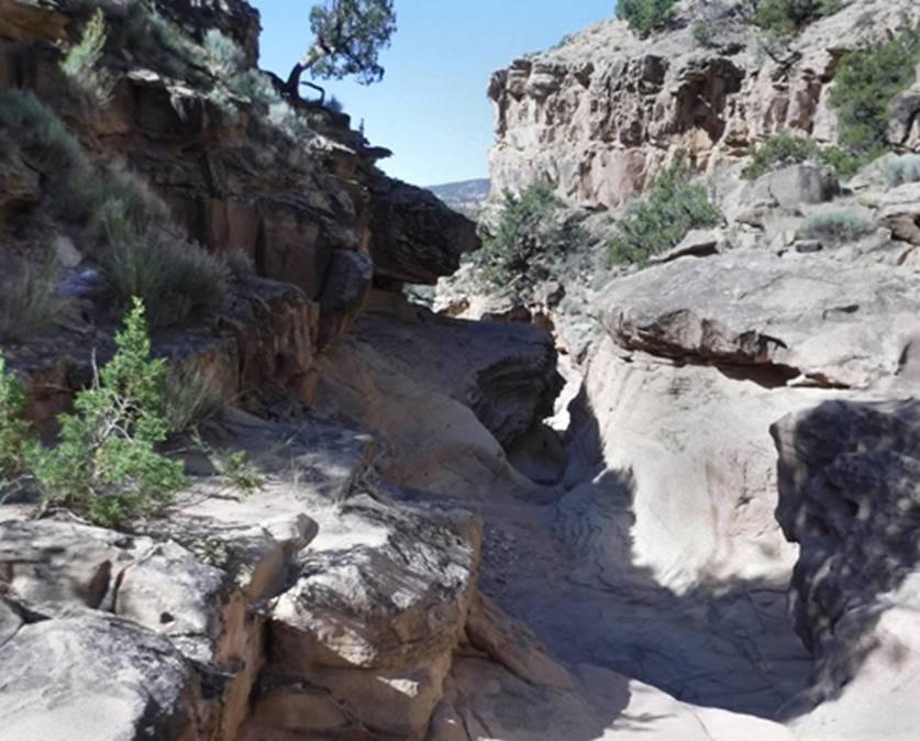
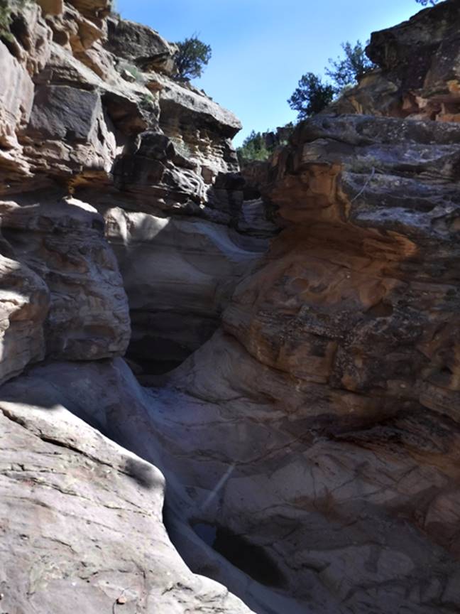
There is a short but sweet canyoneering
practice area a short ways downstream from Forest Road 151
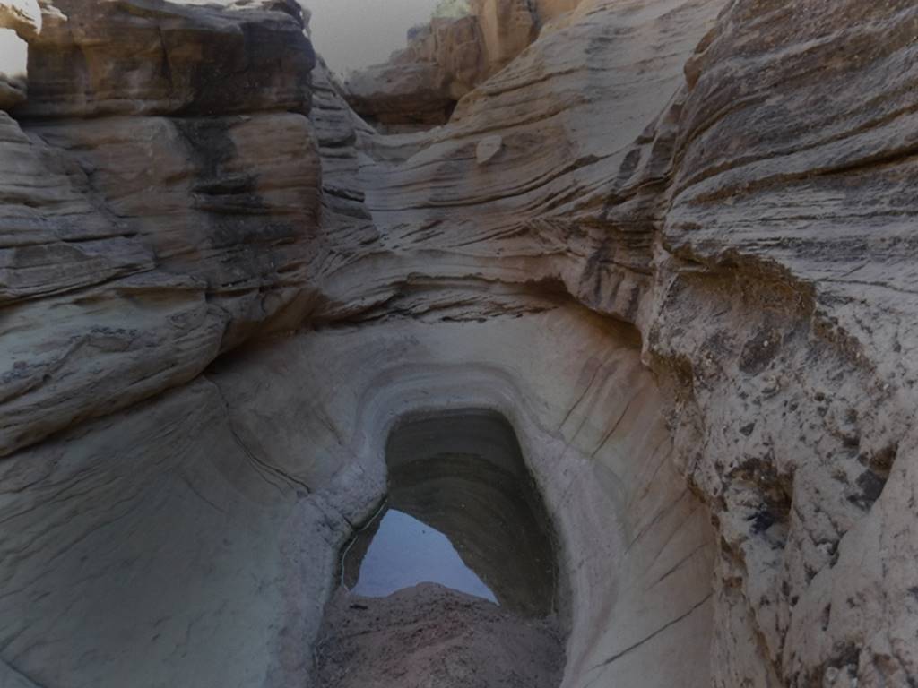
Like below here is a great place to
practice stemming a waterhole
...and more...
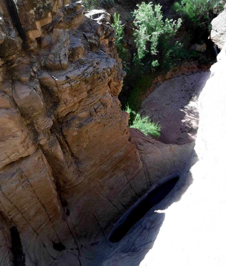
The photo below is looking off of the
40-foot dry falls rappel
beta facts:
name- Poleo Canyon Slot
length of slot canyon- a couple hundred
yards
elevation- 6150’
GPS coordinates- ±36°18.439’N 106°33.705’W
flow- intermittent
season to visit- most anytime except winter
may have ice & NEVER ENTER ANY SLOT CANYON WHEN
HEAVY RAIN IS IN THE FORECAST…!!!
accommodations- nearby campground &
restrooms
ownership- Santa Fe National Forest
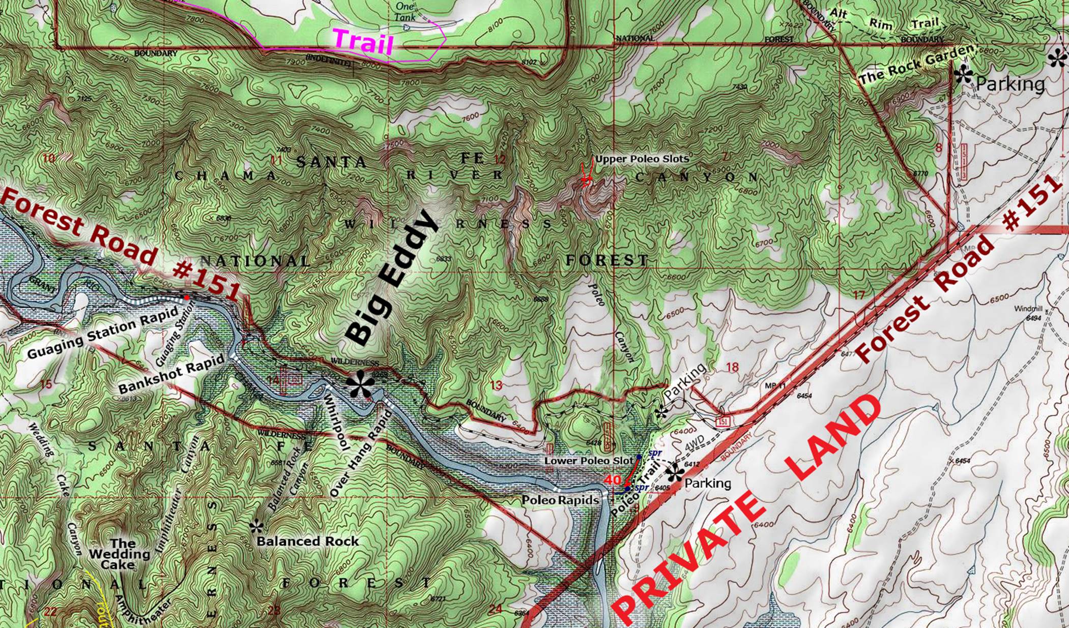
access- is from Forest Road 151… see the
map below
nearest town-Abiquiu is about 16 miles east
of here
fun fact- this area is quite scenic and is suitable for casual hiking as well as technical canyoneering
text
Poleo Canyon got its name from the dominate
sandstone, geologic formation here: the Poleo Formation. Poleo Canyon has narrow, slot canyons above
as well as below Forest Road 151. This
webpage deals only with the small slot canyon that lies downstream about a
quarter-mile below Forest Road 151. See
the map below.
There is a small dirt-road pull-off on a
little hill, along Forest Road 151, near where it crosses Poleo canyon - 36°18.660’N 106°33.580’W This has ample parking for maybe a dozen
automobiles. A quarter-mile hike down
the natural streambed leads you into the area shown by the photos above. Poleo Trail is a nice wide, obvious,
well-kept, trail linking hikers from their vehicle to the river and back. It also serves as a return from the bottom of
the 40 foot high rappel.
The Lower Poleo Slot Canyon appears near
the center of the lower portion of our map below
The upper slot canyons of
Poleo are yet to be descended or documented.
Hopefully soon the secrets of those upper slot canyons will be
discovered and shared.
See map below.
Right-click-save-as
on our map below, to print your own “hand-held” copy for your hike
Enhanced USGS topo map
The Red Lines depict
sections of “slot canyons”
Back to New Mexico
Slot Canyons
Send questions and comments to dscott@themarblesculptor.com