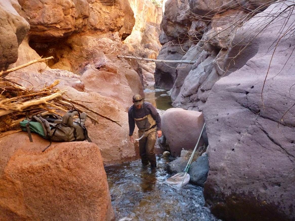
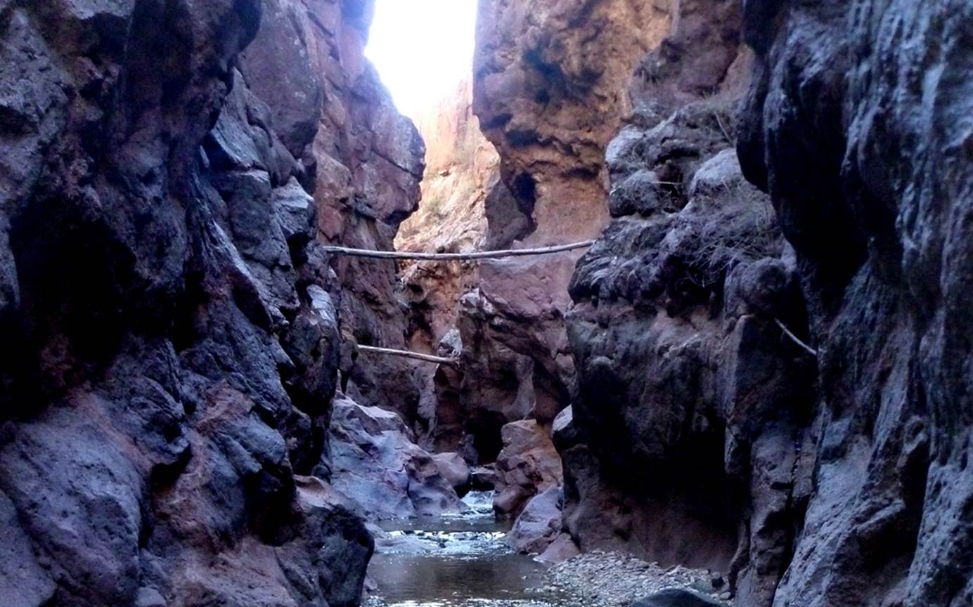
Mule Creek Canyon
ACA Canyon
Rating – 2C III
NEVER ENTER ANY
SLOT CANYON WHEN HEAVY RAIN IS IN THE FORECAST…!!!
Canyon
beta facts:
name- Mule Creek Canyon
length of slot canyon- 1.7 miles
elevation- 4730’at the top down to 4444’at the bottom
GPS coordinates- ±33°11.574’N 108°57.913’W at the top and ±33°11.762’N 108°58.063’W at the lower end
flow- perennial
season to visit- October thru April… NEVER ENTER ANY SLOT CANYON WHEN
HEAVY RAIN IS IN THE FORECAST…!!!
accommodations- NONE
ownership- Gila National Forest
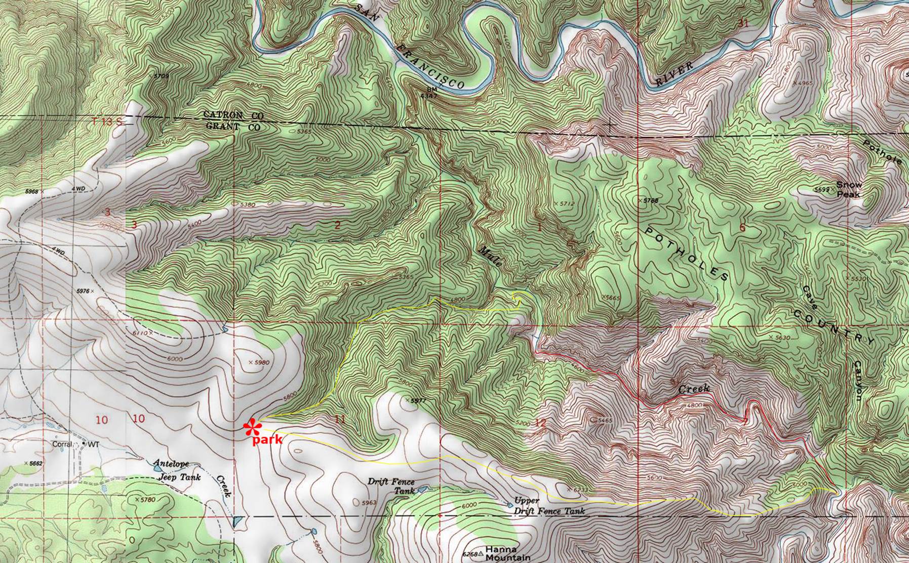
access- is from above on Harden Cieniga Road… see the map below
nearest town- Mule Creek is a few miles southeast
of here
fun fact- this is a beautiful place, with extreme flash-flood danger…!!!
essay bro
Go east of Mule Creek, New Mexico on State
Hwy for 3 miles. Turn north on Harden Cieniga Road for 6 miles to Harden Cieniga. Work your way east on a 4WD
road for 3 miles to near Jeep Tank up Antelope Creek. Take a jeep road another 1/3 mile up to an
open pass to the northeast. Park at that pass. It
is marked with * on
the map below. Travel the 1.7 mile long Mule Creek Slot
Canyon going upstream or downstream. It
is pass-able both directions. The
yellow lines on the map below show access routes.
Altho you may wish to continue on downstream
another mile and a quarter to the San Francisco River... before returning to
your wheels.
Enhanced USGS topo map
The Red Lines depict
sections of “slot canyons”
Back to New Mexico
Slot Canyons
Send questions and comments to dscott@themarblesculptor.com