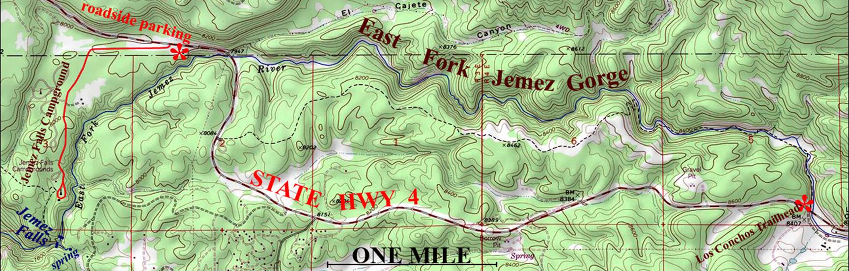
East Fork Jemez Gorge
See on youtube: https://www.youtube.com/watch?v=_82URHLAHiw
ACA Canyon
Rating – 2C III …one swim/wade/climb is fairly risky but anyone can change
directions and return to your upstream auto at any time
Most
possible rappels and/or climbs can be avoided by scrambling up, over and around
the steep stuff…!!!
Beware of July
and August thunderstorm flashfloods…!!!
Also avoid some wet years heavy snow-melt runoff during April
& MAY…!!!
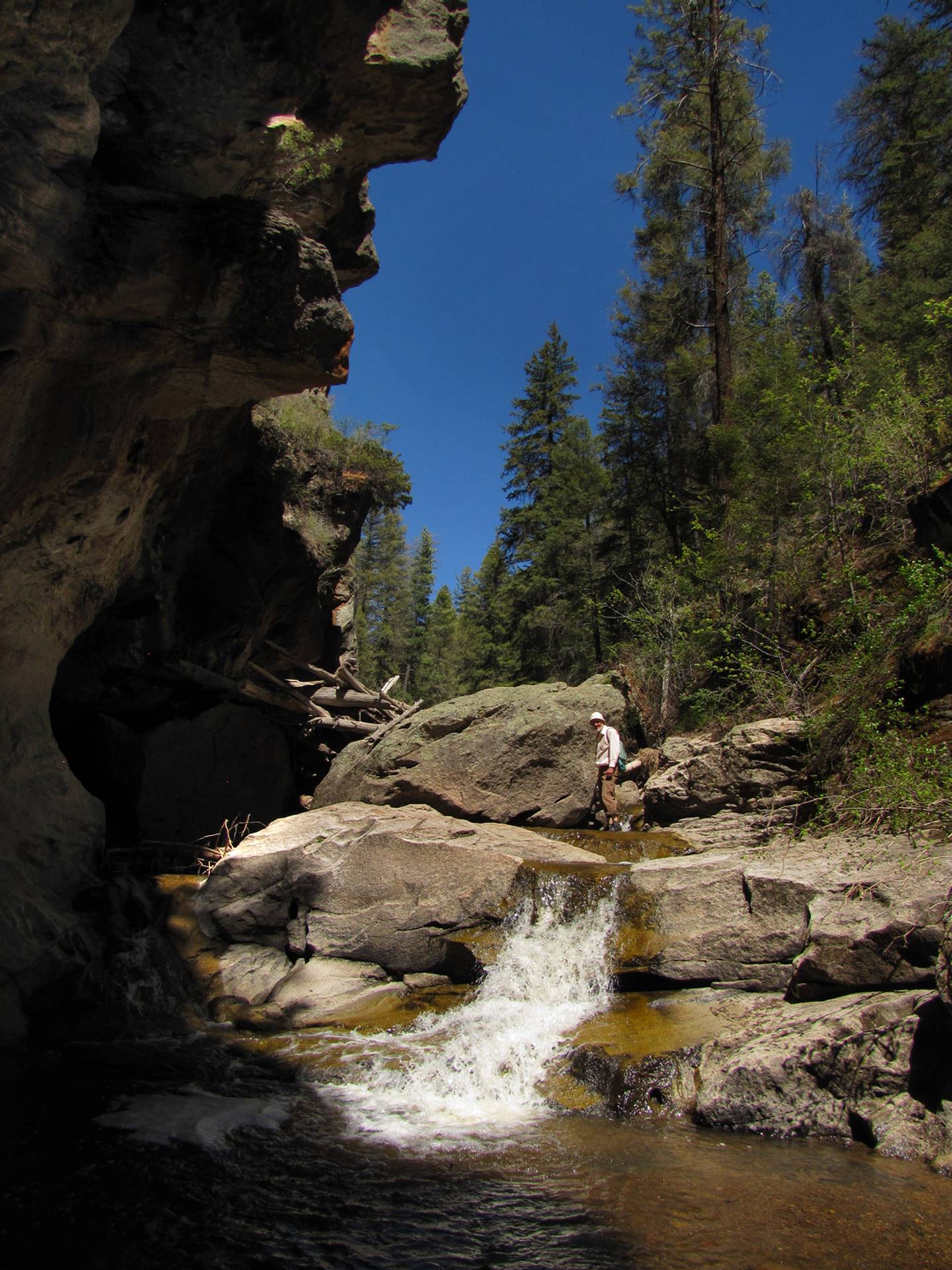
…see the small rope hanging to your left of
the waterfall. Someone put it there to
let people down into the slot canyon, but we climbed up, over ad around the
cliffs. Upon returning to the creek, we
back-tracked up into the slot all the way to the waterfall. Click this link to see a youtube video of us
doing this: https://www.youtube.com/watch?v=_82URHLAHiw&list=UUCJsfIZ3DXVpmoXu2d487VQ
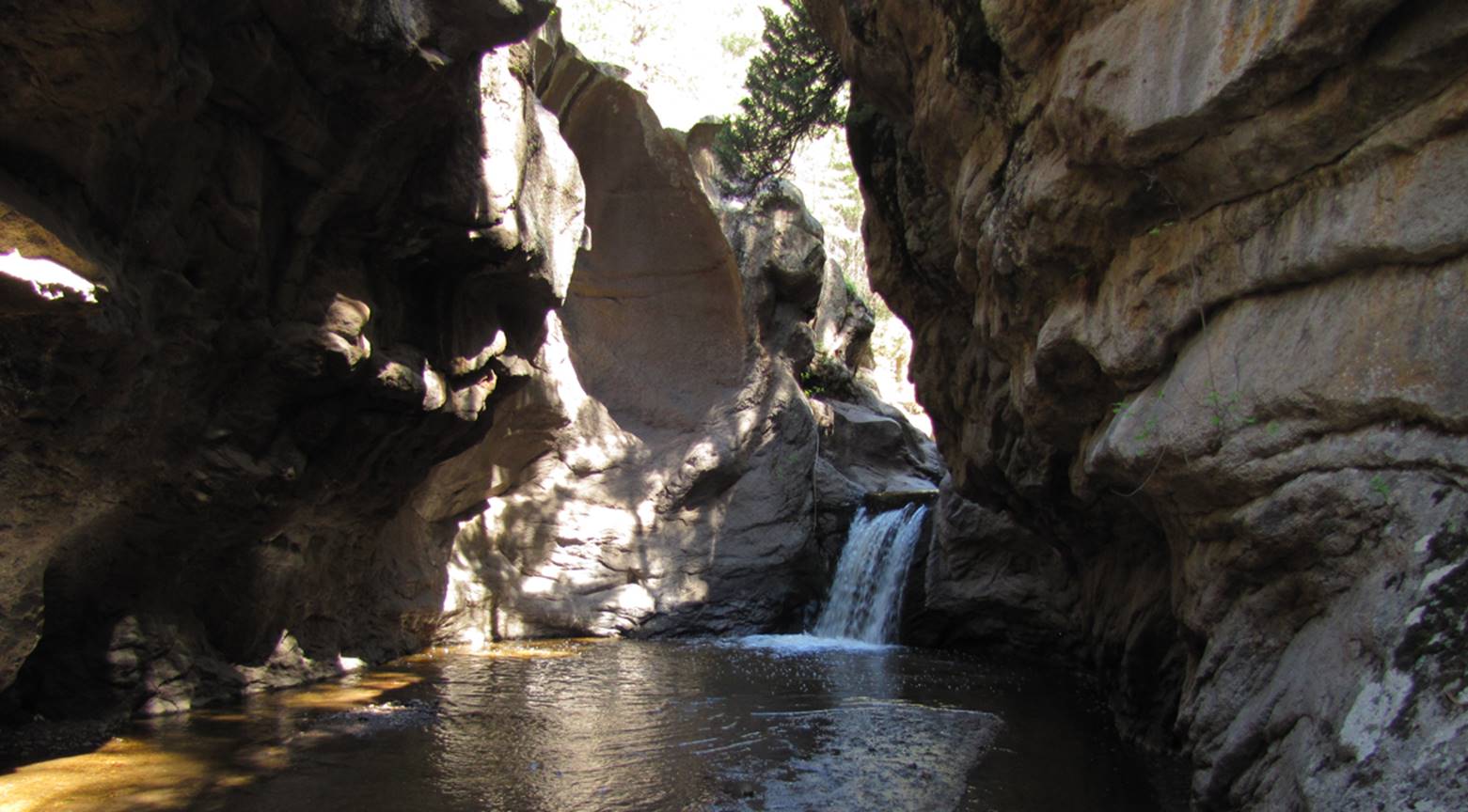
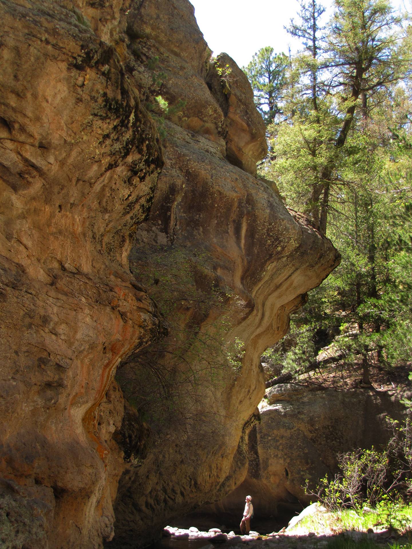
This is an amazingly beautiful canyon… in
places it is out-of-this-world
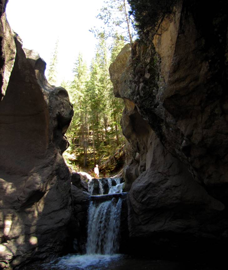
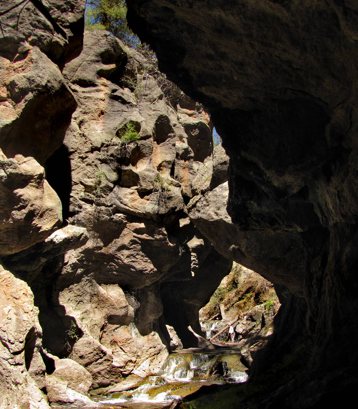
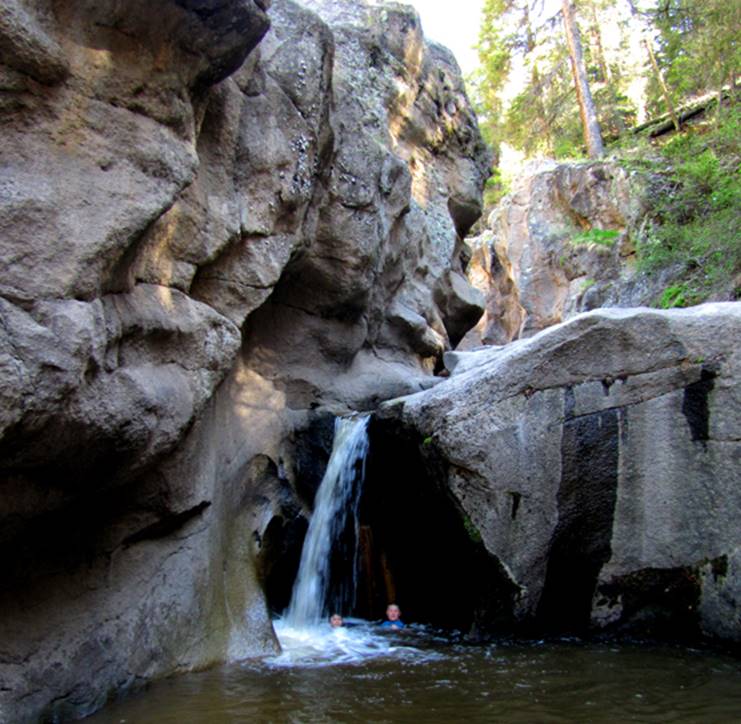
You can barely see me in this photo below…
because I am down in the “subway”
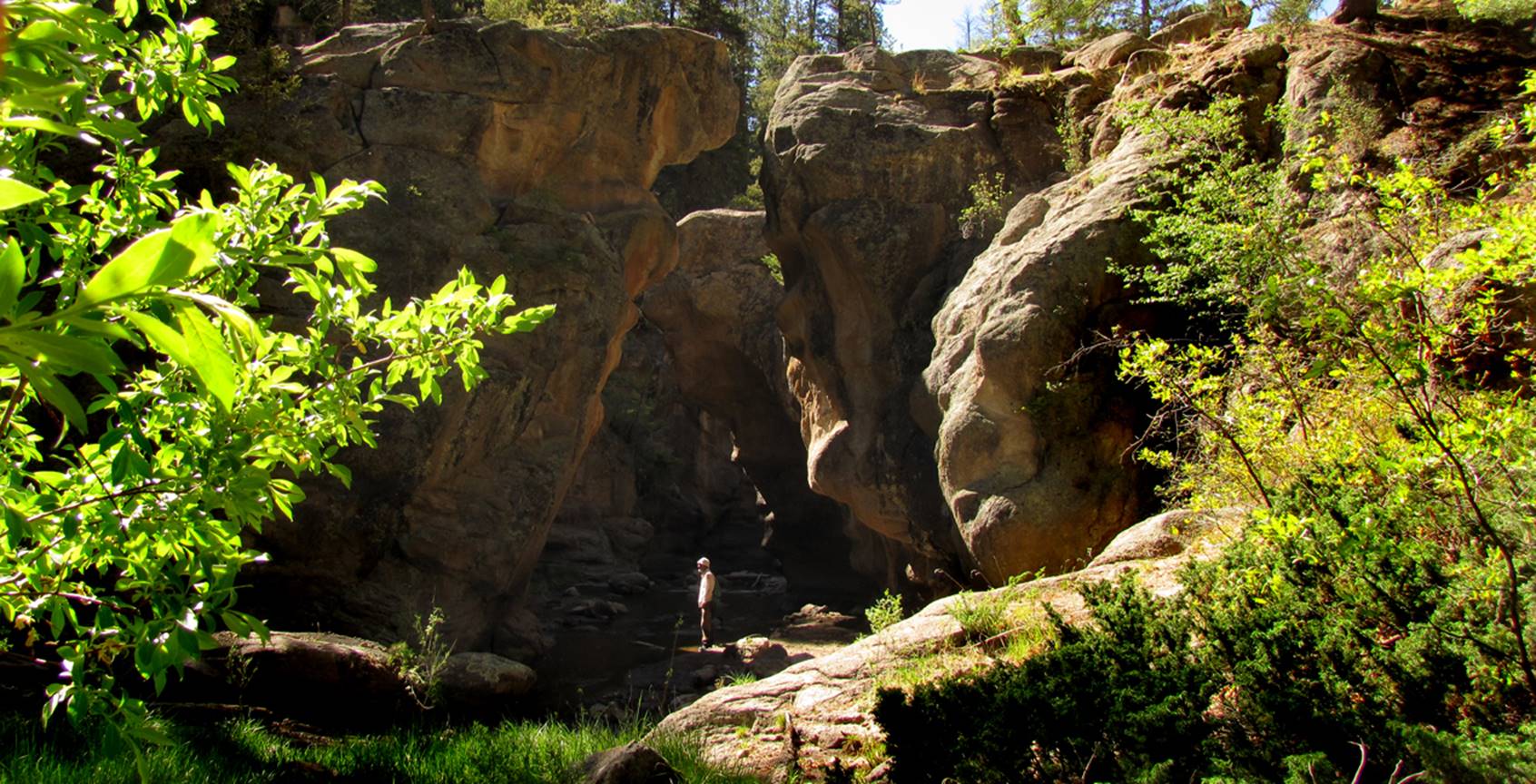
Below children play in shallow water that
used to be 20 feet deep. This is where
60’ high cliff-jumping used to take place.
The water here is now 24 inches deep because extreme flooding that
followed the 2011 Los Chochos Fire, has filled all the deep pools with heavy
silt. The cliff-jumping is no more but
the hiking is actually easier these days, thru the shallow waters.
This is a special place, but traversing the
entire canyon takes most of a day
It worries me to think of
how you or anyone else could trash this place out… PLEASE TAKE CARE OF THIS AMAZING
PLACE…!!!
beta facts:
name- East Fork Jemez Gorge
depth of slot portion- 100+ feet
length of canyon traverse- a scant 5 miles,
but it will keep you most of a day
elevation- 8400’at the top down to 7950’at
the bottom
GPS coordinates- ±35°48.905’N 106°31.987’W at the top and ±35°49.376’N 106°35.750’W at the lower end
flow- a nice size perennial flowing trout
stream
season to visit- drier months of the year,
like May, June, September, October and November… NEVER ENTER ANY SLOT CANYON WHEN HEAVY RAIN IS IN
THE FORCAST…!!!
accommodations- only at campgrounds near
each end
ownership- Santa Fe National Forest
access- is from State Highway 4 between
Jemez Springs and Los Alamos …see the map below
nearest town- Jemez Springs is about 10
air-miles south of here
fun fact- please pick up your own AND other peoples litter…!!!
essay bro
We do a car shuttle for this hike. We put an extra car at the bottom before
driving back to the top to begin. Or you
can hike as far as you like downstream before returning back to your wheels,
the way you came.
It is best to hike this canyon by walking
downstream. Start at the Los Conchos
Trailhead in the lower right-hand corner of the map below. A nice trail follows the stream for a mile
and a half. But where the trail climbs
up out of the canyon is where you want to discontinue following the trail and
start hiking downstream along and/or in the stream. In fact there will be an abundance of deep
wading and possibly even a short swim or two…which is why this trip should NOT
be done during high water. So you may
wish to pack along a life-jacket.
DO NOT DO THIS
TRIP IF THE WATER FLOW IS HIGH AND MUDDY…!!!
ONLY HIKE
THIS CANYON IF THE WATERFLOW IS LOW AND RUNNING CLEAN AND CLEAR
At
the downstream end of this trip the highway crosses the East Fork of the
Jemez. This is a NO PARKING ZONE. This is a dangerous place because people
drive too fast here. When enough people
were hurt and killed here, the parking area was removed. Now you must walk another quarter-mile west
on highway 4 to a roadside parking area near the Jemez Falls Sign.
Make time to visit 50’ high
Jemez Falls while you are here.
Enhanced USGS topo map by Doug Scott
Back to New Mexico
Slot Canyons
Send questions and comments to dscott@themarblesculptor.com