Cuesta Navajo Canyon Slot
ACA Canyon
Rating – 3A II
Experienced Canyoneers
Only
requires a
full range of technical rock climbing equipment and rope…!!!
NEVER ENTER ANY
SLOT CANYON WHEN HEAVY RAIN IS IN THE FORECAST…!!!
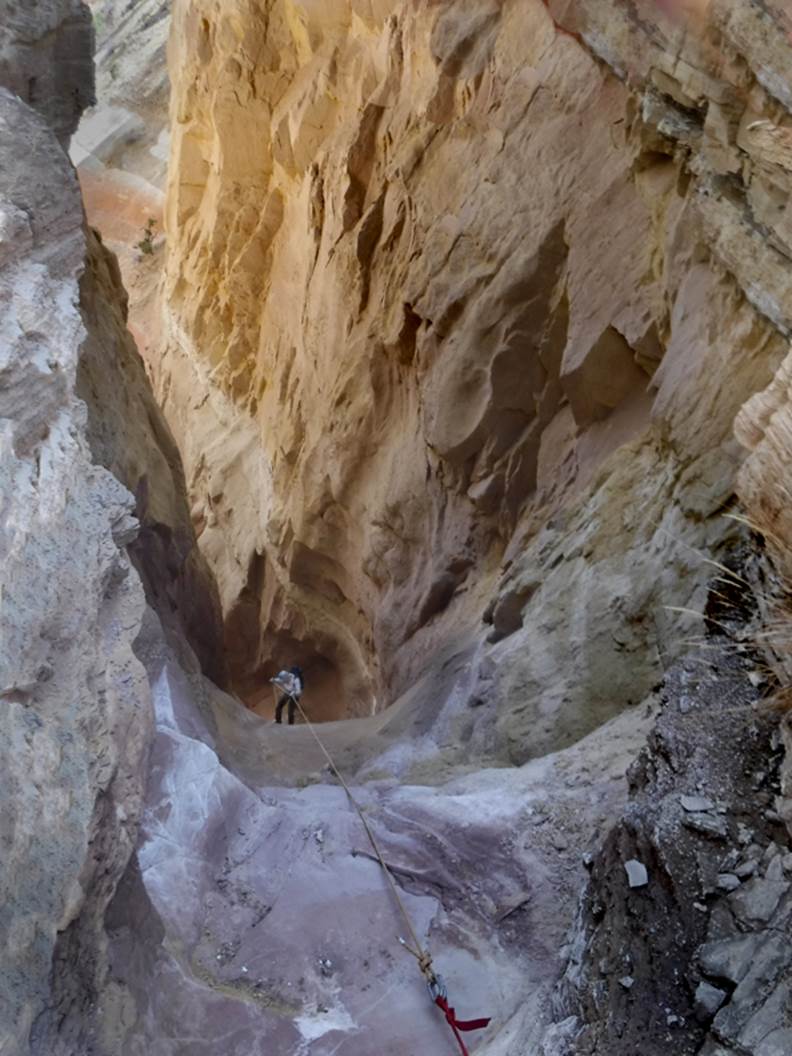
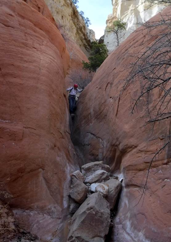
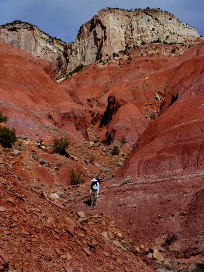
Cuesta Navajo Slot Canyon is short, steep
and AWESOME.....! ! ! - Rorke is on the
150’ rappel.
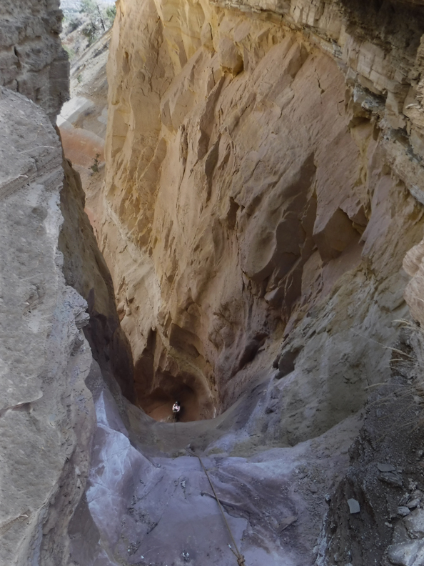
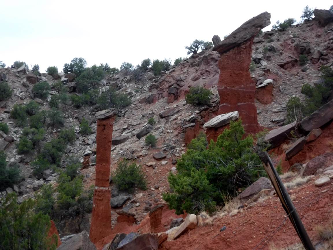
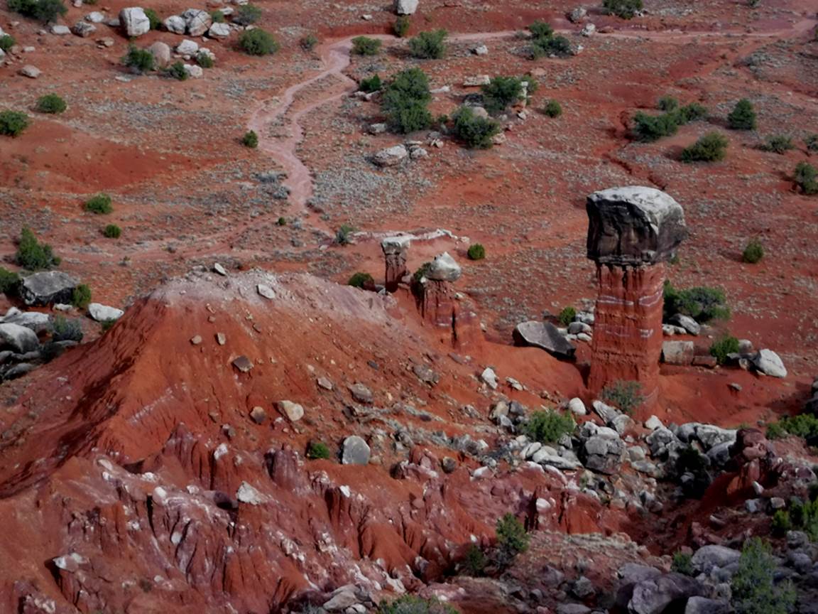
The 150’ rappel & slot below...as seen
from our steep climb-out ridge
...within the Entrada
Sandstone slot below the high rappel...
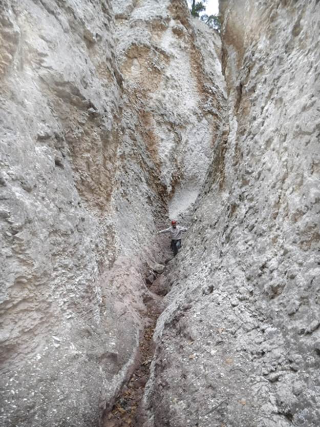
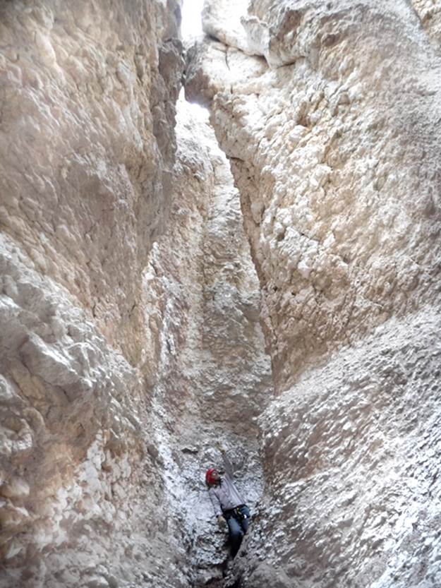
The portion of Cuesta Navajo Slot above the
high rappel is Alabaster... the two rims kiss, overhead in one place...
beta facts:
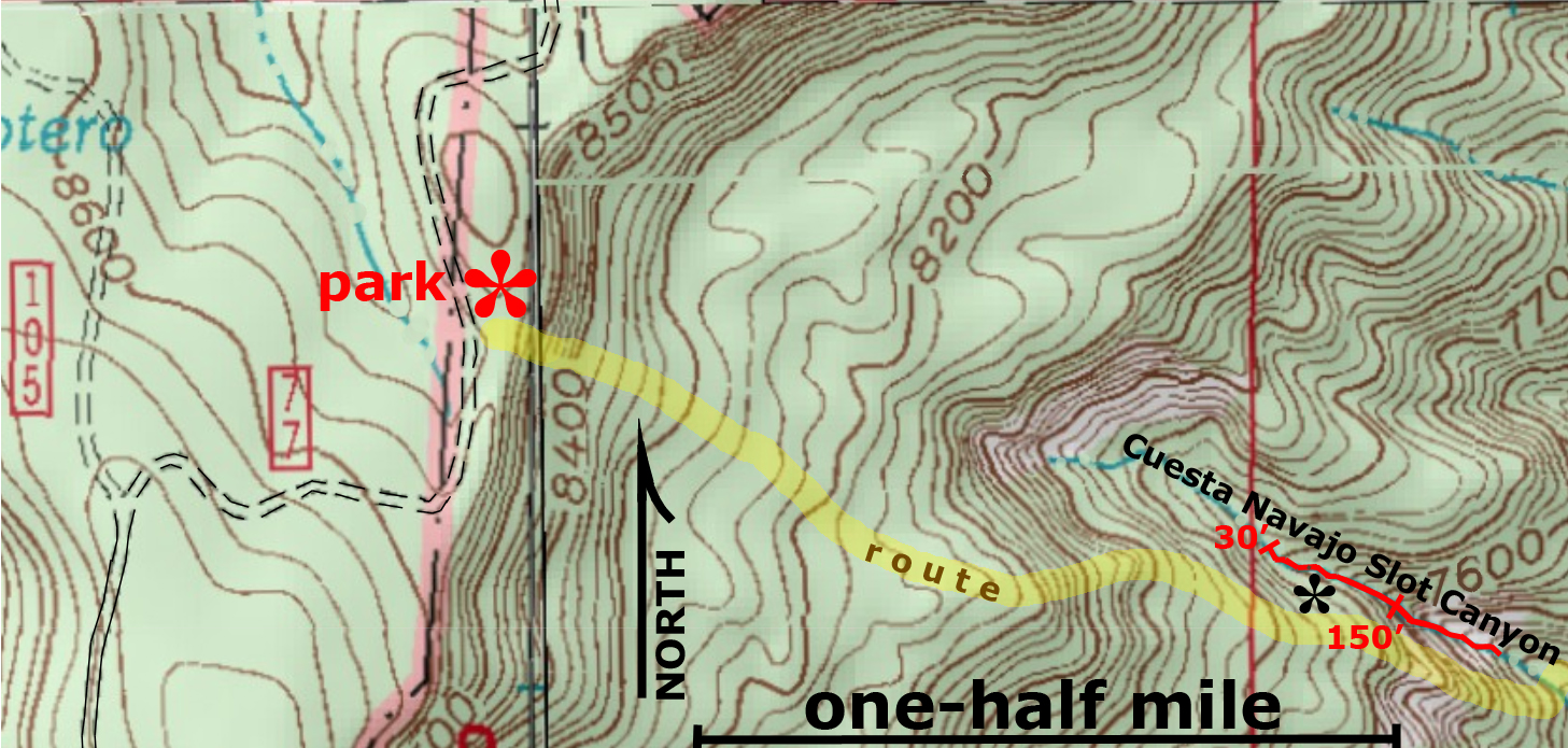
name- Cuesta Navajo Slot Canyon
length of slot canyon- maybe a quarter mile
elevation- 7700’at the top down to about 7400’at the
bottom
GPS coordinates- ±36°14.784’N 106°37.558’W –park your wheels and start hiking down
±36°14.708’N 106°37.047’W
–the first rappel
±36°14.679’N 106°36.971’W
–second rappel
±36°14.613’N 106°36.878’W –climb-out and return up this ridge
flow- intermittent
season to visit- most anytime except winter may
have ice & NEVER ENTER ANY SLOT CANYON WHEN
HEAVY RAIN IS IN THE FORECAST…!!!
accommodations- none
ownership- Santa Fe National Forest
access- is from Forest Road 77… see the map below
nearest town- Coyote is about 6 miles south of
here
fun fact- This is a beautiful slot canyon…! !
!
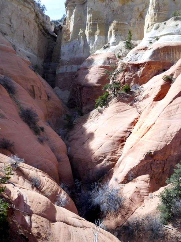
Cuesta Navajo Slot Canyon
Cuesta Navajo is the name that appears on
Santa Fe National Forest maps for this area.
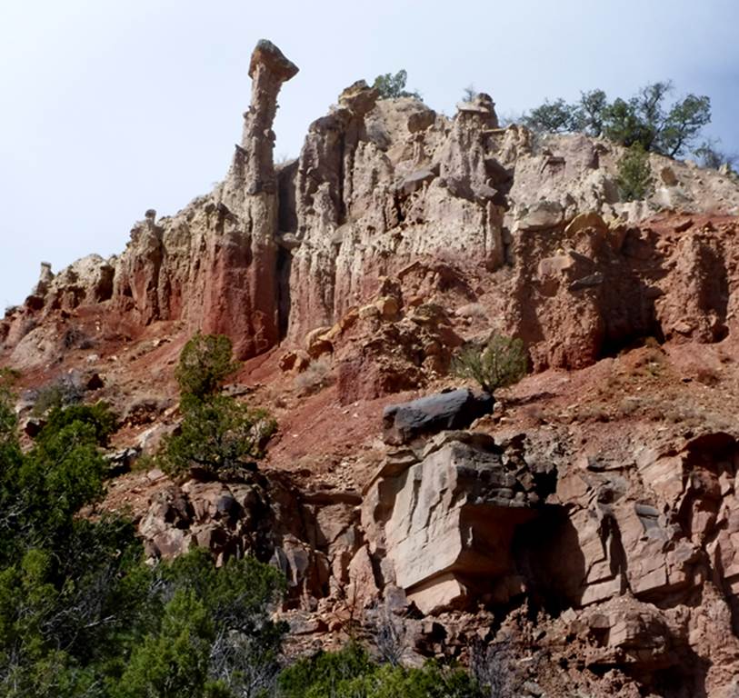
The Questa Navajo area is the brightest colored painted
desert I have ever seen. ...more
deep rich reds and yellows, along with more clean whites than even the painted
desert of Arizona. Please see the photos
of the Cuesta Navajo Desert at the very bottom of this page. The Cuesta Navajo Desert is best accessed via
a small dirt road directly across from the gate to the Coyote Ranger Station
near Coyote, NM. This road is un-maked but legal for public entrance. To access this large colorful desert area you
must follow this dirt road northeast for 4 miles or more. A couple miles in, the road turns east,
following under the big high-line wires out to the very edge of a steep
drop-off ...overlooking the Cuesta Navajo Desert. It is AWESOME…!!! -but you may need a 4WD or at least a
high-clearance rig.
Cuesta Navajo Slot Canyon is best reached
from up on top of Mesa Alta, on Forest Road 77.
Consult a Santa Fe National Forest Map and use it in conjunction with
our map below. As you can see on our map
below, a steep down-hike of less than one mile from your wheels,
brings you to this fine slot canyon. The
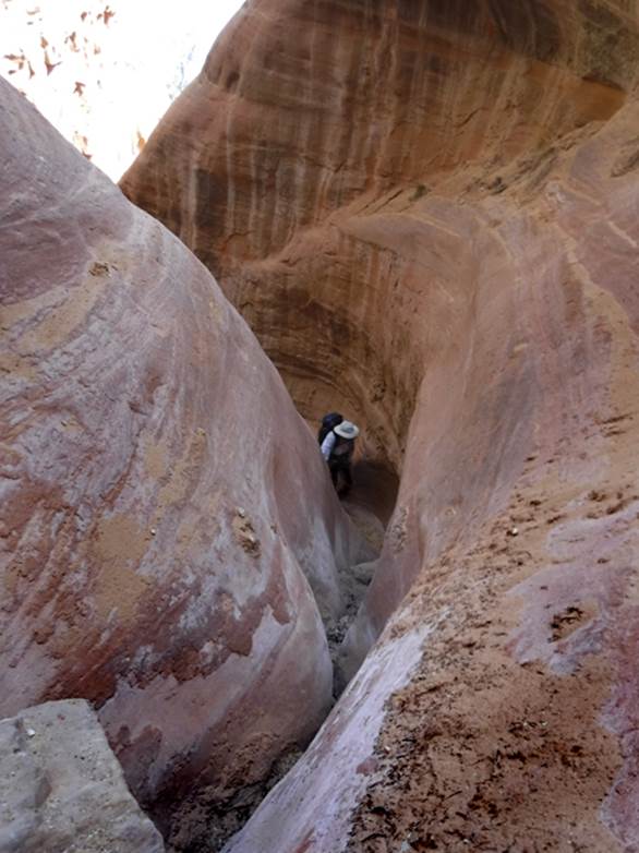
first rappel is about 30’ and the only other rappel is 150’. The hike back up to your vehicle,
is marked with a faint yellow line..... enjoy......! ! !
The black asterisk on the map below marks a
place along the upper, alabaster portion of Cuesta Navajo Slot Canyon, where a
50’ hand-line rope can be anchored to a standing-dead-tree to allow an alternate entrance and/or
exit. This place is quite steep but it
is not sheer. In fact my son climbed
down into the slot at this very place, and back out, without using the rope
hand-line... and he was wearing a 50 pound pack...!!! -but he’s tuffer
than I am... ! ! !
Enhanced USGS topo map
Please right-click-save-as
on our map below to have a hand held hard copy with you in the field
The Red Line depict
sections of “slot canyon”
The Cuesta Navajo Desert is about 3000
acres of extremely colorful hiking
Back to New Mexico
Slot Canyons
Send questions and comments to dscott@themarblesculptor.com