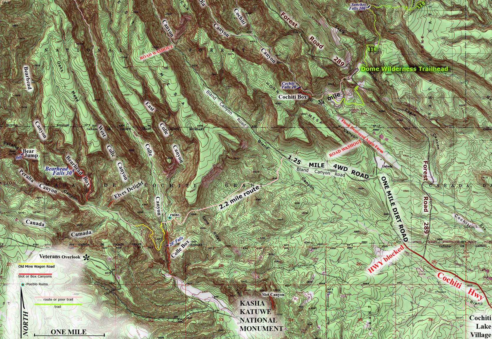
Colle Box Canyon and vicinity
ACA Canyon
Rating – 2A III
NEVER ENTER ANY
SLOT CANYON WHEN HEAVY RAIN IS IN THE FORECAST…!!!
Many of us have been exploring this area for 50
years
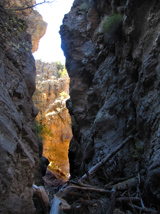
Down in the narrow crux
of Colle Canyon Slot is a 20 foot high climbable drop where often climbers
desire a rope belay
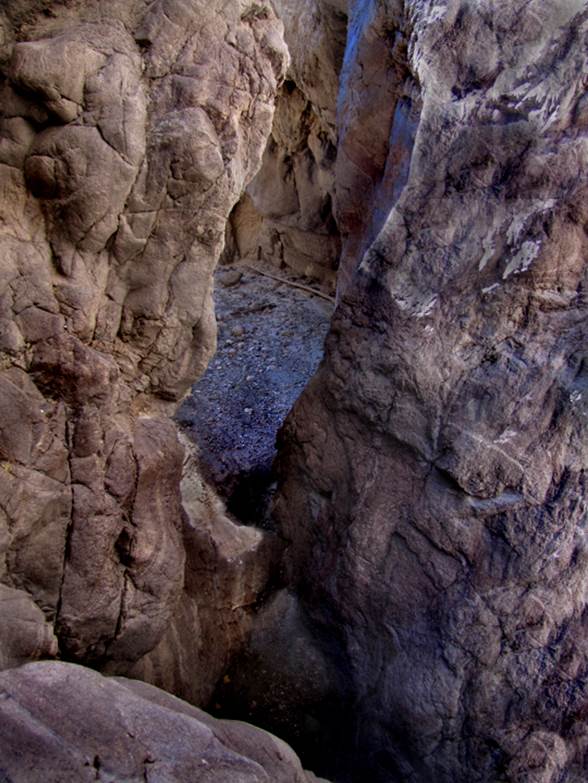
below and above this narrow section is a very
high and sheer walled box canyon almost a mile long.... extremely
spectacular...! ! !
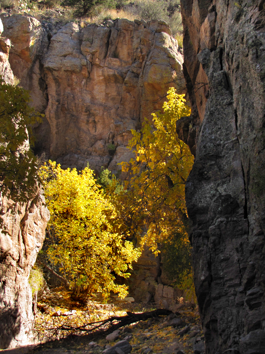
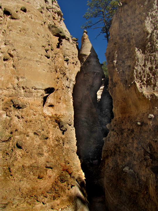
a hiker rests, in the photo above to the
right ...and below are deep narrow Colle Slot Canyon Chambers
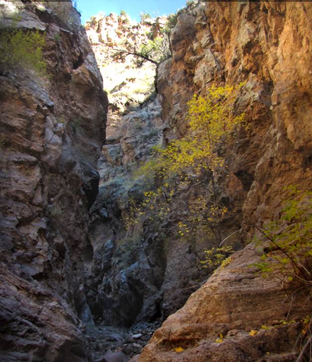
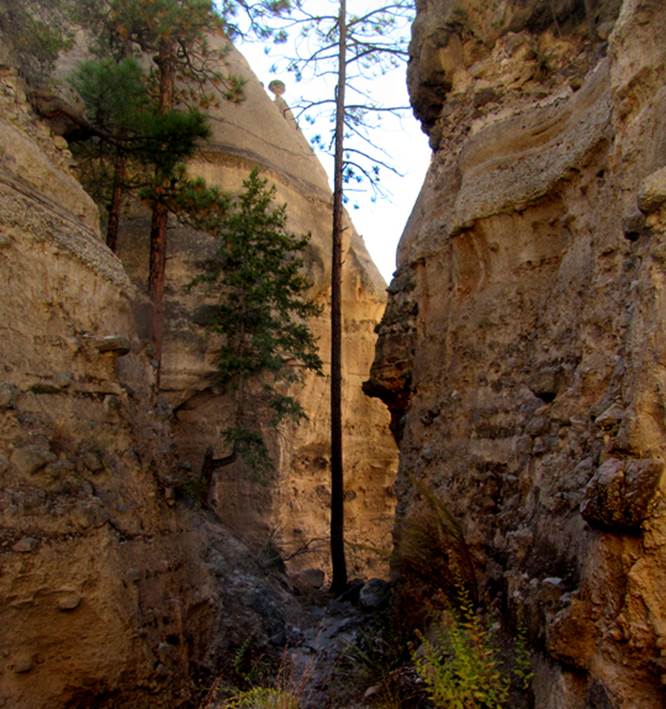
Below is photos of a wonderful, whimsical,
1/8 mile long slot canyon that we call “Elves Delight”...it is up Peralta
Canyon a mile and a half above Colle Canyon
up in the far top-left-hand corner of the topo map below is
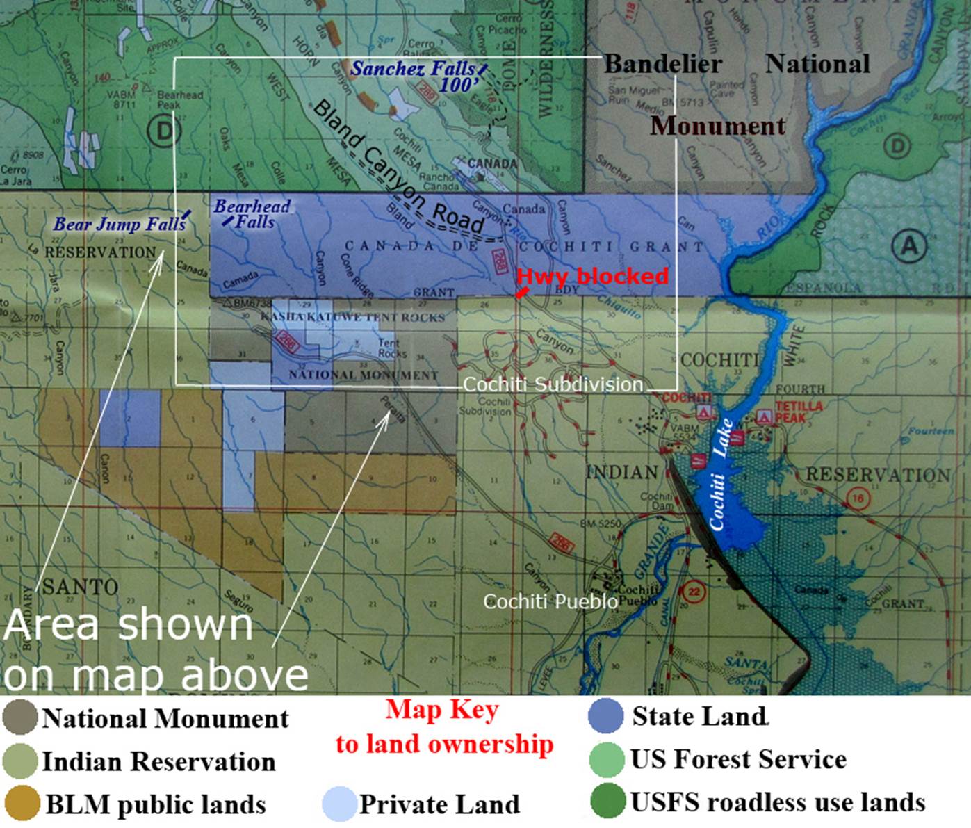
a place named “Bear Jump”... here tiz:
TJ Middleton is the real “Bear” of Bear
Jump TJ
Middleton Photo
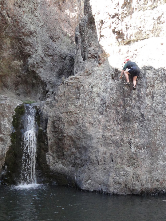
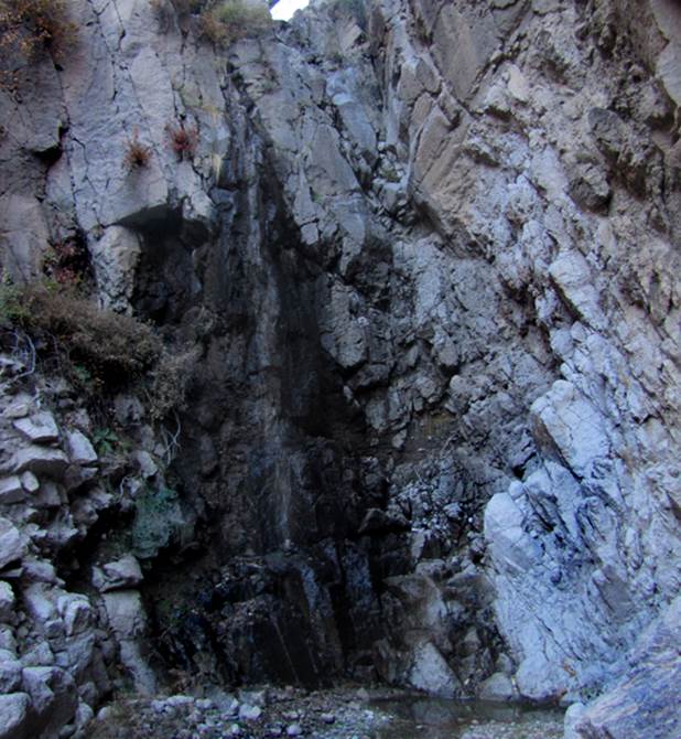
Below is a photo of the spring-fed, 30’
high, Bearhead Falls + 35°41.457’N
106°27.389’W -this falls is at the upper
end of the amazing Bearhead Box
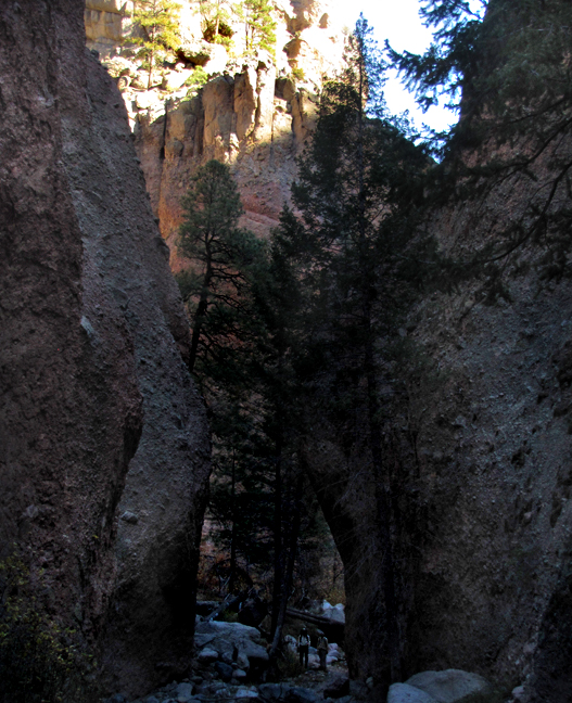
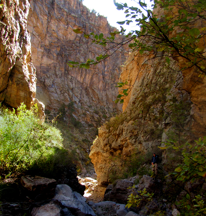
The right-hand photo above shows Randy and
Evan quite small within the depths of the amazing Bearhead
Box Canyon
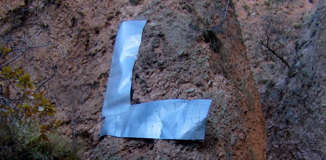
Unfortunately... the
University of New Mexico left many 20 foot long pieces of sheet metal as litter nailed to the beautiful walls
of Bearhead Box...!!!
...and the photo below shows the Albemarle Mine Wagon Road as it cuts above what we call “Dr Sues Land”
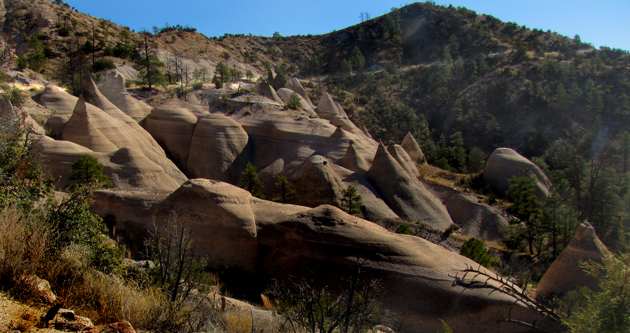
...notice that the Dr
Sues tuff formations are MUCH bigger than the very large Ponderosa Pine trees
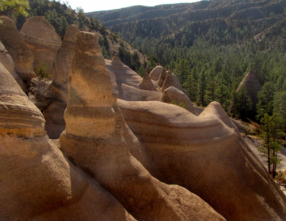
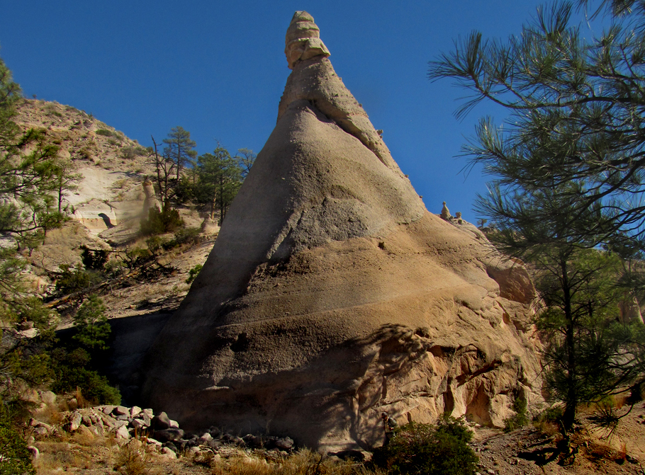
The hiker at the bottom of this lower photo
appears quite small under a Dr Sues Tent Rock
The photo below shows the ONLY posted sign that is true and
legal. OBEY THIS SIGN.
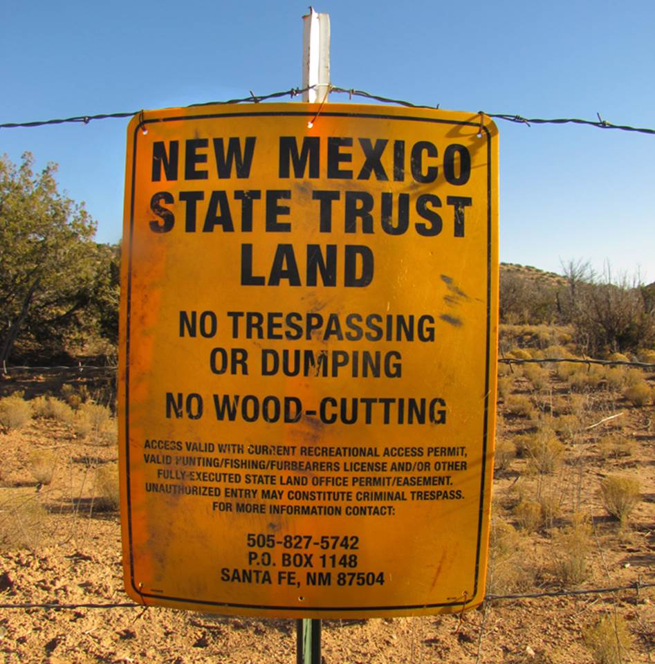
Other signs claiming “Private Ranch” are
neither truth nor legal
beta facts:
name- Colle Box Canyon
depth of canyon- 300 feet and more
length of slot canyon- just under a mile
elevation- 6000’
GPS coordinates- ±35°40.390’N 106°25.955’W
flow- intermittent
season to visit- most of the year. NEVER ENTER ANY SLOT CANYON WHEN HEAVY RAIN IS IN THE FORECAST…!!!
accommodations- NONE
ownership- State of New Mexico Lands
access- is from Bland Canyon Road –see maps below
nearest town- Cochiti Pueblo is about 8 miles
southeast of here
fun fact- the “Albemarle Mine Wagon Road” is
one of New Mexico’s most AMAZING trails, but it is in need of repair
access
Bland Canyon Road is on State of New Mexico
Trust Land. This is not public land. State Trust Lands are the subject of a public
trust created to support the education of New Mexico’s children. The area of concern here can be accessed
legally via a special permit. This special use permit for recreation is
required to legally enter this beautiful area as well as other State Trust
Lands. This
recreational permit can be purchased for $25 a year from the New Mexico State
Land Office at: 310 Old Santa Fe Trail PO
BOX 1148 Santa Fe, NM 87504. This permit is also available online at: http://www.nmstatelands.org/Recreational_Access.aspx#RecreationalPermit
The Cochiti Highway is paved for a few
short miles above the village of Cochiti Lake. At the end of the pavement the highway is
barricaded at the State Land Boundary, but the dirt road continues on as Bland
Canyon Road and eventually dead-ends within Santa Fe National Forest. Up until December first 2015 this gate has
been unlocked and unposted, and we have been accessing this amazingly beautiful
canyon country for many years.
However, Dec 1, 2015 the gate at the end of
the paved highway became locked.
Unfortunately when this gate is locked, access is greatly hampered because of
the long walk in to reach Colle Canyon.
We are unsure of the future of this sweet access that we have enjoyed
for decades.
When traversing the Colle Box, remember
that the lower half of it is private land, so be sure to turn around there and
return back the same way you came in.
All climbs are very do-able as up-climbs or down-climbs. But be sure to allow time to continue on
hiking up and over the ridge on the Albemarle Mine Wagon Road –shown in yellow on
the map below. It is marked on the map
below as the “Old Miner’s
Wagon Road”. This is an amazing trail and it opens up
access to Elves Delight Slot Canyon, Bearhead Box and
on into Peralta Canyon.......! ! !
...by the way... it involves some difficult
all-fours scrambling to reach Bearhead Falls and a
few good climbers scale the cliff to the left of the falls and continue farther
upstream
See maps below... AND
Please
right-click-save-as our map below, so you can make a hard copy to carry with
you on your hike. No other map on earth,
will show anywhere near these details.
Enhanced
USGS topo map - red
lines depict “slot” and/or “box” canyons
The map below shows land ownership in this
area
Back to New Mexico
Slot Canyons
Send questions and comments to dscott@themarblesculptor.com