Cochiti Canyon
ACA Canyon
Rating – 2B II
NEVER ENTER ANY
SLOT CANYON WHEN HEAVY RAIN IS IN THE FORCAST…!!!
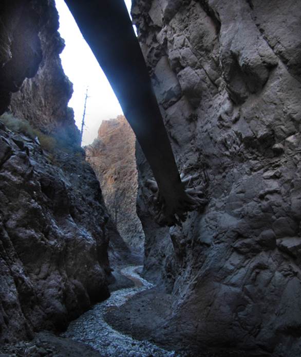
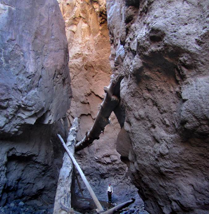
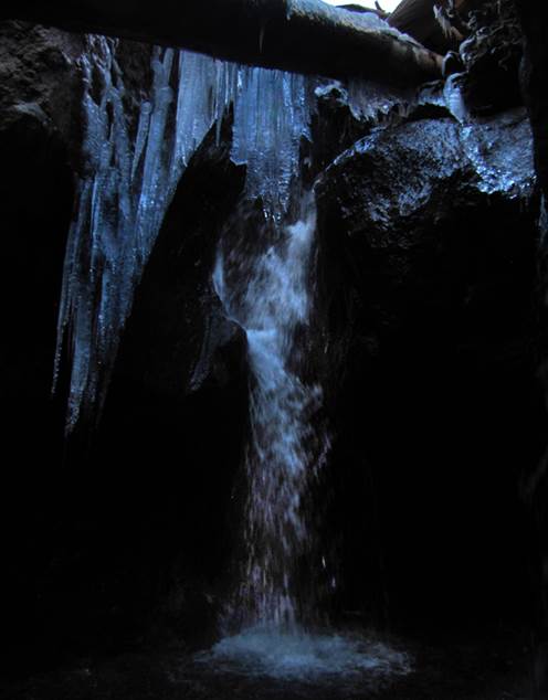
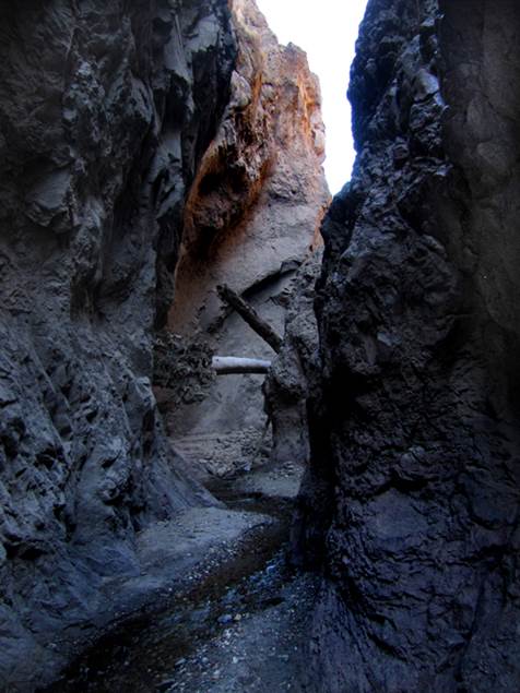
Cochiti Box Canyon boasts a short but
beautiful “slot canyon” section with a beautiful 20’ high waterfall
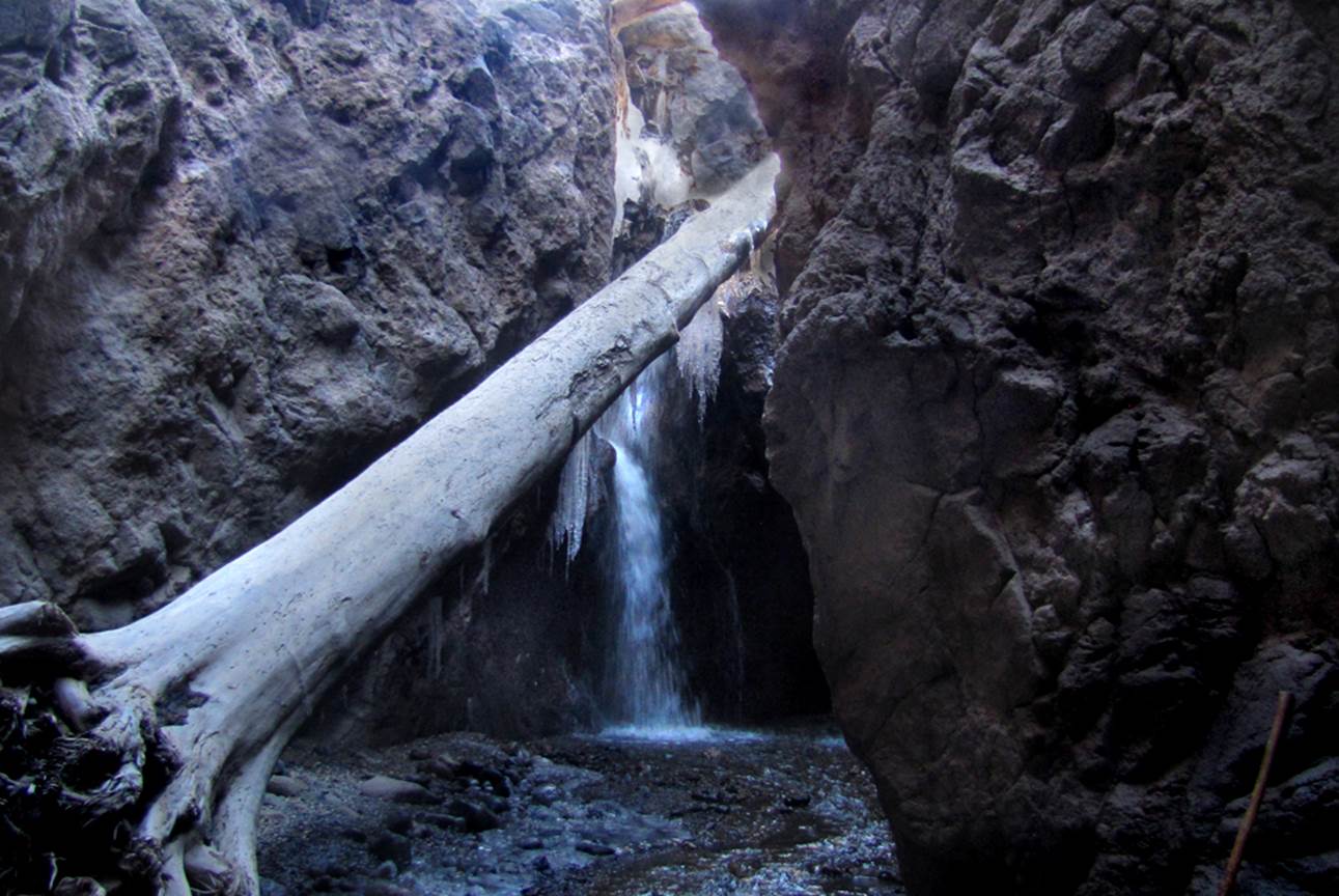
The catastrophic floods that followed the
2011 Los Conchas Fire, deposited uprooted Ponderosa
logs well over 100’ long throughout Cochiti Slot Canyon
beta facts:
name- Cochiti Canyon
length of slot canyon- ¼ mile
elevation- 6100’
GPS coordinates- ±35°42.422’N 106°23.909’W
flow- perennial
season to visit- most any time of year… NEVER ENTER ANY SLOT CANYON WHEN
HEAVY RAIN IS IN THE FORCAST…!!!
accommodations- NONE
ownership- Santa Fe National Forest
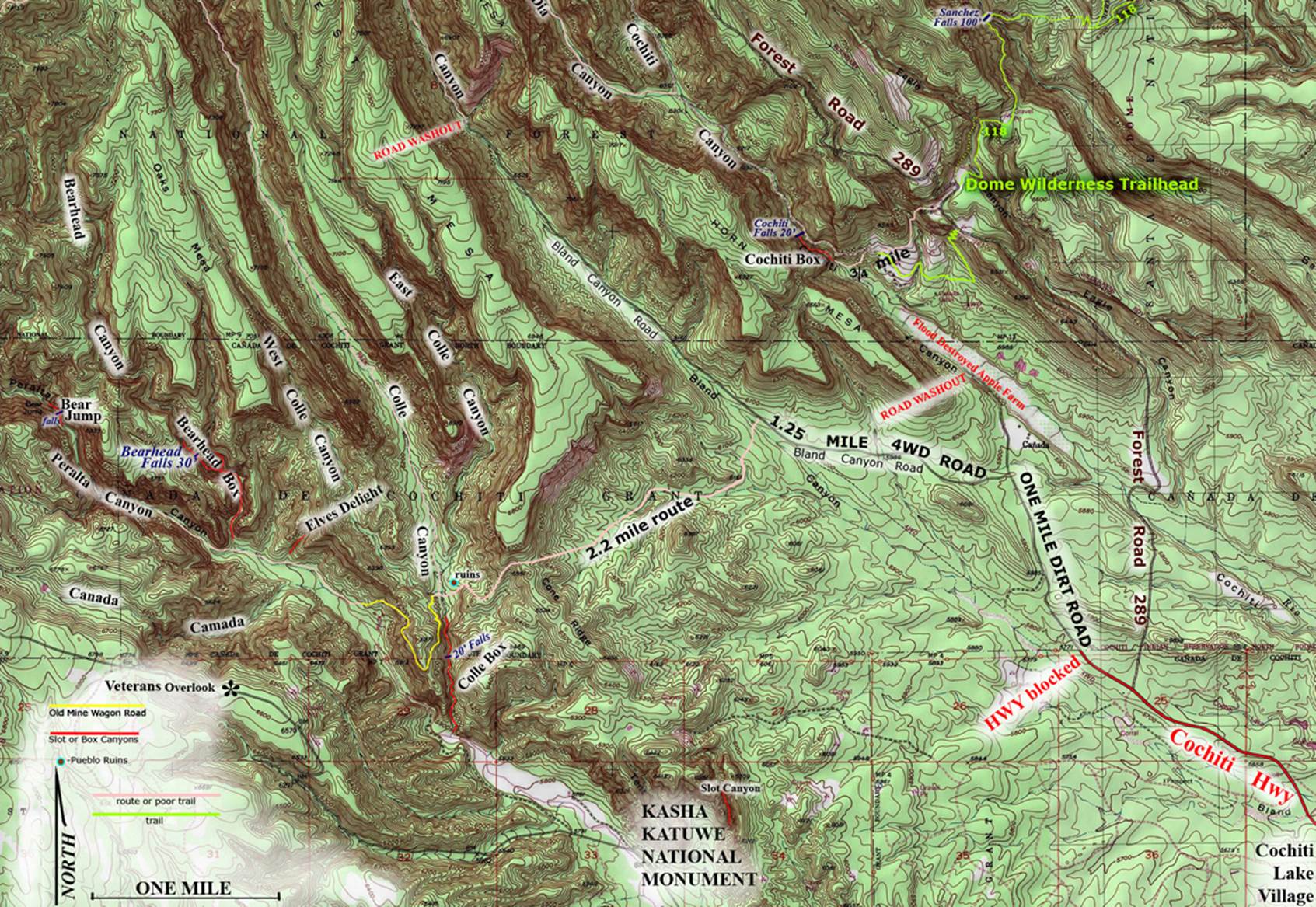
access- is from above to the north on Forest Road
#289… see the map below
nearest town- Cochiti Lake is about 6 miles
southeast of here
fun fact- this is a beautiful place close
to Albuquerque
essay bro
As you can see by the photos above...
Cochiti Box Canyon is amazing. The
closest access point for hiking into Cochiti Box is an eight of a mile
down-the-road from the Dome Wilderness Trailhead on Forest Road 289 in the
Santa Fe National Forest. F R 289 is
closed during the winter. The topo map
below shows a ¾ mile long trail-less route marked with a pink line and the
one-mile-and-a-quarter mile long “Old Cochiti Trail” marked with a light green
line. This Old Cochiti Trail is not
labeled on the map below as well as having no signs marking it in the field. Therefore... it is difficult to find. This is an extremely scenic hike to an
outstanding and unusual destination.....! ! !
This slot canyon is called Cochiti
Box on the map
below and it is found just to the right of the center of the map.
Enhanced USGS topo map
The Red Lines depict
sections of “slot canyons”
Back to New Mexico
Slot Canyons
Send questions and comments to dscott@themarblesculptor.com