Cañada de los Apaches
Sandoval Canyon
ACA Canyon
Rating – 2B II
NEVER ENTER ANY
SLOT CANYON WHEN HEAVY RAIN IS IN THE FORECAST…!!!
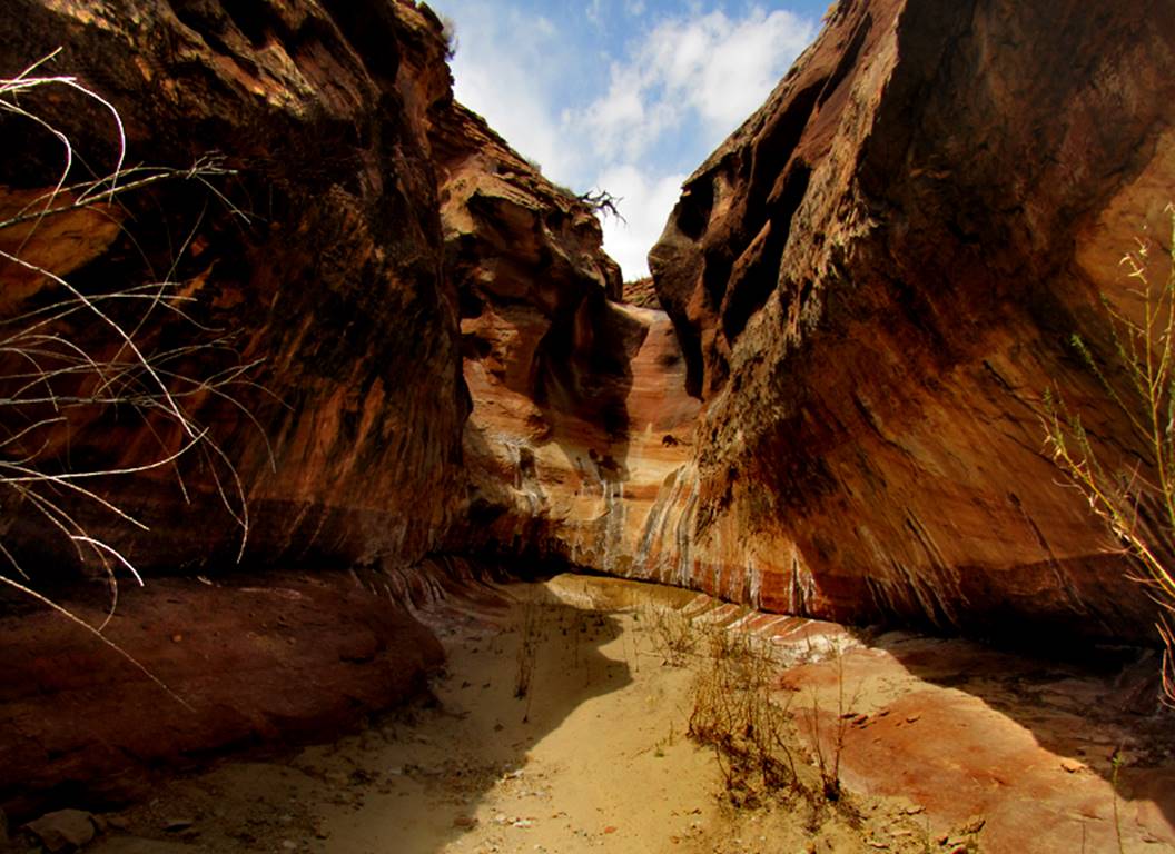
...a side scenic side
canyon to Sandoval Canyon in it’s upper reaches
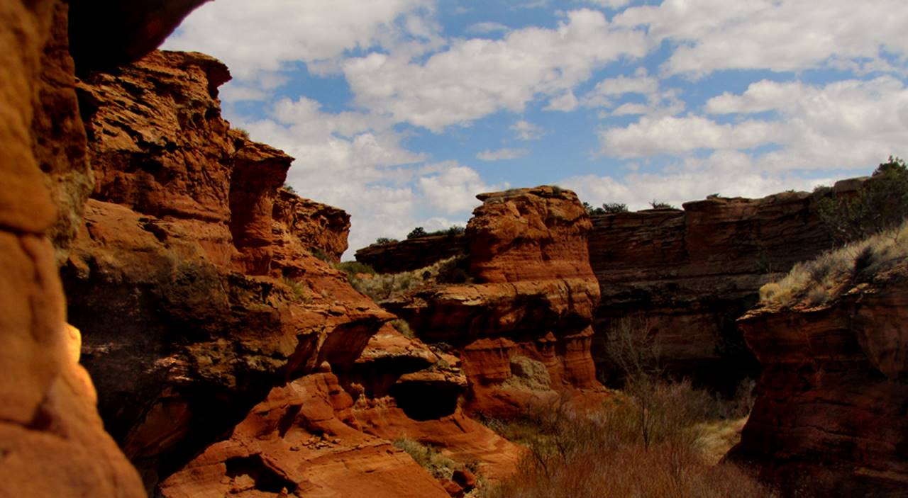
...much of Sandoval
Canyon is a box canyon but parts of it’s
upper reaches slot up as do it’s tributaries upper
reaches
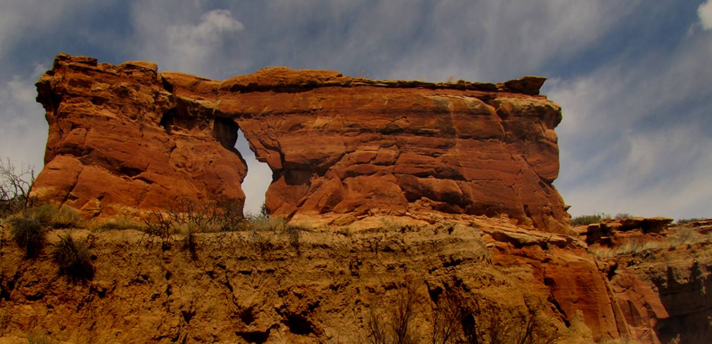
A fine 25’ high natural
arch appears within this wonderful canyon... however the top has eroded apart
by 2 inches, even tho the strata’s match perfectly-
so is it no longer a complete natural arch…???
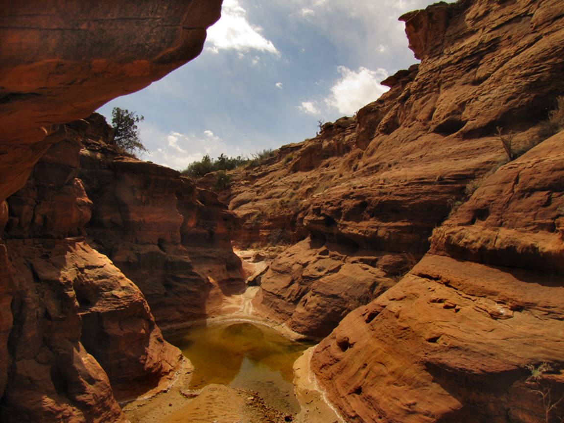
Some all-fours
scrambling is involved to circumvent this water pothole in the largest major
tributary –see map below-
Be sure to hike all the
way up to the end of this mile long tributary as the upper reaches hold the
narrow slot canyon portions
beta facts:
name- Sandoval Canyon
depth of slot portion- up to 40 feet
length of slot canyon- about 2 miles of
continuous box canyon here, with some narrow slots up on the ends of the
canyons
elevation- 5700’
GPS coordinates- ±35°05.792’N 107°09.110’W
season to visit- drier months of the year,
like May, June, September, October and November… NEVER ENTER ANY SLOT CANYON WHEN HEAVY RAIN IS IN
THE FORECAST…!!!
accommodations- NONE –Canoncito
Reservation
access- a couple miles a more, of beautiful
canyon hiking and scrambling, reached via Road 7039 from Canoncito
Road north of Tohajiilee exit on I-40 west o Rio Puerco
nearest town- Rio Puerco/ Route 66 Casino
is about 15 miles southeast of here
fun fact- no keep out signs and beautiful
hiking
_____________________________________________________________________________________________________
Jose Manuel Canyon
ACA Canyon
Rating – 1B I
NEVER ENTER ANY
SLOT CANYON WHEN HEAVY RAIN IS IN THE FORECAST…!!!
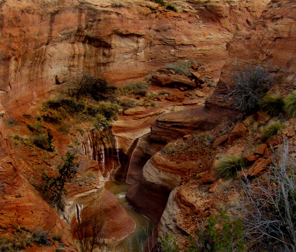
Jose Manuel Spring makes this 20’ high
waterfall wet and slippery and causes Jose Manuel Canyon to have some fairly
deep wading.... this is a special tributary to Cañada de los Apaches -see map below-
beta facts:
name- Jose Manuel Canyon
depth of slot portion- up to 40 feet
length of slot canyon- almost a mile
elevation- 5800’
GPS coordinates- ±35°07.755’N 107°08.347’W
season to visit- drier months of the year,
like May, June, September, October and November… NEVER ENTER ANY SLOT CANYON WHEN HEAVY RAIN IS IN
THE FORECAST…!!!
accommodations- NONE –Canoncito
Reservation
access- a mile or two of beautiful canyon
hiking and scrambling, reached via Road 7039 from Canoncito
Road north of Tohajiilee exit on I-40 west o Rio Puerco
nearest town- Rio Puerco/ Route 66 Casino
is about 15 miles southeast of here
fun fact- no keep out signs and beautiful
hiking
The To’Hajiilee Nation
desires for all visitors to check in at their nearby “Chapter House” before
hiking. See the map below.
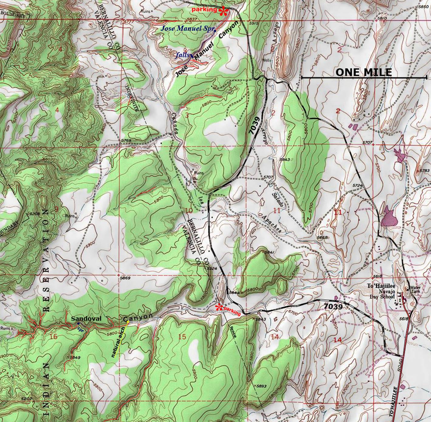
Enhanced USGS topo map
The Red Lines depict
sections of “slot canyons”
Back to New Mexico
Slot Canyons
Send questions and comments to dscott@themarblesculptor.com