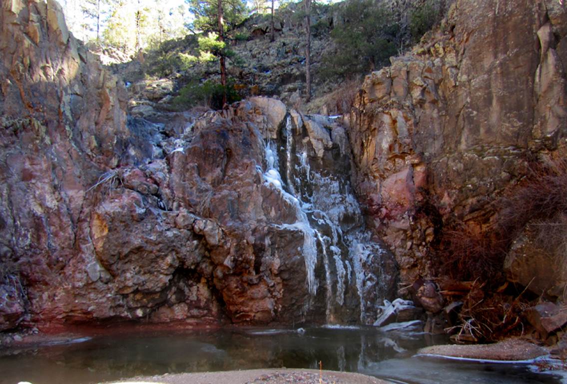
Whiskey Creek Falls
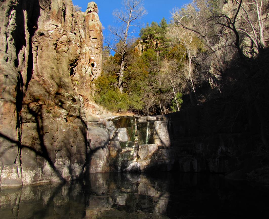
20’ high - Lower Whiskey Creek Falls
&
35’ high – Upper Whiskey Creek Falls
beta facts:
name- Whiskey Creek Falls
height- two waterfalls 20’ and 35’ high
elevation- 7200’
GPS coordinates- ±33°57.284’N 108°38.973’W
flow- perennial
season- anytime
accommodations- none
ownership- Apache National Forest land
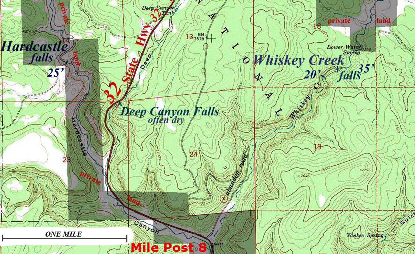
access-
...a strong one mile hike from the end of the ruff and abandon Whiskey
Creek Road
nearest town- Apache Creek is about 9 miles south
of here
fun fact- this is a fabulous walk
essay bro
This is a short, quick, easy and wonderful
hike. Never pass it up anytime you are
driving this road…!!! State Highway 32 thru New
Mexico’s Apache National Forest, between Reserve and Quemado.
See also nearby: Hardcastle Falls
Enhanced USGS 7.5’ topo map
Send questions and comments to dscott@TheMarbleSculptor.com