Minnesota Waterfalls
Two waterfalls in Minnesota: Pigeon River Falls and Baptism River
Falls... have an interesting story.....
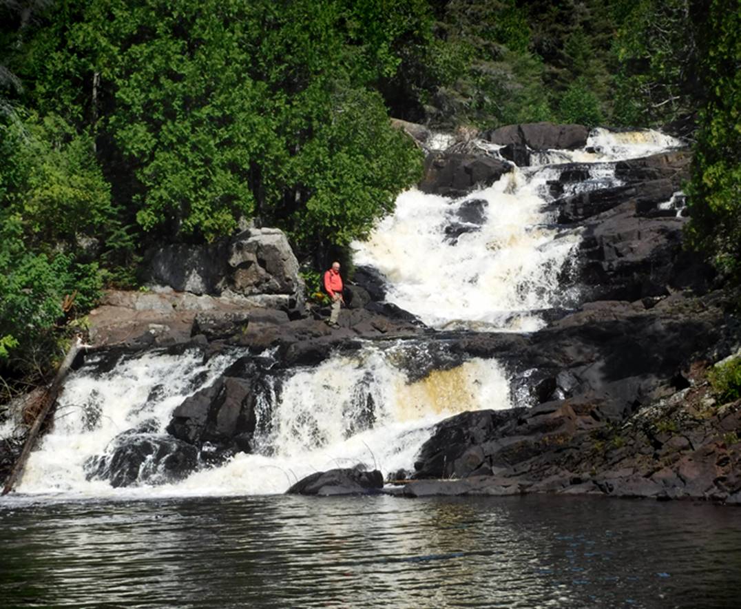
While visiting the high, beautiful waterfall on the Pigeon River
recently, the locals told us that the name of this waterfall is “High Falls”
and it is the “highest waterfall in Minnesota” ...more than one hundred feet
high. The signs read: High Falls - 130’
high. WOW.....! ! ! -but it sure
doesn’t look that high.
While visiting the high, beautiful waterfall on the Baptism River
later that same day, the locals told us that the name of this waterfall is
“High Falls” and it is the “highest waterfall in Minnesota” ...one hundred feet
high. WOW.....! ! ! -but it sure
doesn’t look that high.
So… Ah…. Er… lemme
see here... Both waterfalls have the same name: “High Falls” (NOT a very
original name, huh...???) AND... they are not very far away from each other
along “The North Shore” of Lake Superior... AND... They are BOTH the “highest
waterfall in Minnesota” ... AND... They are both 100 feet high or... more... ...WHAT...! ! !
Research has
revealed that extreme kayakers (who carry rescue ropes with them) have measured
these waterfalls with more accuracy than most anyone else. They have measured
Pigeon River Falls to be 85’ high” ...and Baptism River Falls to be about 63’
high
Hey... call these waterfalls by any name you wish & make any
claim you can imagine for their height, but I call them by the name of the
river that they are on while appreciating some measure of honesty concerning
their height.
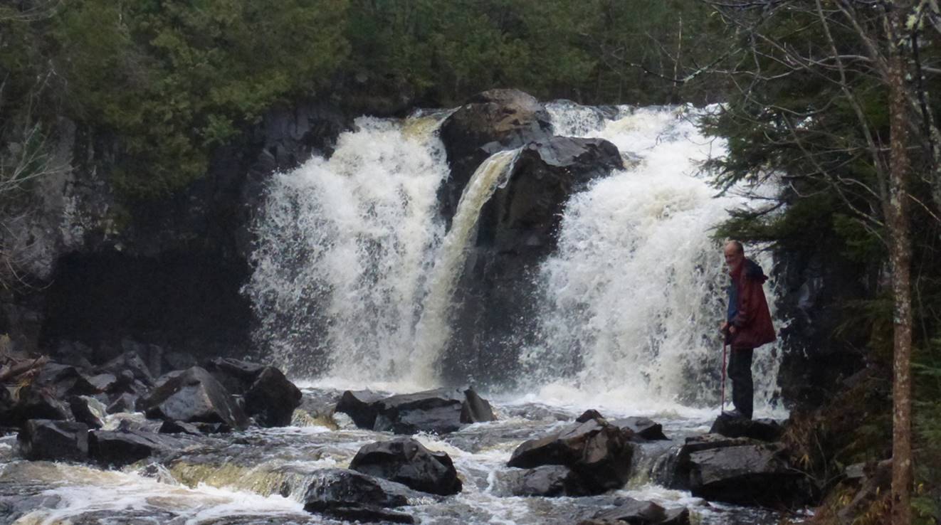
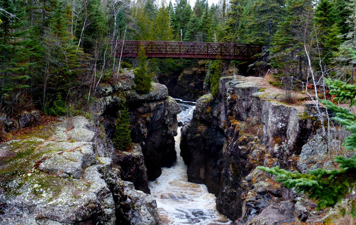
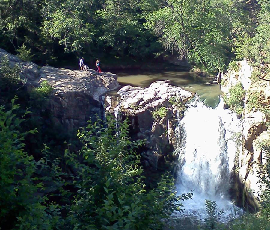
Pigeon
River Falls
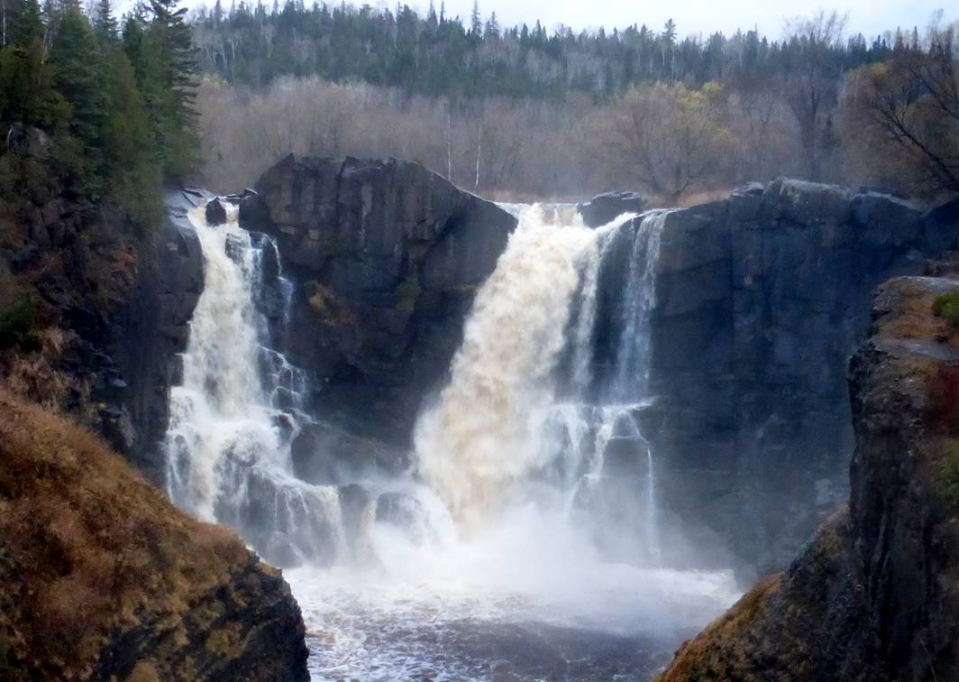
The Pigeon River here
at this spectacular waterfall, is the boundary between Canada and the USA. Lowell Hill Photo
beta facts:
name- Pigeon River Falls
height- 85’
GPS coordinates- ±48°00.290’N 89°35.880’W
access- is via a well-marked trail from Grand
Portage State Park in Minnesota near the Canada border
nearest town- Grand Portage is about 10 miles southwest of here
fun fact- The truth does not diminish the
beauty of this splendid waterfall
____________________________________________________________________________________________________
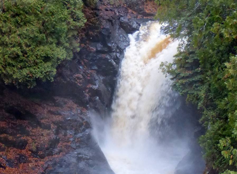
Baptism
River Falls
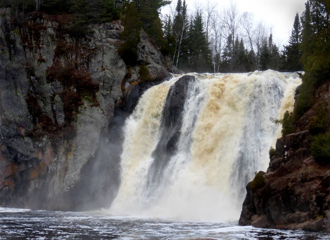
I have been told that a few of those
insane, extreme kayakers have successfully paddled over this 63’ high beautiful
waterfall.....! !
! Lowell Hill Photo
Please do NOT try this at home... or away
from home either...
beta facts:
name- Baptism Falls
height- 63 feet
GPS coordinates- ±47°21.080’N 91°12.610’W
access- is via a trail from George H Crosby
State Park
nearest town- Illgen
City is about 3 miles southeast of here
fun fact- The truth does not diminish the
beauty of this splendid waterfall
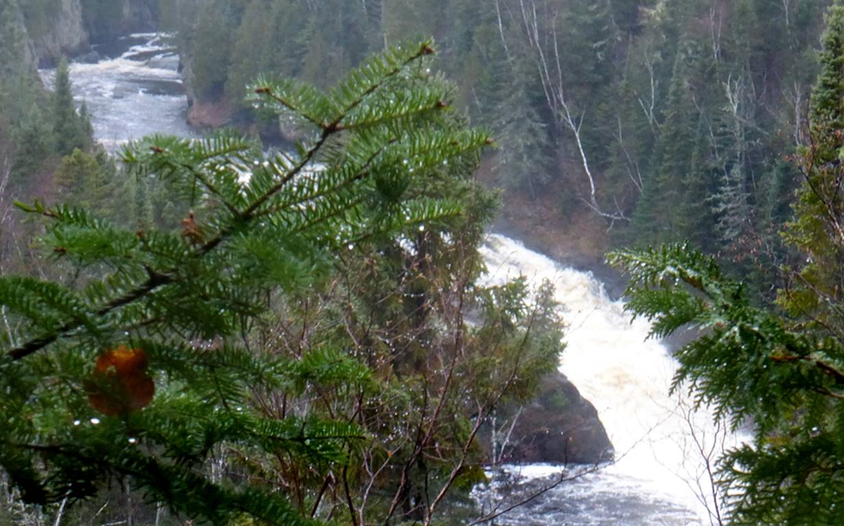
AND...
...a mile or so downstream, also connected
by that same trail, is another named waterfall:
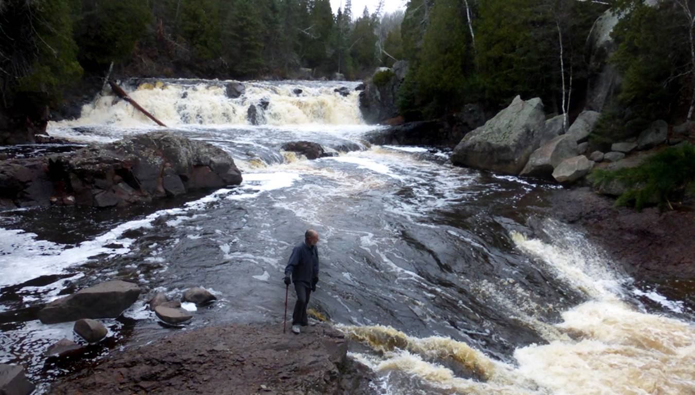
Two Step Falls... The upper and lower tiers
are about 10’ high each. This photo is
only showing the upper tier. The lower
tier is just downstream from what this photo shows... Lowell
Hill Photo
___________________________________________________________________________________________________________________________
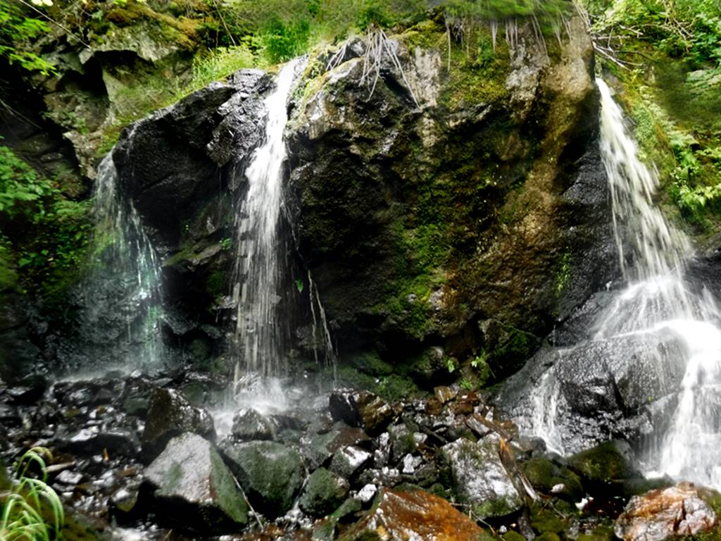
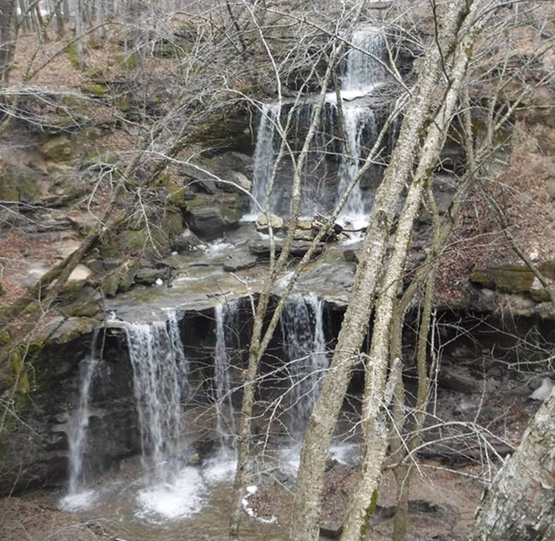
Loft
Falls
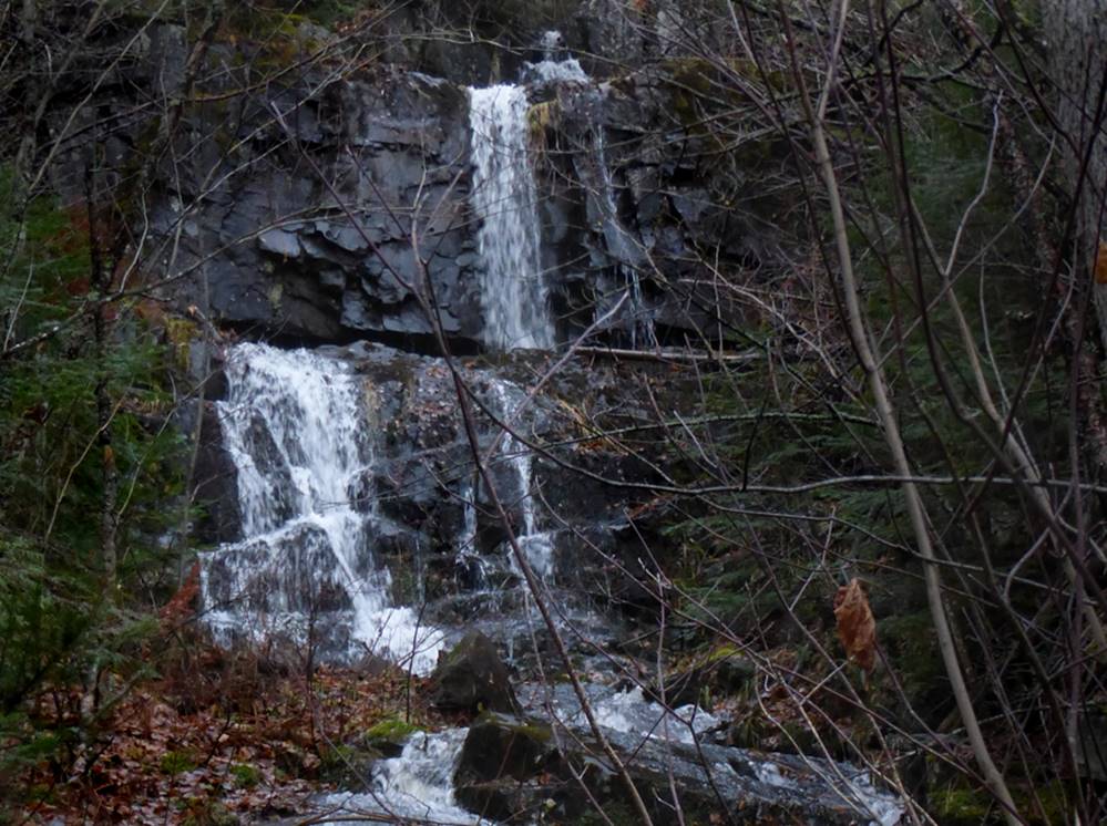
Loft Falls is a tiered
waterfall. All 4 tiers of Loft Falls are
shown in this photo. The total height of
all 4 tiers combined is about 50’
Lowell Hill Photo
beta facts:
name- Loft Falls
height- + 50’ (the sum height of all
4 tiers)
GPS coordinates- ±48°01.023’N 90°03.858’W
access- is a half mile bushwhack downstream
from Loft Lake - on Shoe Lake Rd. East
of Road 16 which runs north of Hovland.
nearest town- Hovland is about 18 miles south of here
fun fact- Loft Falls is very beautiful,
secluded -and a “bushwhack” to visit
We have found this area to harbor several
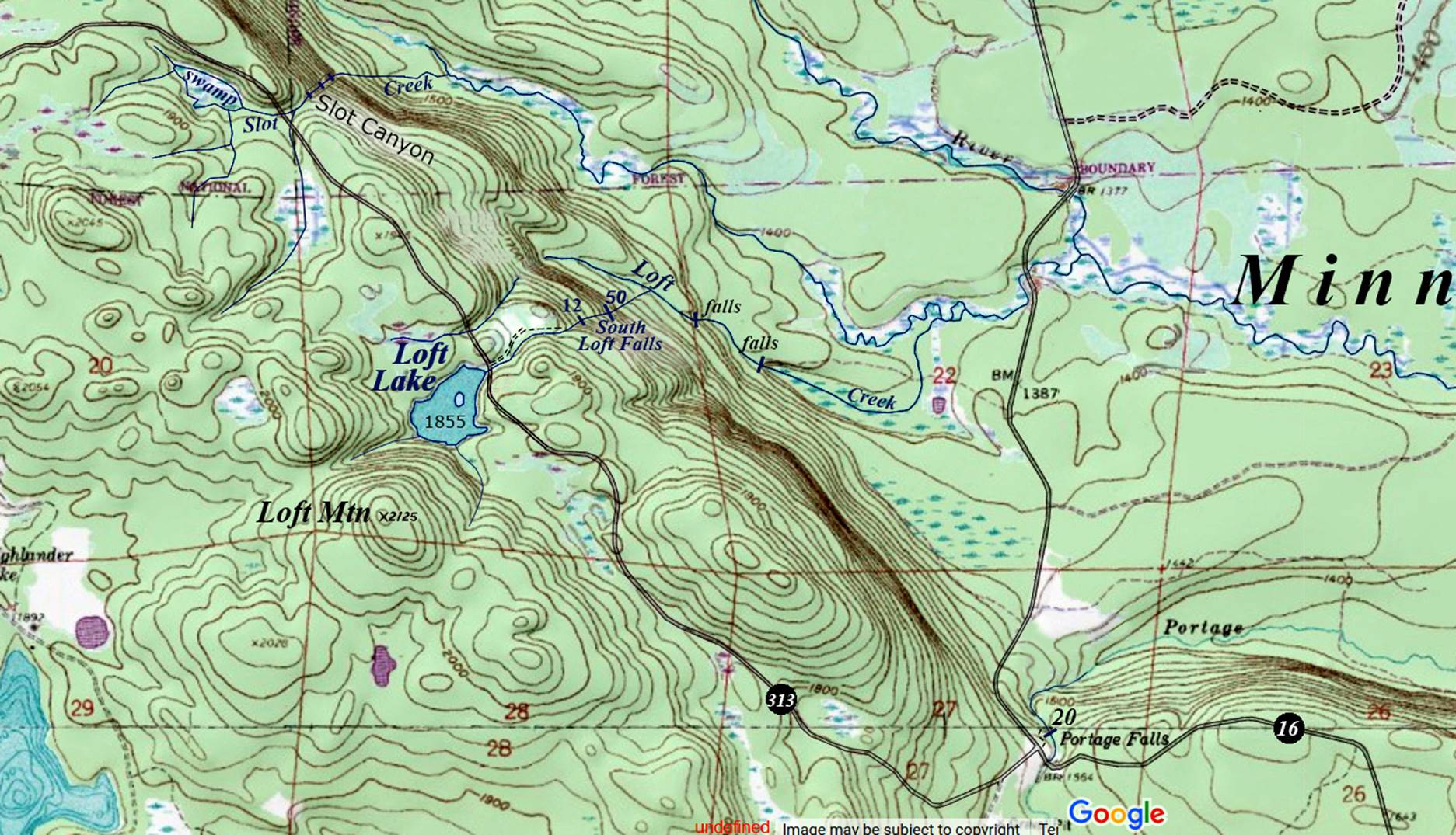
more waterfalls. Loft Mtn, Loft Lake and
Loft Falls all appear on the left-hand side of our map below. Feel free to right-click-save-as on our map,
to save it to your desktop and print a hard copy for your hike. This image is public domain.
Loft Mountain Topo Map
this map is the only known map to show Loft
Falls and Slot Canyon
____________________________________________________________________________________________________
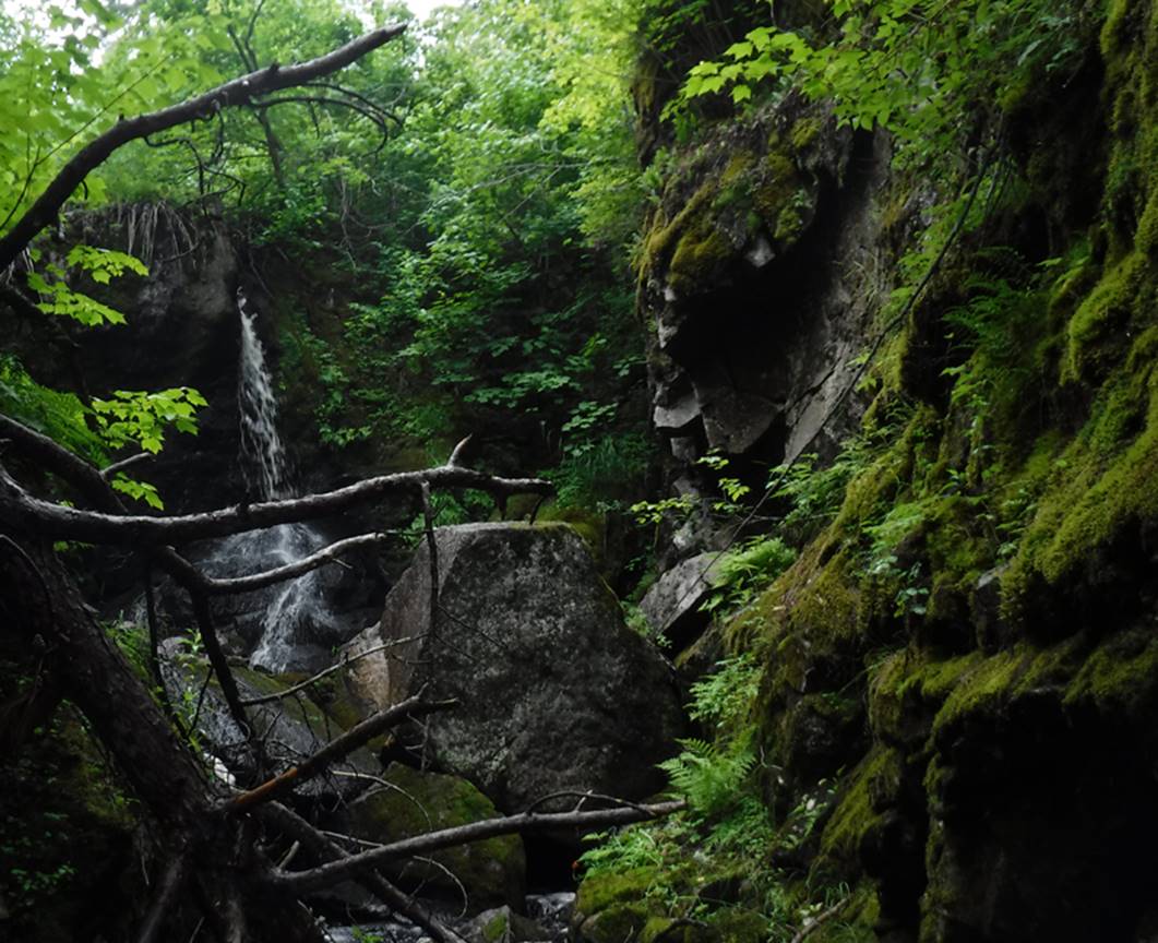
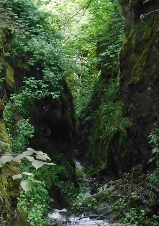
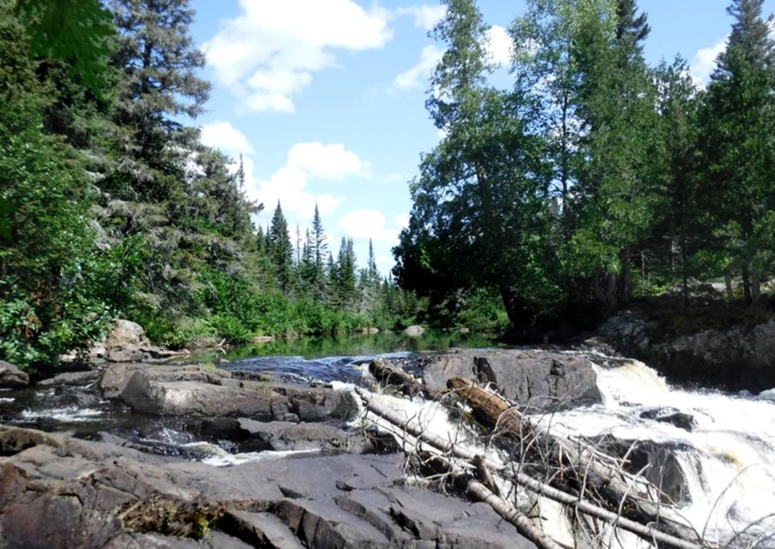
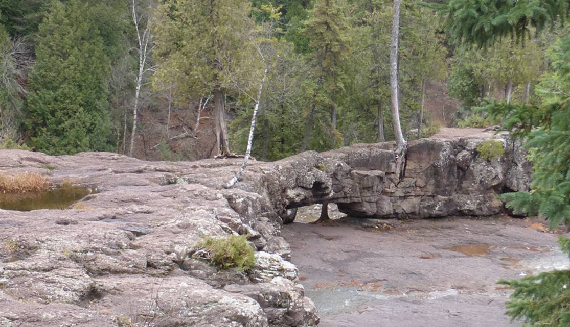
Slot Canyon
falls
This slot canyon appears in the upper left corner of the map above
The first falls is 20’
high and actually drops into the slot canyon at it’s
start. It is seen in the photo below as
well.
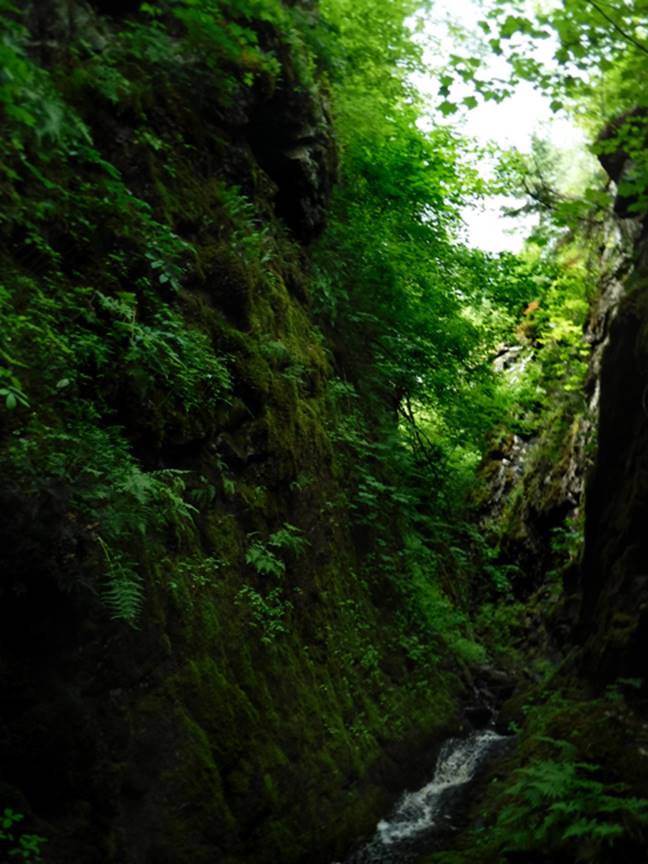
...and looking
downstream from here, as seen the next photos, the slot canyon is quite narrow
– waist deep wading becomes mandatory
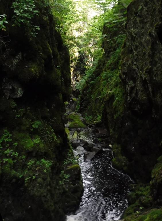
A 40
foot long rope, used as a hand-line, is quite helpful on this smooth,
wet, slippery bedrock
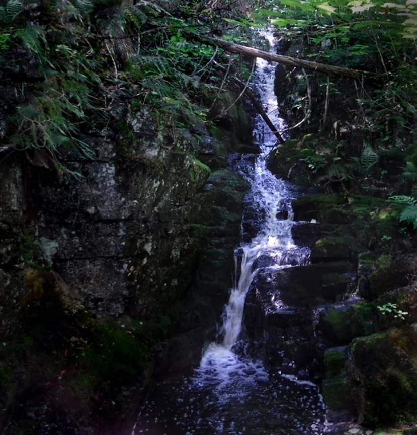
The second waterfall, also
about 20’ high, is at about midway
This is a very fine
slot canyon
The third falls is a
40’ high cataract near the end of the slot canyon
beta facts:
name- Slot Canyon Falls
height- up to 40’ high
GPS coordinates- ±48°01.415’N 90°04.600’W
access- is north on County Road #16 –
Arrowhead Trail. Then turn east on Shoe
Lake Road for 2 & a half miles… a short half mile past Loft Lake
nearest town-Hovland is about 19 miles south of here
fun fact- Minnesota has a wonderful
non-technical slot canyon here...! !
!
This is a very fine slot canyon that
Minnesota can be proud of. It can be
traversed with only a 40’ long rope hand-line.
It starts within a couple hundred feet from the forest road. It is about a quarter mile long (or
less). It looses approximately 250’ of elevation.
____________________________________________________________________________________________________
Portage
Falls
 Yours truly, here at 20’
high Portage Falls... The 20’ waterfall seems small, because I am too close to
the camera. Lowell Hill Photo
Yours truly, here at 20’
high Portage Falls... The 20’ waterfall seems small, because I am too close to
the camera. Lowell Hill Photo
beta facts:
name- Portage Falls
height- 20
GPS coordinates- ±47°59.983’N 90°02.159’W
access- is a 100-yard-long unmarked trail
from the intersection of Road 16 and Road 313 in Grand Portage State Forest **
nearest town- Hovland is about 17 miles south of here – the North Shore of Lake Superior
fun fact- This is sweet country
Portage Falls is near the bottom of the map
above
**Land ownership in this area is
checkerboard between Superior National Forest, Grand Portage State Forest and
small parcels of private land
____________________________________________________________________________________________________
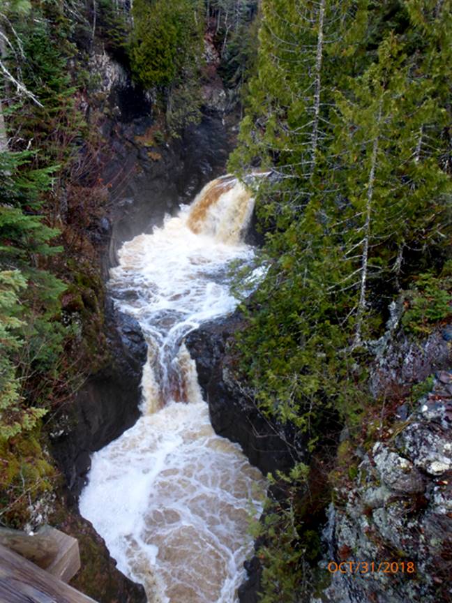
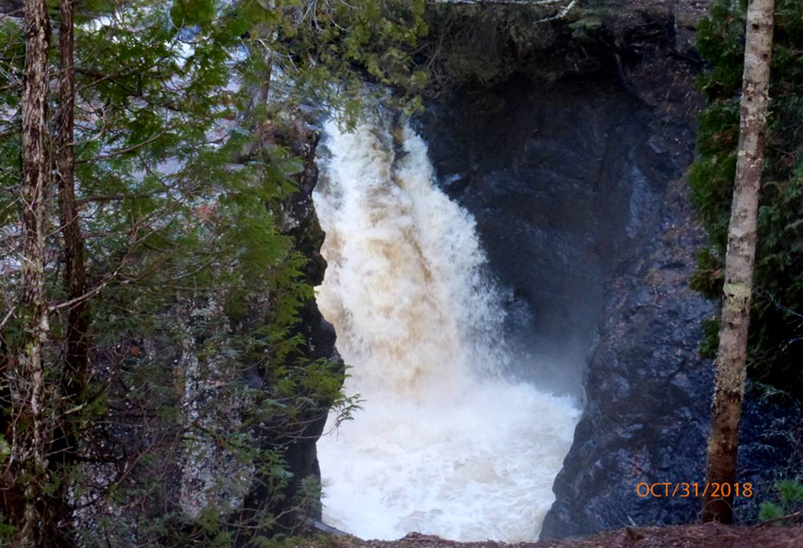
The Devils
Kettle
 The Devils Kettle is a
mysterious 35 foot high waterfall on Minnesota’s Brule
River up along Lake Superiors North Shore
Lowell Hill Photo
The Devils Kettle is a
mysterious 35 foot high waterfall on Minnesota’s Brule
River up along Lake Superiors North Shore
Lowell Hill Photo
beta facts:
name- The Devils Kettle
height- 35’
GPS coordinates- ±47°49.758’N 90°02.970’W
access- is by trail from Judge C R Magney State Park
nearest town- Hovland is about 4 miles east of here
fun fact- As you can see in the photo
above... half of this waterfall’s water disappears down into a sink-hole in the
bedrock... which causes some people to believe that it mysteriously vanishes
forever... however... the river’s volume of flow is the same above and below
the falls ...therefore nothing vanishes anywhere.
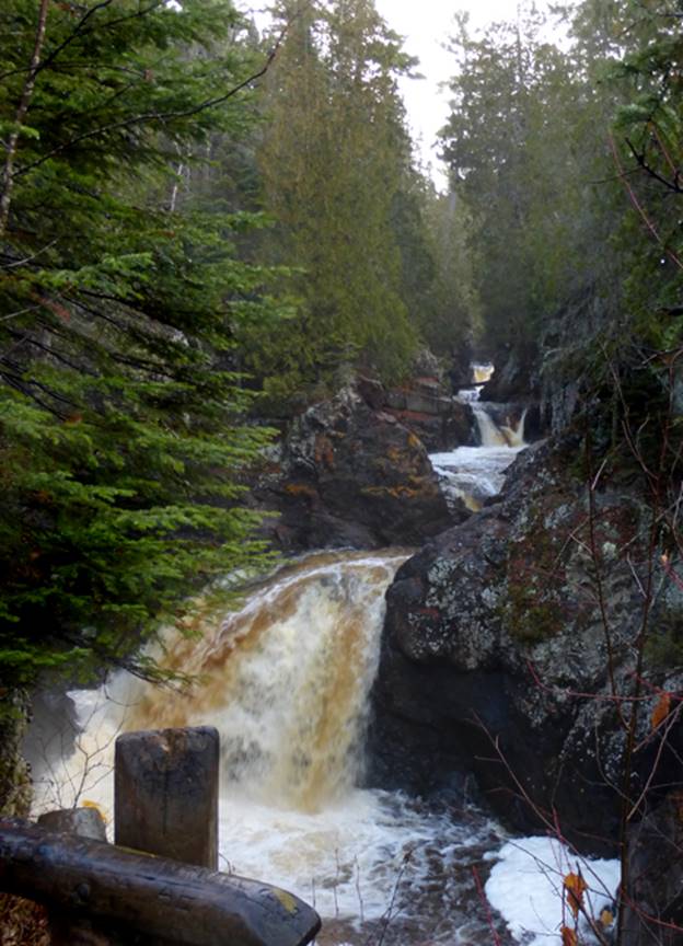
The Devils Kettle is not the only waterfall
along the Brule River. There are several
other waterfalls on this river. The
waterfall in the photo below is a quarter-mile downstream from The Devils
Kettle. The trail in to visit The Devils
Kettle stops by this waterfall on its way.
40’ high Upper Falls of the Brule
River...not very steep but extremely violent...!!! -on a lightly rainy day... Lowell
Hill Photo
____________________________________________________________________________________________________
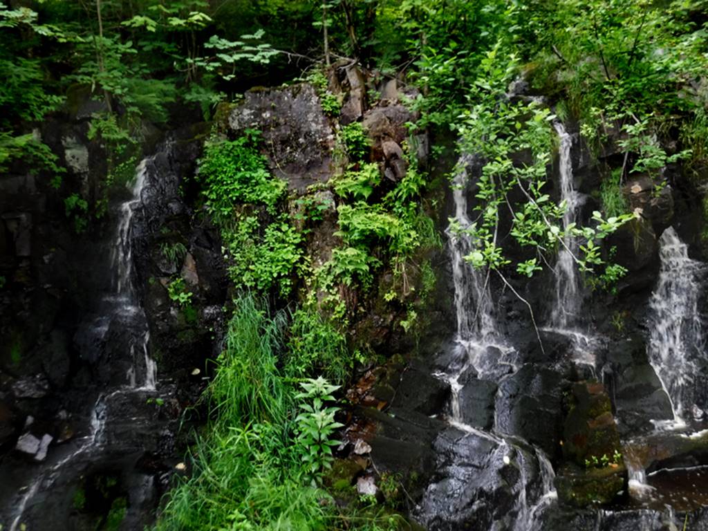
Cascade
falls
Cascade River has many
waterfalls, but this 30 footer is one of the
better... Lowell Hill Photo
and...this
same waterfall appears on the cover of “Northwoods Whitewater” by Jim
Rada. See him in his kayak, cresting the
brink of the falls...! ! ! He’s braver than I am.
The kayakers call this
waterfall: “Lover’s Leap”
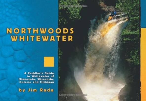
BTW this book is an
interesting read...! ! !
beta facts:
name- Cascade Falls
height-30’
GPS coordinates- ±47°42.595’N 90°31.448’W
access- is via a marked trail from Cascade
River State Park
nearest town- Grand Marais is about 9 miles east of here
fun fact- lots of beautiful waterfalls
here
more beautiful waterfalls along Cascade
River, some near 20’ high – I’d like to watch those extreme kayakers paddle
thru here hey…! ! ! -and they really do this.
Lowell Hill Photos
____________________________________________________________________________________________________
Temperance
falls
The Temperance River
flows thru an AMAZING Gorge & has many waterfalls. Hidden Falls (shown above) is the highest at
about 30’ Lowell Hill Photo
beta facts:
name- Hidden Falls
height- 30’
GPS coordinates- ±47°33.372’N 90°52.428’W
access- is by trail from Temperance River
State Park
nearest town- Taconite Harbor is about 3 miles southwest of here
fun fact- VERY AMAZING PLACE…!!!
Lowell Hill Photo
____________________________________________________________________________________________________
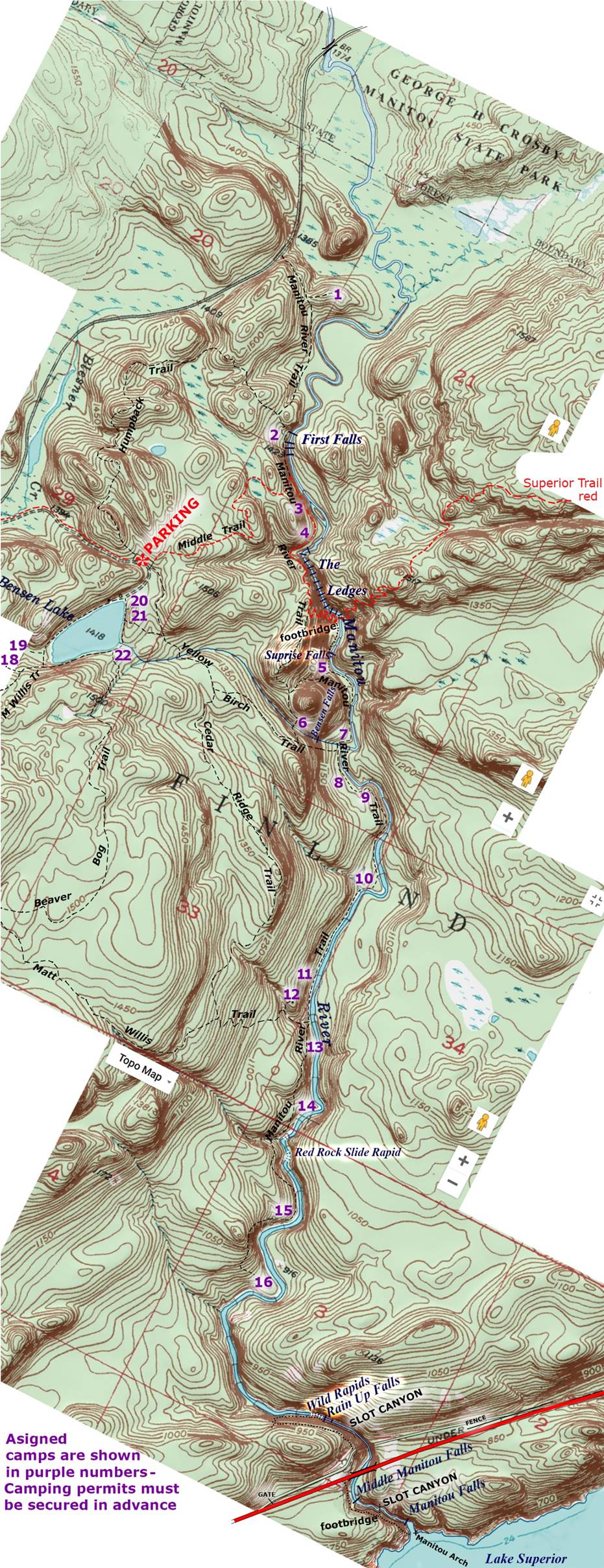
Manitou
falls
...isn’t this waterfall a beauty...! ! !
The Manitou River drops about 30 to 40
feet - out of its own narrow gorge... landing in the waters of Lake Superior...! ! !
Manitou Falls is “MY” most beautiful waterfall in Minnesota - GPS coordinates- ±47.4429390°N, -91.064466°W
...and just west of this wonderful waterfall
is an amazing “Sea Arch” in Minnesota’s ocean- Lake Superior...! ! !
Manitou Natural Arch
appears in the photo below - GPS cords: 47.4427857°N,
-91.063502°W
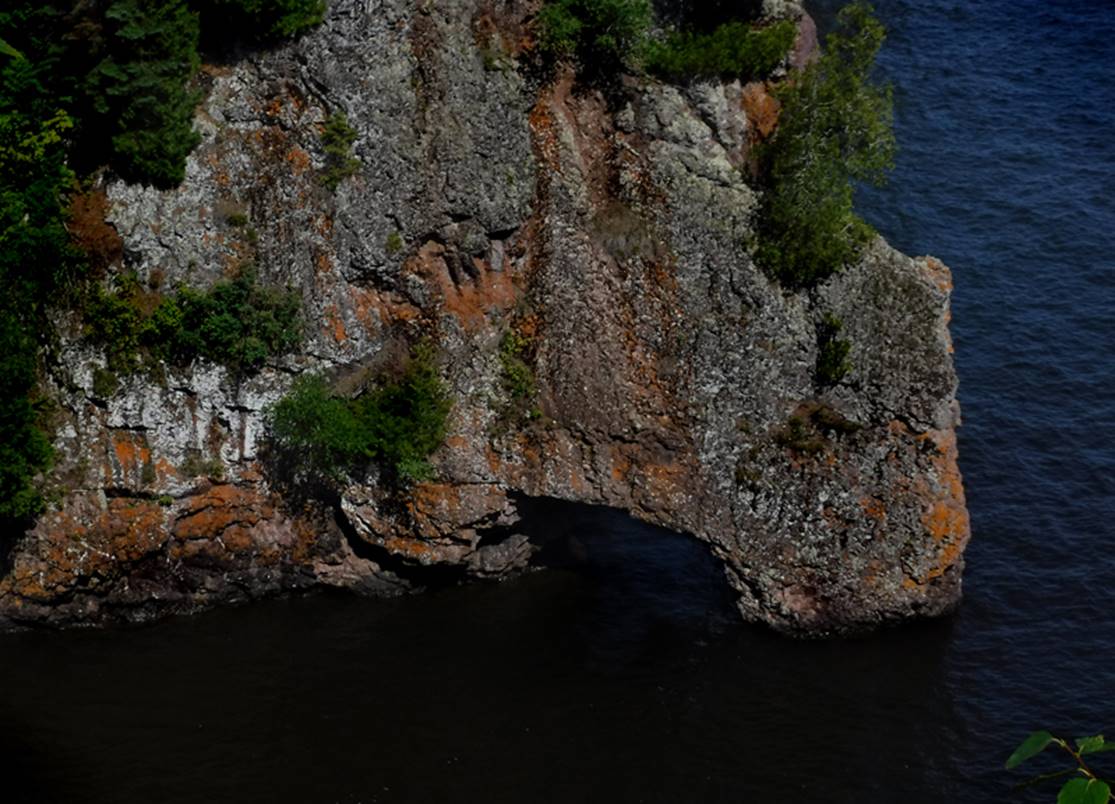
Manitou Falls can be seen thru Manitou Natural Arch... I wanna paddle thru this arch, in my canoe...! ! !
30 to 40 foot high- Middle Manitou Falls
is maybe a quarter-mile upstream from Manitou Falls.
*note- the small natural arch below this falls.
Dave posed for me at the “First Falls” – way upstream on the
Manitou River – this is an AWESOME hike BTW...
This photo below shows the top of First Falls and the calm
beautiful Manitou River above...
7’ high- “Surprise Falls” (shown below) is a short distance
downstream from the Superior Trail Footbridge.
20’ high Benson Creek Falls... This Manitou River area host some
of the finest hiking in all of Minnesota...! ! !
beta facts:
name- Manitou Falls
and others: …Middle Manitou Falls, First
Falls, Surprise Falls, Upper Manitou Falls, Slot Canyon Falls AKA “Rain Falling
UP Falls”
height- up to 40 feet high
GPS coordinates- ±47.4429390°N, -91.064466°W
access- is from Hwy 61 on the North Shore
of Lake Superior
nearest town- Little Marais is about 4 miles southwest of here
fun fact- The Manitou River –
George Crosby – Manitou State Park, has the most scenic hiking in all of
Minnesota
OUR TOPO MAP
Right-click-save-as
on our map to save the file to your desktop... and print your own hard copy to
take with...
Minnesota State Park Map
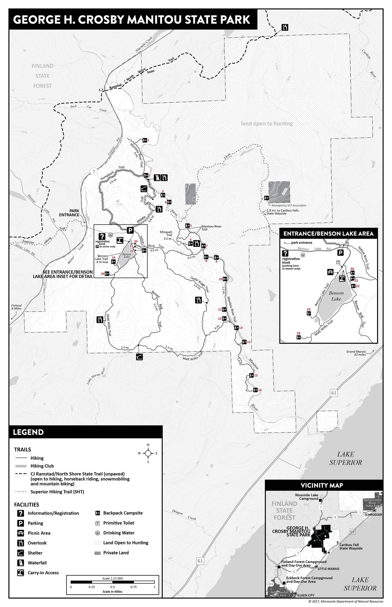
Another Minnesota State Park map
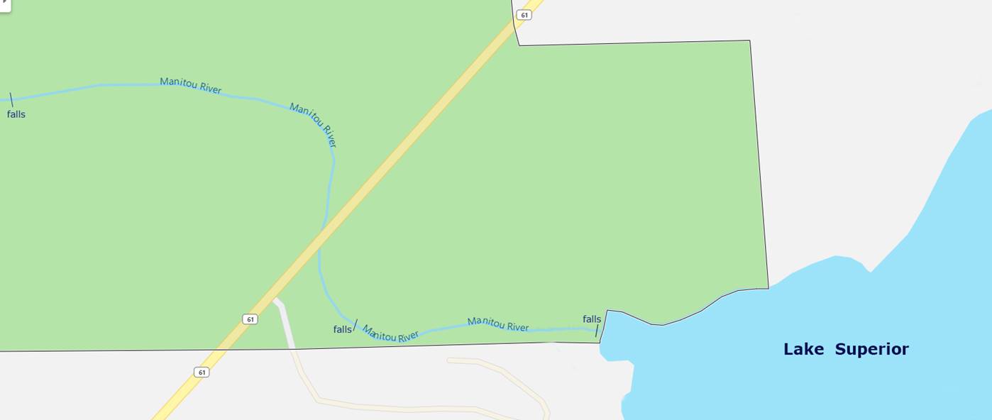
One more map here: Superior National Forest
This last map- Superior National Forest – shows that the George
H Crosby Manitou State Park boarders a mile or more of Hwy 61, on both
sides. No Trespassing signs display the
opposite on location.
I cannot help but wonder why every map I find shows the southeast-end
boundary line of George H Crosby Manitou
State Park -
differently. Are those two most
beautiful Manitou Waterfalls on public land or private…? If indeed the Manitou River below Hwy 61 is
entirely private then where did that beautiful, (National Park) looking
footbridge across the Manitou River Slot Canyon below Hwy 61, come from? It does not look like a private built
bridge. But rather it looks extremely
much like a government funded and constructed bridge.
The NO TRESPASSING signs along the Hwy 61, are likely… for
real. However, wading thru the tunnel at
river level, the one and only sign we noticed seemed to be in a very confusing
location… leaving the question in our minds: what is public and what is
private…??? The river appeared to be
public to us. Which maps are correct and
which maps are incorrect? Perhaps only a
visit to Lake County Courthouse will clear the fog.
____________________________________________________________________________________________________
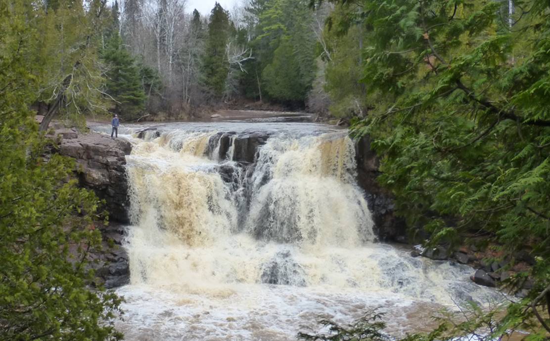
Gooseberry
Falls
See on Youtube: https://www.youtube.com/watch?v=fy-pvmUsUS4
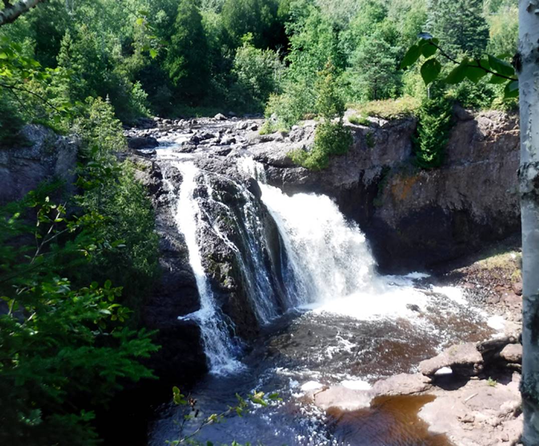
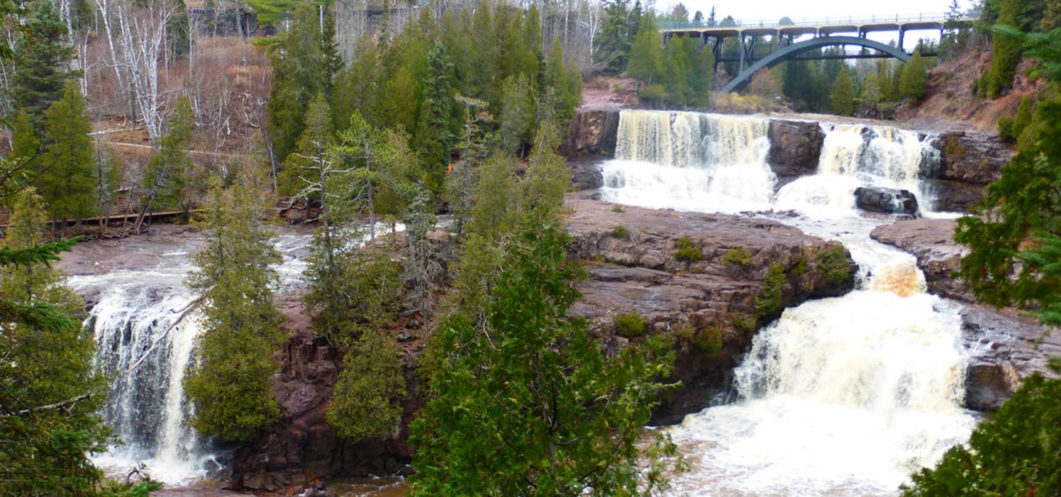 There are 3 main tiers
to Gooseberry Falls. The photo above
shows the main falls near the highway and the lower tier in the
foreground. All 3 tiers are about the
same height... approximately 40 feet high each. Lowell Hill Photo
There are 3 main tiers
to Gooseberry Falls. The photo above
shows the main falls near the highway and the lower tier in the
foreground. All 3 tiers are about the
same height... approximately 40 feet high each. Lowell Hill Photo
The 40’ high upper tier
(shown below) ...upstream a short ways above the
highway
There’s a nice little
natural arch at Gooseberry Falls hey…! ! ! Lowell Hill Photo
Lowell Hill Photo
beta facts:
name- Gooseberry Falls
height- all three tiers are the same height
= 40’ each
GPS coordinates- ±47°08.582’N 91°28.072’W
access- is from Hwy 61
nearest town- Castle Danger is about 2.5 miles southwest of here
fun fact- close to Hwy 61, paved trails...
easy access for all
____________________________________________________________________________________________________
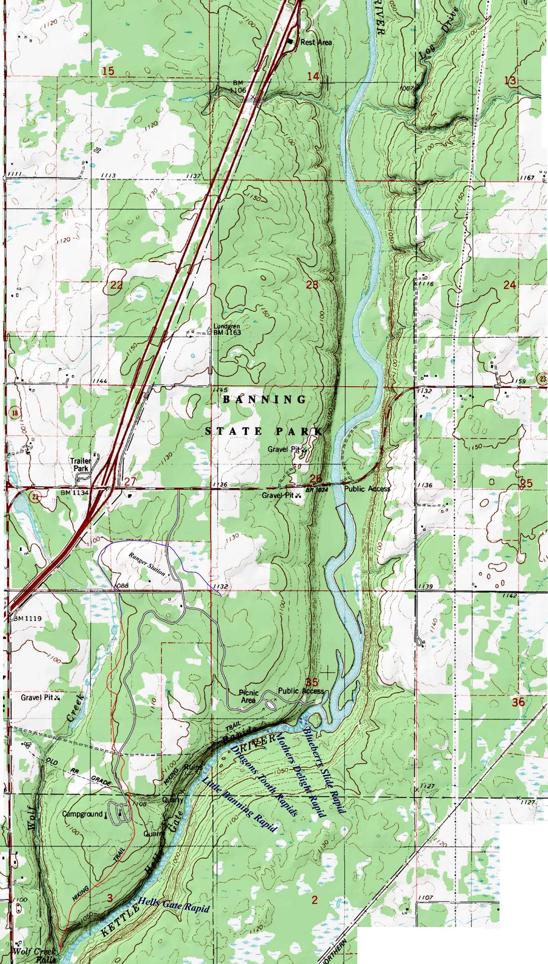
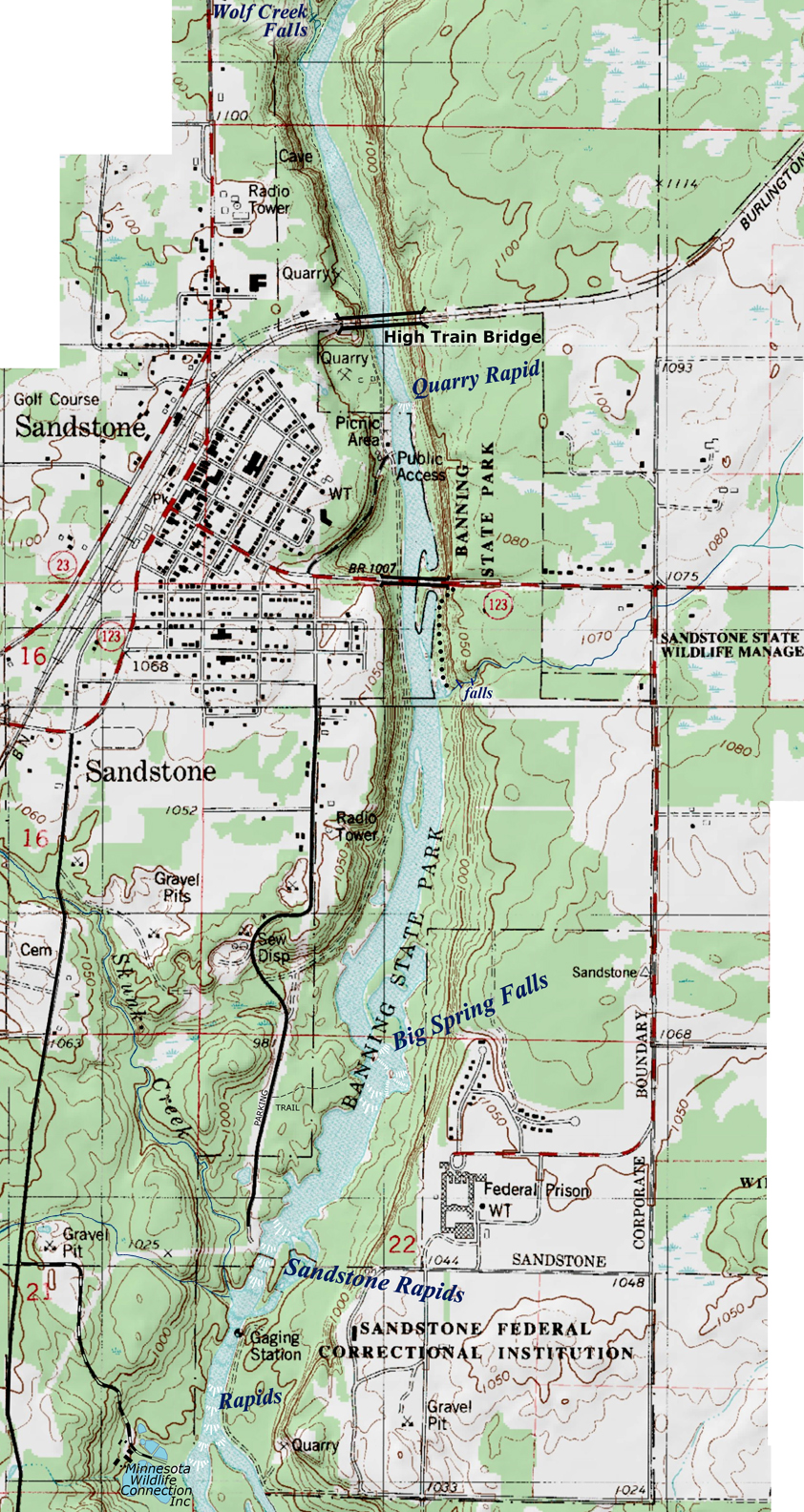
There are many waterfalls within Banning
State Park
We
hope to document them all someday, but until then... here are a couple of them:
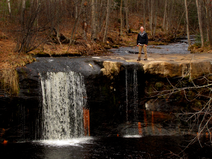
Big Spring
Falls
See on Youtube: https://www.youtube.com/watch?v=Zru79hQD_bA
At Big Spring Falls in
Banning State Park, the Kettle River falls about 10’
beta facts:
name- Big Spring Falls
height- 12’
GPS coordinates- ±46°06.802’N 92°51.457’W
access- Drive south on Pine Ave a mile or
two. Park at the locked gate and hike
the trail to Big Spring falls.
nearest town- Sandstone is about 2 miles north of here
fun fact- Men buried this beautiful
waterfall under water for years...!!! then thankfully the dam was removed about
20 years ago and the falls re-appeared...! ! !
Big Spring Falls appears near the center of
the lower map.
Topo Map
*note that Wolf Creek Falls appears on both
maps, right where the two maps join.
North Map
South Map
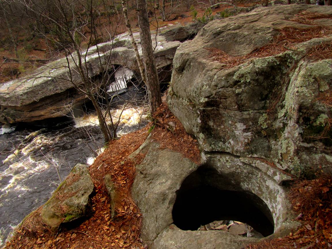
Wolf Creek
Falls
See on Youtube: https://www.youtube.com/watch?v=zJvWsU9xso8
12’ high Wolf Creek
Falls is a very pleasant hiking destination within Banning State Park
beta facts:
name- Wolf Creek Falls
height- 12’
GPS coordinates- ±46°08.800’N 92°51.665’W
access- is from Banning State Park or hike
north from Robinson Park
nearest town- Sandstone is about 1 mile south of here
fun fact- Banning State Park is GREAT
HIKING......! ! !
Two Natural Arches at Hells Gate Rapid -One on each side of the Kettle River.
____________________________________________________________________________________________________
Ramsey
falls
See on Youtube: https://www.youtube.com/watch?v=clVL5QwtJac
Ramsey
Falls is
about 30’ high on Ramsey Creek within Alexander Ramsey Park Janelle Ericson Photo
-below is a high water photo:
beta facts:
name- Ramsey Falls
height- 30’
GPS coordinates- ±44°32.778’N 95°07.536’W
access- is from Alexander Ramsey Park –
Redwood, Minnesota
fun fact- -easy access... beautiful waterfall
___________________________________________________________________________________________
Redwood
falls
Redwood
Falls has
been capped over with a man-made dam.
All of it’s original
beauty is lost.
Downstream a
quarter-mile is a 3-foot high falls over a natural occurring granite
outcropping
beta facts:
name- Redwood Falls
height- unknown
GPS coordinates- ±44°32.473’N 95°07.306’W
access- is from Hwy 19 Bridge in Redwood,
Mn
fun fact- nothing nice about man’s
destruction of Redwood Falls
____________________________________________________________________________________________________
Minneopa falls
See on Youtube: https://www.youtube.com/watch?v=vv23TD1JvUc
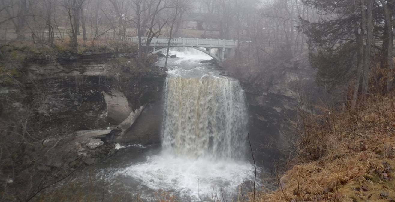 30’ high Minneopa Falls is found within Minneopa
State Park. Notice the footbridge above
it and the ten foot high upper tier/waterfall -
upstream in this photo above.
30’ high Minneopa Falls is found within Minneopa
State Park. Notice the footbridge above
it and the ten foot high upper tier/waterfall -
upstream in this photo above.
beta facts:
name- Minneopa
Falls
height- 30’ plus a ten – foot high tier
upstream
GPS coordinates- ±44°08.929’N 95°05.427’W
access- is from Minneopa
State Park at Mankato, Mn
fun fact- This is a very pleasant park
____________________________________________________________________________________________________
Triple
falls
See on Youtube: https://www.youtube.com/watch?v=RXuhW3qVPsA
& https://www.youtube.com/watch?v=ptlrWXoPh1M
30’
high Triple Falls has 3 tiers and is found along the Blue Earth River south of
Mankato, Mn
*Triple Falls sometimes runs dry during dry
weather conditions*
beta facts:
name- Triple Falls
height- 30’ in three tiers...
GPS coordinates- ±44°07.048’N 94°06.856’W
access- is from Hwy 169 and 198th
road-
nearest town-Rapidan is about 2 miles south of here
fun fact- This beautiful waterfall is a bit
difficult to find
____________________________________________________________________________________________________
next falls ?
send us your
photo and info... ! ! !
-Photo-
Falls is blah, blah,
blah... your name goes here.
beta facts:
name- xx
height- x
GPS coordinates- ±°.’N °.’W
access- is from
nearest town- ? is about ? miles ? of here
fun fact- ?
?
____________________________________________________________________________________________________
Send questions and comments to dscott@themarblesculptor.com